Near Bonham in Fannin County, Texas — The American South (West South Central)
Edhube Baptist Church
Photographed by James Hulse, December 27, 2024
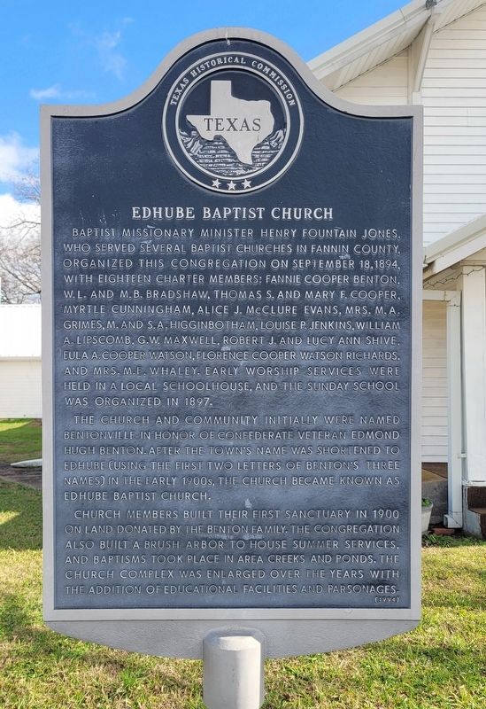
1. Edhube Baptist Church Marker
The church and community initially were named Bentonville in honor of Confederate veteran Edmond Hugh Benton. After the town's name was shortened to Edhube (using the first two letters of Benton's three names) in the early 1900s, the church became known as Edhube Baptist Church.
Church members built their first sanctuary in 1900 on land donated by the Benton family. The congregation also built a brush arbor to house summer services, and baptisms took place in area creeks and ponds. The church complex was enlarged over the years with the addition of educational facilities and parsonages.
Erected 1994 by Texas Historical Commission. (Marker Number 14575.)
Topics. This historical marker is listed in this topic list: Religion & Religious Structures. A significant historical date for this entry is September 18, 1894.
Location. 33° 31.528′ N, 96° 13.017′ W. Marker is near Bonham, Texas, in Fannin County. It is on Farm to Market Road 1553 south of County Road 4225, on the left when traveling south. The marker is located at the front of the church. Touch for map. Marker is at or near this postal address: 577 FM 1553, Bonham TX 75418, United States of America. Touch for directions.

Regionally, this marker is
this page online
Other nearby markers. At least 8 other markers are within 4 miles of this marker, measured as the crow flies: Arledge Ridge Cemetery (approx. 2.7 miles away); Lindsey-Randolph Cemetery (approx. 3.1 miles away); Congressman Sam Rayburn (approx. 3.1 miles away); Sam Rayburn House (approx. 3.1 miles away); Charles Henry Christian (approx. 3.6 miles away); Clark Memorial United Methodist Church (approx. 3.6 miles away); Dr. Tom Douglas Spies (approx. 3.9 miles away); Powder Creek Bridge (approx. 3.9 miles away). Touch for a list and map of all markers in Bonham.
Photographed by James Hulse, December 27, 2024
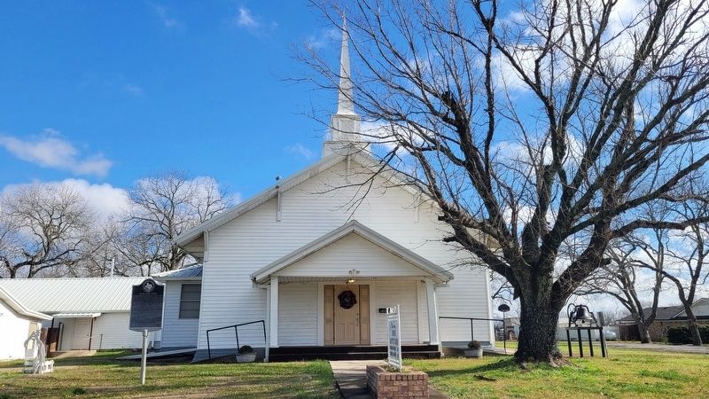
2. The front view of Edhube Baptist Church and Marker
Photographed by James Hulse, December 27, 2024
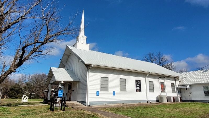
3. The side view of Edhube Baptist Church
Credits. This page was last revised on December 29, 2024. It was originally submitted on December 28, 2024, by James Hulse of Medina, Texas. This page has been viewed 235 times since then and 39 times this year. Photos: 1, 2, 3. submitted on December 29, 2024, by James Hulse of Medina, Texas.
