
Historische Binnenstad in Dordrecht, South Holland, Netherlands — Northwestern Europe
Stokholm
Photographed by Steve Stoessel, December 14, 2024
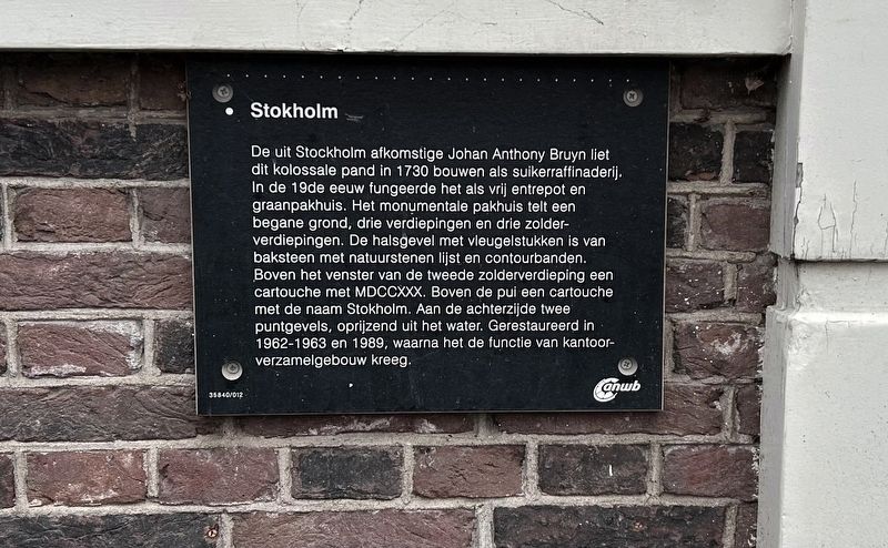
1. Stokholm Marker
Johan Anthony Bruyn, originally from Stockholm, had this colossal building built in 1730 as a sugar refinery.
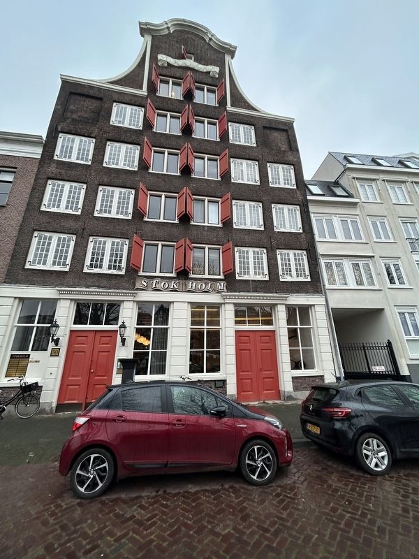
In the 19th century it functioned as a free warehouse and grain warehouse. The monumental warehouse has a ground floor, three floors and three attic floors. The neck gable with wing pieces is made of brick with a natural stone frame and contour bands.
Above the window of the second attic floor a cartouche with MDCCXXX. Above the facade a cartouche with the name Stokholm. At the rear two pointed gables, rising from the water. Restored in 1962-1963 and 1989, after which it was given the function of office building.
[Nederland]
De uit Stockholm afkomstige Johan Anthony Bruyn liet dit kolossale pand in 1730 bouwen als suikerraffinaderij.
In de 19de eeuw fungeerde het als vrij entrepot en graanpakhuis. Het monumentale pakhuis telt een begane grond, drie verdiepingen en drie zolderverdiepingen. De halsgevel met vleugelstukken is van baksteen met natuurstenen lijst en contourbanden.
Boven het venster van de tweede zolderverdieping een cartouche met MDCCXXX. Boven de pui een cartouche met de naam Stokholm.
this page online
Topics. This historical marker is listed in this topic list: Industry & Commerce. A significant historical year for this entry is 1730.
Location. 51° 49.103′ N, 4° 39.95′ E. Marker is in Dordrecht, Zuid-Holland (South Holland). It is in Historische Binnenstad. It is on Wolwevershaven 0.1 kilometers north of Vlak. Touch for map. Marker is at or near this postal address: Wolwevershaven 30C, Dordrecht, Zuid-Holland 3311 AV, Netherlands. Touch for directions.

Regionally, it is in Europe, the European Union, Atlantic Europe, the Benelux Low Countries, the Schengen Area, Western Europe, and the Western World. Historically, it finds itself in what was once the Roman Empire and specifically also the Holy Roman Empire.
Other nearby markers. At least 8 other markers are within walking distance of this marker: First Dutch Shipping Association (within shouting distance of this marker); In de Speykermandt (within shouting distance of this marker); Hey Meevat (about 90 meters away, measured
Photographed by Steve Stoessel, December 14, 2024
2. Stokholm Marker
Credits. This page was last revised on January 16, 2025. It was originally submitted on December 29, 2024, by Steve Stoessel of Niskayuna, New York. This page has been viewed 117 times since then and 26 times this year. Photos: 1, 2. submitted on December 29, 2024, by Steve Stoessel of Niskayuna, New York.
