Sherman in Grayson County, Texas — The American South (West South Central)
Grayson Bible Baptist Church
Photographed by James Hulse, December 27, 2024
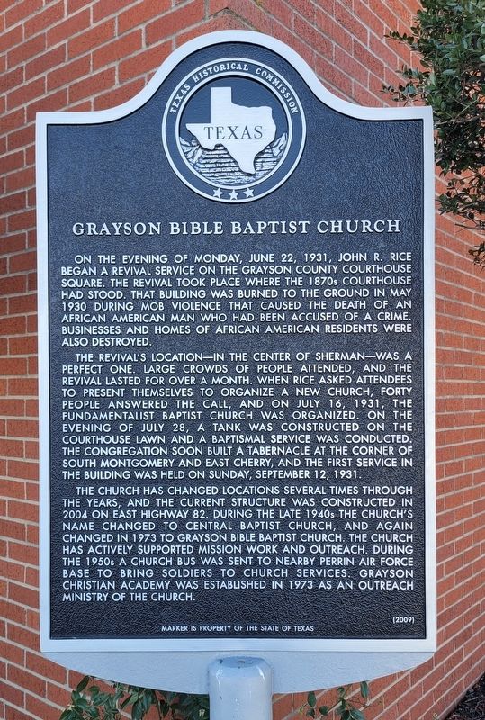
1. Grayson Bible Baptist Church Marker
The revival's location - in the center of Sherman - was a perfect one. Large crowds of people attended, and the revival lasted for over a month. When Rice asked attendees to present themselves to organize a new church, forty people answered the call, and on July 16, 1931, the Fundamentalist Baptist Church was organized. On the evening of July 28, a tank was constructed on the courthouse lawn and a baptismal service was conducted. The congregation soon built a tabernacle at the corner of South Montgomery and East Cherry, and the first service in the building was held on Sunday, September 12, 1931.
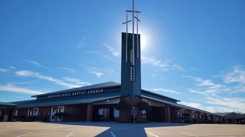
The church has changed locations several times through the years, and the current structure was constructed in 2004 on East Highway 82. During the late 1940s the church's name changed to Central Baptist Church, and again changed in 1973 to Grayson Bible Baptist Church. The church has actively supported mission work and outreach. During the 1950s a church bus was sent to nearby Perrin Air Force Base to bring soldiers to church services. Grayson Christian Academy was established in 1973 as an outreach ministry of the church.
Erected 2009 by Texas Historical Commission. (Marker Number 15986.)
Topics. This historical marker is listed in this topic list: Religion & Religious Structures. A significant historical month for this entry is May 1930.
Location. 33° 39.463′ N, 96° 33.758′ W. Marker is in Sherman, Texas, in Grayson
this page online

Regionally, this marker is in the Prairies & Lakes Region. It is also in the American South. Globally, it is in North America, a Gulf of Mexico state, the Western Hemisphere, the Western World, and the Anglosphere. Historically, it finds itself in what was once New Spain, the Republic of Texas, one of the Confederate States of America, and the Antebellum South.
Other nearby markers. At least 8 other markers are within 3 miles of this marker, measured as the crow flies: Park of Old Settlers Association of Grayson County (approx. 1.8 miles away); Hendrix Cemetery (approx. 2 miles away); Albert Hendrix (approx. 2 miles away); Austin College (approx. 2 miles away); Thompson House/Temple Center (approx. 2 miles away); Old Main (former location) (approx. 2.1 miles away); Wynne Chapel (approx. 2.1 miles
Photographed by James Hulse, December 27, 2024
2. Grayson Bible Baptist Church and Marker
Credits. This page was last revised on December 30, 2024. It was originally submitted on December 29, 2024, by James Hulse of Medina, Texas. This page has been viewed 263 times since then and 66 times this year. Photos: 1, 2. submitted on December 30, 2024, by James Hulse of Medina, Texas.
