Irving in Dallas County, Texas — The American South (West South Central)
Twin Wells Community
Photographed by Morgan Petermann, December 20, 2024
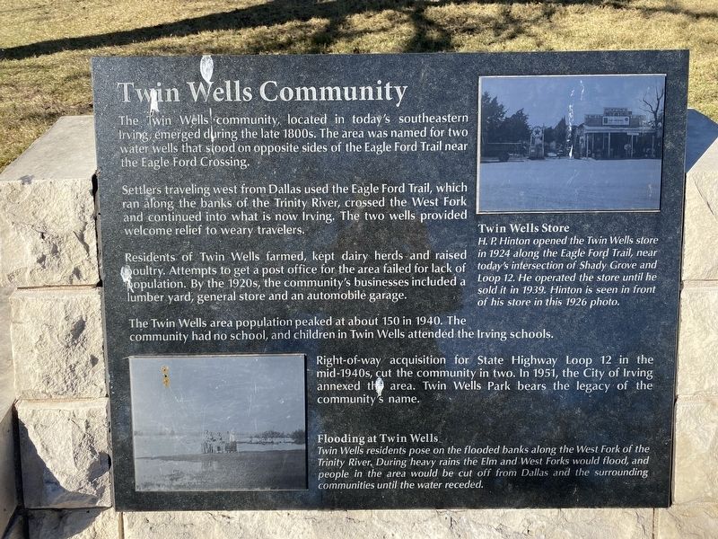
1. Twin Wells Community Marker
Settlers traveling west from Dallas used the Eagle Ford Trail, which ran along the banks of the Trinity River, crossed the West Fork and continued into what is now Irving. The two wells provided welcome relief to weary travelers.
Residents of Twin Wells farmed, kept dairy herds and raised poultry. Attempts to get a post office failed for lack of population. By the 1920s, the community's businesses included a lumber yard, general store and an automobile garage.
The Twin Wells area population peaked at about 150 in 1940. The community had no school, and children in Twin Wells attended the Irving schools.
Right-of-way acquisition for State Highway Loop 12 in the mid-1940s, cut the community in two. In 1951, the City of Irving annexed the area. Twin Wells Park bears the legacy of the community's name.
Captions
(Photo #1) Flooding at Twin Wells
Twin Wells residents pose on the flooded banks along the West Fork of the Trinity River. During heavy rains the Elm and West Forks would flood, and people in the area would be cut off from Dallas and the surrounding communities until the water receded.
(Photo #2) Twin Wells Store
H.P. Hinton opened the Twin Wells store in 1924 along the Eagle Ford Trail, near today's intersection of Shady Grove and Loop 12. He operated the store until he sold it in 1939. Hinton is seen in front of his store in this 1926 photo.
Erected by City
this page online
Topics. This historical marker is listed in this topic list: Settlements & Settlers.
Location. 32° 48.73′ N, 96° 56.785′ W. Marker is in Irving, Texas, in Dallas County. It is at the intersection of South Main Street and West 2nd Street on South Main Street. Touch for map. Marker is at or near this postal address: 217 S Main St, Irving TX 75060, United States of America. Touch for directions.

Regionally, this marker is in the Prairies & Lakes Region and in the Dallas-Fort Worth Metropolitan Area. Globally, it is in North America, a Gulf of Mexico state, the Western Hemisphere, the Western World, and the Anglosphere. Historically, it finds itself in what was once New Spain, the Republic of Texas, one of the Confederate States of America, and the Antebellum South.
Other nearby markers. At least 8 other markers are within walking distance of this marker: Kit Community (here, next to this marker); Eagle Ford Crossing (here, next to this marker); Heritage Park Gazebo (a few steps from this marker); Union Bower Community (a few steps from this marker); Irving's First 'Water Tower'
Photographed by Morgan Petermann, December 20, 2024
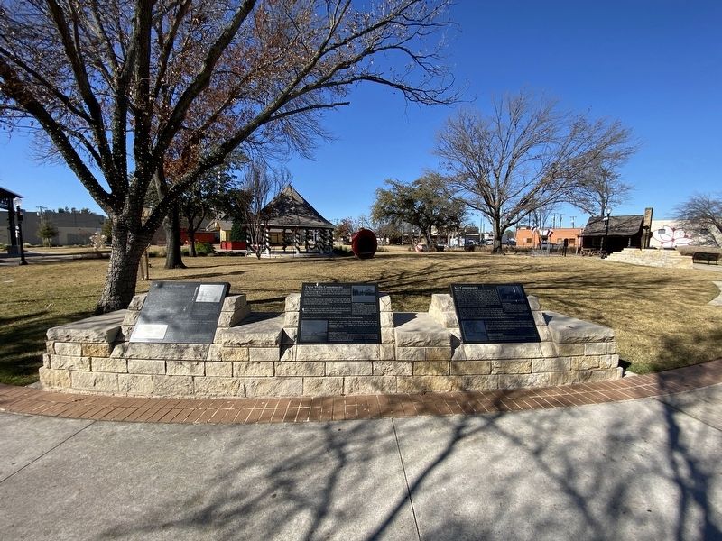
2. Eagle Ford, Twin Wells, and Kit Markers.
Twin Wells is in the middle.
Credits. This page was last revised on January 1, 2025. It was originally submitted on December 30, 2024, by Morgan Petermann of Hurst, Texas. This page has been viewed 250 times since then and 51 times this year. Photos: 1, 2. submitted on December 30, 2024, by Morgan Petermann of Hurst, Texas. • James Hulse was the editor who published this page.
