Stevenson in Skamania County, Washington — The American West (Northwest)
Lewis and Clark Trail
November 1, 2015
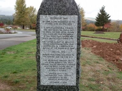
1. Lewis and Clark Trail Marker
The “little island” is about 1 ½ miles downstream from this marker and is submerged by the waters of the Bonneville Dam.
Daughters of the American Revolution
December 3, 1999
Erected 1999 by Washington State Society Daughters of the American Revolution.
Topics and series. This historical marker is listed in this topic list: Exploration. In addition, it is included in the Daughters of the American Revolution (DAR), and the Lewis & Clark Expedition series lists. A significant historical date for this entry is October 30, 1805.
Location. 45° 41.129′ N, 121° 53.948′ W. Marker is in Stevenson, Washington, in Skamania
this page online

Regionally, this marker is in the Columbia River Gorge and in Southwest Washington State. It is also on the American Pacific Coast, in the Pacific Northwest, and in the Lewis & Clark Corridor. Globally, it is in North America, in the Cascade Range, on the Ring of Fire, on the Pacific Rim, in the Western Hemisphere, in the Western World, and in the Anglosphere.
Other nearby markers. At least 8 other markers are within one mile of this marker, measured as the crow flies: Gatekeepers of the Columbia (within shouting distance of this marker); Great Depression Threatens Bank (approx. 0.9 miles away); "The Great Shoote" (approx. 0.9 miles away); Steamboats Docked at Stevenson (approx. 0.9 miles away); "Stump Lifter" Elected First Mayor (approx. one mile away); Stevenson Washington (approx. one mile away); "White Lightning" In The Back Alley (approx. one mile away); Bretz Floods (approx. 1.1 miles away). Touch for a list and map
Photographed by Shirley A Stirling, November 4, 2015
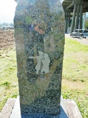
2. Lewis and Clark Marker - Reverse Side
More about this marker. The marker is made of Lake Superior green granite.
Between September 1999 and October 2000, the Washington State Society Daughters of the American Revolution placed a series of four markers commemorating the Lewis and Clark Expedition in what is now Washington State. The markers are located in/near the cities of Ilwaco, Clarkston, Stevenson, and Burbank, Washington.
https://www.hmdb.org/m.asp?m=120771 Ilwaco
https://www.hmdb.org/m.asp?m=120772 Clarkston
https://www.hmdb.org/m.asp?m=91486 Stevenson
https://www.hmdb.org/m.asp?m=259602 Burbank
Regarding Lewis and Clark Trail. Excerpt from Lewis & Clark Trail Heritage Foundation WA Chapter Newsletter, January 2000 edition:
“Approximately 35 members and friends showed up on a cloudy, blustery and rainy day to witness the dedication of this beautiful marker. Shirley Wagers, WSSDAR State Regent, gave the opening address and Barbara Carlson, WSSDAR 2nd Vice Regent (and the newest member of our WSLCTHF chapter along with her husband, Richard) arid Leota "Lee" King, WSSDAR State Historian and WS LCTHF member, unveiled the newest
November 4, 2015
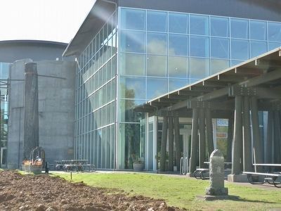
3. Lewis and Clark Marker - Wide View
Erected: December 3, 1999 by Washington State Society of Daughters of the American Revolution. It was their second Lewis and Clark marker.
Credits. This page was last revised on February 2, 2025. It was originally submitted on December 12, 2015, by Shirley A Stirling of Lacey, Washington. This page has been viewed 797 times since then and 66 times this year. Last updated on December 31, 2024, by Shirley A Stirling of Lacey, Washington. Photos: 1. submitted on December 12, 2015, by Shirley A Stirling of Lacey, Washington. 2. submitted on December 12, 2015. 3. submitted on December 12, 2015, by Shirley A Stirling of Lacey, Washington. • J. Makali Bruton was the editor who published this page.
