Jefferson City in Cole County, Missouri — The American Midwest (Upper Plains)
Jefferson City

Photographed by Delbert Botes, February 3, 2024
1. Jefferson City Marker
The capital of Missouri, officially named the City of Jefferson in honor of the third U.S. President, is built on a site chosen by the First General Assembly, 1821, for a seat of government. St. Charles, until 1826, was the temporary capital while the new town was established here. The first statehouse here burned, 1837, the second, 1911. Today's magnificent capitol completed 1917, is built of native Carthage marble.
The capitol is famous for its paintings, sculpture, and murals which highlight the historic role of Missouri as Frontier State; Gateway to the West; Mother of the West; and agricultural and industrial Center State. Other features are the Resources Museum; Soldiers and Sailors Hall; murals by Benton and Brangwyn; and legislative chambers.
In 1829 the city became the seat of Cole Co., organized 1820, named for Stephen Cole, pioneer. In 1833 the State Penitentiary was located here; the Missouri Pacific Railroad reached this point, 1855; and the Missouri River was bridged, 1896. Lincoln University, now State supported, was chartered as an institute for Negroes, 1866.
(See other side)
Reverse
(Continued from
this page online
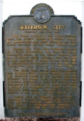
The State capital, in the Ozark foothills, near the State's center, was settled mainly by Southerners and later Germans on land ceded the U.S. by the Osage Indians, 1808.
During the Civil War, delegates elected to a State Convention, Feb. 1861, to decide Missouri's status in the Union, deposed the pro-Southern State officers who had left at the approach of Union troops, June 1861. A "Provisional Government, set up by the Convention, kept Missouri in the Union.
The State Seal, shown atop the marker, was adopted, 1822. Among symbols used are the crescent mark of the second son for Missouri, the second state formed from the Louisiana Purchase; a bear for courage and resources; the U.S. Coat of Arms for union; a helmet for strength; and a large star for Missouri, 24th state. The motto is "Let the welfare of the people be the supreme law."
Among sites of interest are the National Cemetery; Executive Mansion; Cole Co. Hist. Soc. Museum; Supreme Court, State Highway, and other State buildings; and statuary on capitol grounds and the river front view.
Erected 1953 by State Historical Society of Missouri and State Highway

Photographed by William Fischer, Jr., January 22, 2012
2. Jefferson City Marker
Topics and series. This historical marker is listed in these topic lists: Government & Politics • Settlements & Settlers. In addition, it is included in the Historically Black Colleges and Universities, and the Missouri, The State Historical Society of series lists. A significant historical year for this entry is 1821.
Location. 38° 35.088′ N, 92° 10.818′ W. Marker is in Jefferson City, Missouri, in Cole County. It is at the intersection of West Main Street and Clay Street, on the right when traveling west on West Main Street. Marker is located at the Clay Street Trailhead Plaza. Touch for map. Marker is in this post office area: Jefferson City MO 65109, United States of America. Touch for directions.

Regionally, this marker is in the Missouri River Corridor. It is also in the American Midwest, in the Lewis & Clark Corridor, and in the Corn Belt. Globally, it is in North America, the Western Hemisphere, the Western World, and the Anglosphere. Historically, it finds itself in what was once the territory of the Mississippian Culture, the Louisiana Purchase, and the Antebellum South.
Other nearby markers. At least 8 other markers are within walking distance of this marker: The Bolivar Street Neighborhood (about 700 feet away, measured in a direct line); The Bolivar Street Bridge (about 700 feet away); Gold Star Memorial (approx. half a mile away); Dedicated to You, A Free Citizen in a Free Land (approx. half a mile away); Thomas Jefferson (approx. 0.6 miles away); The State Capital During The Civil War (approx. 0.6 miles away); Site of Price Mansion (approx. 0.6 miles away); Gold Star Families Memorial Monument (approx. 0.6 miles away). Touch for a list and map of all markers in Jefferson City.
Also see . . . History/Heritage of Jefferson City MO. City website entry (Submitted on January 5, 2013, by William Fischer, Jr. of Reynoldsburg, Ohio.)

Photographed by Delbert Botes, February 3, 2024
3. Jefferson City Marker Reverse
Photographed by William Fischer, Jr., January 22, 2012
4. Jefferson City Marker Reverse
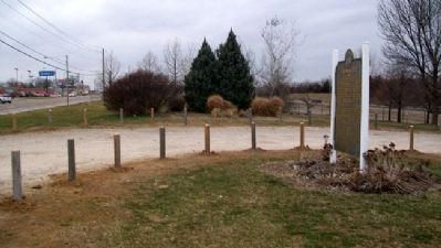
Photographed by William Fischer, Jr., January 22, 2012
5. Jefferson City Marker
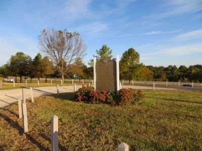
Photographed by Bill Kirchner, October 4, 2014
6. Jefferson City Marker
Photographed by Jason Voigt, October 11, 2022
7. Jefferson City Marker Previous Location
Credits. This page was last revised on February 2, 2025. It was originally submitted on January 5, 2013, by William Fischer, Jr. of Reynoldsburg, Ohio. This page has been viewed 1,078 times since then and 44 times this year. Last updated on December 31, 2024, by Delbert Botes of Columbia, Missouri. Photos: 1. submitted on December 31, 2024, by Delbert Botes of Columbia, Missouri. 2. submitted on January 5, 2013, by William Fischer, Jr. of Reynoldsburg, Ohio. 3. submitted on December 31, 2024, by Delbert Botes of Columbia, Missouri. 4, 5. submitted on January 5, 2013, by William Fischer, Jr. of Reynoldsburg, Ohio. 6. submitted on November 8, 2014, by Bill Kirchner of Tucson, Arizona. 7. submitted on October 12, 2022, by Jason Voigt of Glen Carbon, Illinois. • J. Makali Bruton was the editor who published this page.
