Edenvale in San Jose in Santa Clara County, California — The American West (Pacific Coastal)
New Almaden Quicksilver Mine
Inscription.
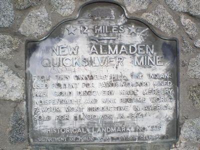
12 miles ← [west]. From this cinnabar hill the Indians used pigment for paint. Mercury was mined, 1845. Gold discovery made mercury indispensable and the mine became the most productive in America, became world famous. It sold for $1,700,700 in 1864.
Erected 1939 by California Department of Public Works - Division of Highways. (Marker Number 339.)
Topics and series. This historical marker is listed in these topic lists: Industry & Commerce • Natural Resources • Settlements & Settlers. In addition, it is included in the California Historical Landmarks series list. A significant historical year for this entry is 1845.
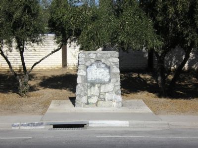
Location. 37° 14.892′ N, 121° 47.328′ W. Marker is in San Jose, California, in Santa Clara County. It is in Edenvale. Marker is on Monterey Highway (U.S. 101) half a mile south of Flintwell Way, on the left when traveling south. Touch for map. Marker is in this post office area: San Jose CA 95138, United States of America. Touch for directions.
Other nearby markers. At least 8 other markers are within 2 miles of this marker, measured as the crow flies. IBM Building 025 (approx. 0.8 miles away); The Bernal Adobe Site and Bear Tree (approx. 1˝ miles away); The Bernal Hacienda (approx. 1.6 miles away); The Santa Teresa Spring (approx. 1.6 miles away); Welcome to the Bernal-Gulnac-Joice Ranch (approx. 1.6 miles away); a different marker also named The Santa Teresa Spring (approx. 1.6 miles away); Farming Replaces Cattle Ranching (approx. 1.6 miles away); Farm Animals (approx. 1.6 miles away). Touch for a list and map of all markers in San Jose.
More about this marker. Marker is 12 miles east of the village of New Almaden & the New Almaden Mine.
Additional keywords. Quicksilver Mining, Mercury Mining
Credits. This page was last revised on February 7, 2023. It was originally submitted on September 22, 2007, by Mathew H. Kohnen of San Jose, California. This page has been viewed 1,724 times since then and 56 times this year. Photos: 1, 2. submitted on September 22, 2007, by Mathew H. Kohnen of San Jose, California. • J. J. Prats was the editor who published this page.

