Plaine-Monceau in Paris in Département de Paris, Île-de-France, France — Western Europe
Place du Général Catroux
| — | Histoire de Paris | — |

Photographed by Andrew Ruppenstein, March 24, 2024
1. Place du Général Catroux Marker

(English translation:)
Formerly Place Malesherbes, it was unofficially named Place des Trois Dumas at the beginning of the century. Alexandre Dumas Fils was one of the first writers to settle in the Plaine Monceau, at 98, Avenue de Villiers. His statue, by the sculptor René de Saint-Marceau, was erected in 1906. That of his father, by Gustave Doré, was inaugurated on November 4, 1883, in the presence of a large crowd. In 1942, the Germans deprived us of the statue of the grandfather. A comical work, designed in 1912 by Alphonse Moncel, it represented General Dumas leaning on an enormous rifle. A neighbor of the Dumas, Sarah Bernhardt lived at the corner of Avenue de Villiers and Rue Fortuny. She was immortalized by the sculptor François Sicard in the role of Phèdre.
Topics and series. This historical marker is listed in these topic lists: Arts, Letters, Music • Notable Places. In addition, it is included in the Histoire de Paris series list. A significant historical year for this entry is 1906.
Location. 48° 53.002′ N, 2° 18.554′ E.
this page online

Regionally, it is in the North Atlantic Region, Europe, the European Union, Atlantic Europe, the Schengen Area, Western Europe, a coastal Mediterranean country, and the Western World. Historically, it finds itself in what was once a French colony and also the Roman Empire.
Other nearby markers. At least 8 other markers are within walking distance of this marker: Mstislav Rostropovich (within shouting distance of this marker); La Mulâtresse Solitude (within shouting distance of this marker); Charles Gounod (about 90 meters away, measured in a direct line); La rue Fortuny (about 90 meters away); Fers / Irons (about 120 meters away); Lycée Carnot Deported Jewish Students Memorial (about 150 meters away); Elena Theodorini and l’Académie Lyrique Roumaine (about
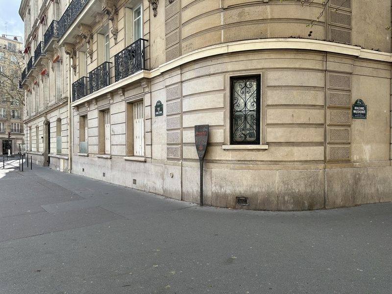
Photographed by Andrew Ruppenstein, March 24, 2024
2. Place du Général Catroux Marker - wide view
Also see . . . Place du Général-Catroux (Wikipedia, in French). Excerpt (in translation):
Until the 1850s and 1860s, the Monceau plain remained agricultural land crossed by rural paths. As part of the urbanization of this area by the Pereire brothers, the Boulevard Malesherbes, planned on the site of an existing path, and the Boulevard de Neuilly (now Avenue de Villiers) were traced and a rectangular square was planned at their intersection. Opened in 1862 on the site of a park, this square was officially named "Place Malesherbes" in 1864. However, it was long nicknamed "Place des Trois Dumas" because of the three statues of the Dumas, which adorn the center of this square. It took its current name in 1977.(Submitted on January 4, 2025.)
Additional keywords. panneau

Photographed by Andrew Ruppenstein, March 24, 2024
3. Place du Général Catroux
Looking northwest across part of the square, with the marker visible on the right in the distance. The statue (by Gustave Doré, mentioned on the marker) is that of Alexandre Dumas, author of, amongst other works, Les Trois Mousquetaires (“The Three Musketeers”).
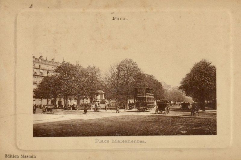
Photographed by Edition Masmin, circa 1900
4. Place Malesherbes, now Place du Général Catroux
Credits. This page was last revised on April 14, 2025. It was originally submitted on January 4, 2025, by Andrew Ruppenstein of Lamorinda, California. This page has been viewed 286 times since then and 65 times this year. Photos: 1, 2, 3, 4. submitted on January 4, 2025, by Andrew Ruppenstein of Lamorinda, California.
