Near Greenville in Jefferson County, Florida — The American South (South Atlantic)
Livingston Place
Photographed by Tim Fillmon, December 29, 2024
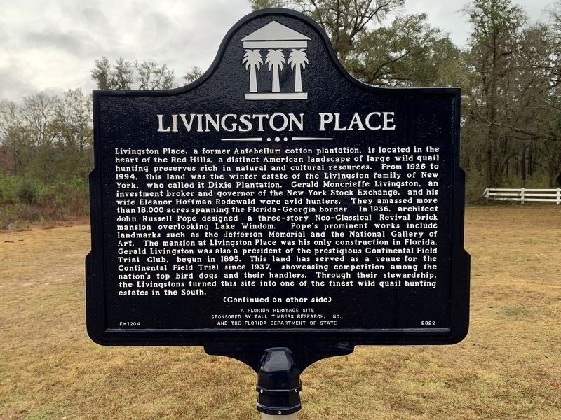
1. Livingston Place Marker Side 1
Livingston Place, a former Antebellum cotton plantation, is located in the heart of the Red Hills, a distinct American landscape of large wild quail hunting preserves rich in natural and cultural resources. From 1926 to 1994, this land was the winter estate of the Livingston family of New York, who called it Dixie Plantation. Gerald Moncrieffe Livingston, an investment broker and governor of the New York Stock Exchange, and his wife Eleanor Hoffman Rodewald were avid hunters. They amassed more than 18,000 acres spanning the Florida-Georgia border. In 1936, architect John Russell Pope designed a three-story Neo-Classical Revival brick mansion overlooking Lake Windom. Pope’s prominent works include landmarks such as the Jefferson Memorial and the National Gallery of Art. The mansion at Livingston Place was his only construction in Florida. Gerald Livingston was also a president of the prestigious Continental Field Trial Club, begun in 1895. This land has served as a venue for the Continental Field Trial since 1937, showcasing competition among the nation’s top bird dogs and their handlers. Through their stewardship, the
this page online
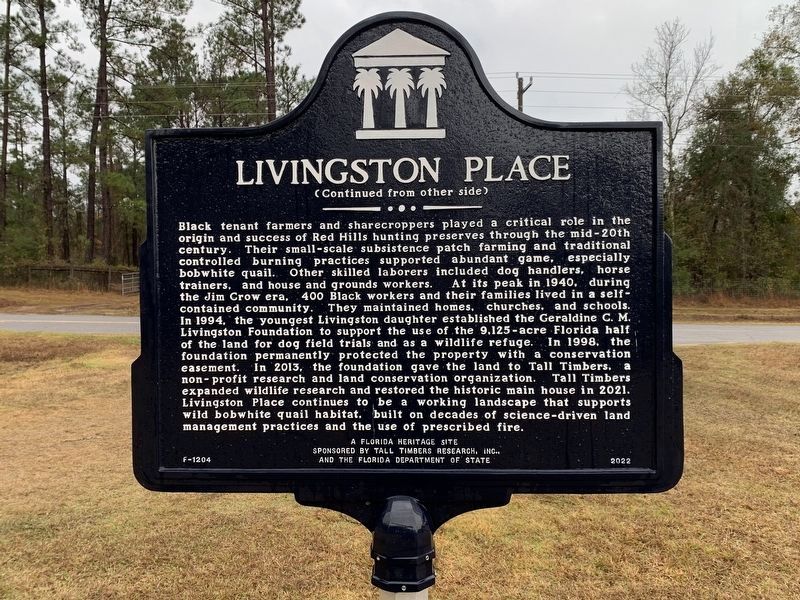
Black tenant farmers and sharecroppers played a critical role in the origin and success of Red Hills hunting preserves through the mid-20th century. Their small-scale subsistence patch farming and traditional controlled burning practices supported abundant game, especially bobwhite quail. Other skilled laborers included dog handlers, horse trainers, and house and grounds workers. At its peak in 1940, during the Jim Crow era, 400 Black workers and their families lived in a self-contained community. They maintained homes, churches, and schools. In 1994, the youngest Livingston daughter established the Geraldine C. M. Livingston Foundation to support the use of the 9,125-acre Florida half of the land for dog field trials and as a wildlife refuge. In 1998, the foundation permanently protected the property with a conservation easement. In 2013, the foundation gave the land to Tall Timbers, a non-profit research and land conservation organization. Tall Timbers expanded wildlife research and restored the historic main house in 2021. Livingston
Photographed by Tim Fillmon, December 29, 2024
2. Livingston Place Marker Side 2
A Florida Heritage Site
Erected 2022 by Tall Timbers Research, Inc. and the Florida Department of State. (Marker Number F-1204.)
Topics. This historical marker is listed in these topic lists: African Americans • Horticulture & Forestry • Settlements & Settlers. A significant historical year for this entry is 1926.
Location. 30° 35.777′ N, 83° 42.454′ W. Marker is near Greenville, Florida, in Jefferson County. It is at the intersection of Ashville Highway (County Route 146) and Livingston Road, on the left when traveling east on Ashville Highway. Livingston Road is a private road. Touch for map. Marker is in this post office area: Monticello FL 32344, United States of America. Touch for directions.

Regionally, this marker is in Florida’s Big Bend, in Greater Tallahassee, and in North Florida. It is also in the American South and specifically in the Deep South. Globally, it is in the North Atlantic Region, North America, a Gulf of Mexico
Photographed by Tim Fillmon, December 29, 2024
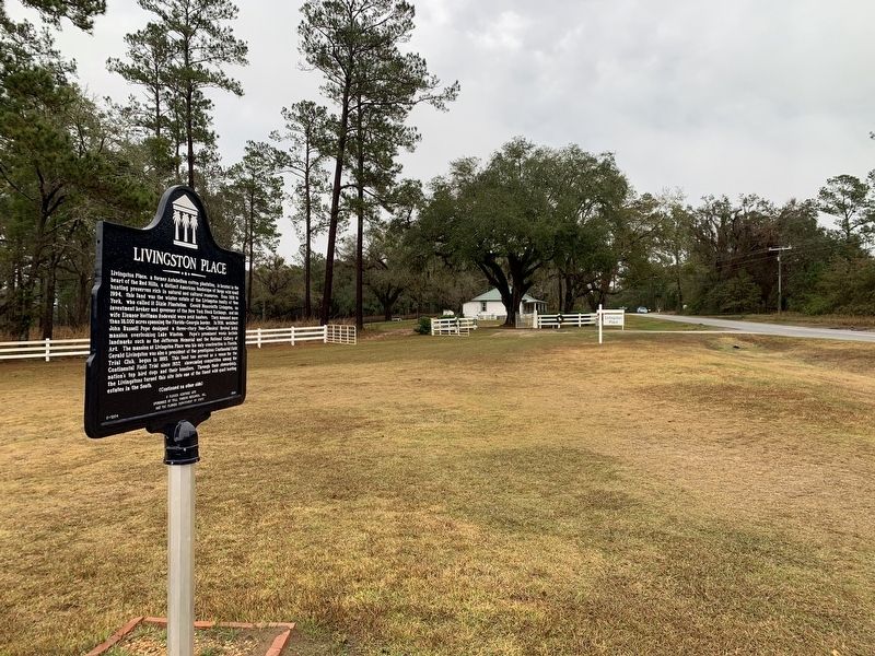
3. Livingston Place Marker
Other nearby markers. At least 8 other markers are within 10 miles of this marker, measured as the crow flies: Olive Baptist Church (approx. 7.6 miles away); Grooverville Methodist Church (approx. 8.8 miles away in Georgia); Liberty Baptist Church (approx. 8.8 miles away in Georgia); Howard Academy Elementary and Junior High School (Later Howard Academy High School) Second Street (approx. 9.8 miles away); Howard Academy High School on Chestnut Street (approx. 9.8 miles away); The Girardeau House (approx. 9.8 miles away); The Town of Greenville (approx. 9.8 miles away); Ray Charles Childhood Home (approx. 10 miles away). Touch for a list and map of all markers in Greenville.
Another marker is no longer nearby. Elizabeth Elementary School (was approx. 4.6 miles away but has been confirmed missing).
Credits. This page was last revised on June 29, 2025. It was originally submitted on January 7, 2025, by Tim Fillmon of Webster, Florida. This page has been viewed 852 times since then and 198 times this year. Photos: 1, 2, 3. submitted on January 7, 2025, by Tim Fillmon of Webster, Florida.
