Milford in South Central Region, Connecticut — The American Northeast (New England)
Jefferson Bridge
Photographed by Michael Herrick, January 7, 2010
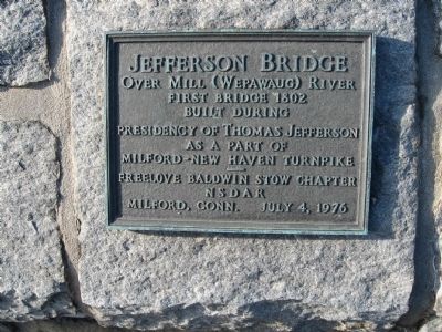
1. Jefferson Bridge Marker
Over Mill (Wepawaug) River
First Bridge 1802
Built During
Presidency of Thomas Jefferson
As a Part Of
Milford – New Haven Turnpike
Freelove Baldwin Stow Chapter
N S D A R
Milford, Conn. July 4, 1976
Erected 1976 by Freelove Baldwin Stow Chapter D.A.R.
Topics and series. This historical marker is listed in this topic list: Bridges & Viaducts. In addition, it is included in the Daughters of the American Revolution (DAR), and the Former U.S. Presidents: #03 Thomas Jefferson series lists. A significant historical date for this entry is July 4, 1976.
Location. 41° 13.529′ N, 73° 3.431′ W. Marker is in Milford in South Central Region, Connecticut. It is on River Street 0.1 miles north of West River Street, on the left when traveling north. Located on the west wall on the bridge. Touch for map. Marker is in this post office area: Milford CT 06460, United States of America. Touch for directions.

Regionally, this marker is in the Connecticut River Valley, on the Connecticut Shoreline, and in Greater New Haven. It is also in the American Northeast, in New England, and on the Eastern Seaboard.
this page online
Other nearby markers. At least 8 other markers are within walking distance of this marker: Memorial to Three Milford Men (a few steps from this marker); Arctic Engine Co. No. 1 (within shouting distance of this marker); Milford Remembers (within shouting distance of this marker); Milford Town Halls (within shouting distance of this marker); Milford World War I Memorial (about 300 feet away, measured in a direct line); The Regicides (about 300 feet away); Home Site of Jonathan Law (about 300 feet away); Early Post Office Site (about 400 feet away). Touch for a list and map of all markers in Milford.
Photographed by Michael Herrick, January 7, 2010
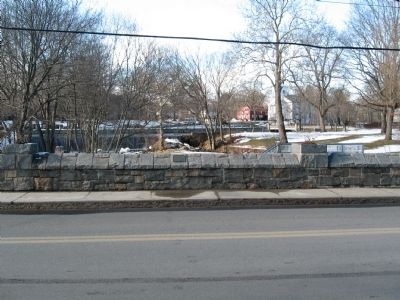
2. Jefferson Bridge Marker
On the bridge wall in the center
Photographed by Michael Herrick, January 7, 2010
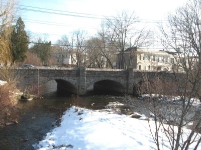
3. The Jefferson Bridge Over the Wepawaug River
Credits. This page was last revised on May 19, 2026. It was originally submitted on January 14, 2010, by Michael Herrick of Southbury, Connecticut. This page has been viewed 1,616 times since then and 33 times this year. Photos: 1, 2, 3. submitted on January 14, 2010, by Michael Herrick of Southbury, Connecticut. • Bill Pfingsten was the editor who published this page.
