
Marker Logo
THE HISTORICAL
MARKER DATABASE
“Bite-Size Bits of Local, National, and Global History”
Historische Binnenstad in Dordrecht, South Holland, Netherlands — Northwestern Europe
 

Stadhuis
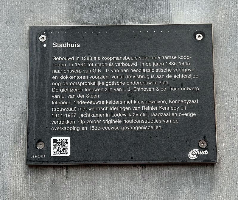
 
 
Stadhuis Marker image. Click for full size.
Photographed by Steve Stoessel, December 14, 2024
1. Stadhuis Marker
Inscription.  
Gebouwd in 1383 als koopmansbeurs voor de Vlaamse koop- lieden. In 1544 tot stadhuis verbouwd. In de jaren 1835-1845 naar ontwerp van G.N. Itz van een neoclassicistische voorgevel en klokkentoren voorzien. Vanaf de Visbrug is aan de achterzijde nog de oorspronkelijke gotische onderbouw te zien. De gietijzeren leeuwen zijn van L.J. Enthoven & Co. naar ontwerp van L. van der Steen.
Interieur: 14de-eeuwse kelders met kruisgewelven, Kennedyzaal (trouwzaal) met wandschilderingen van Reinier Kennedy uit 1914-1927, jachtkamer in Lodewijk XV-stijl, raadzaal en overige vertrekken. Op zolder originele houtconstructies van de overkapping en 18de-eeuwse gevangeniscellen.

Built in 1383 as a merchants' exchange for Flemish merchants. Rebuilt into a town hall in 1544. In the years 1835-1845, designed by G.N. Itz, it was given a neoclassical facade and bell tower. From the Visbrug, the original Gothic substructure can still be seen at the rear. The cast iron lions are by L.J. Enthoven & Co. designed by L. van der Steen. Interior: 14th-century cellars with cross vaults, and wedding hall with murals by Reinier Kennedy
Paid Advertisement
Click or scan to see
this page online
from 1914-1927, hunting room in Louis XV style, council chamber and other rooms. In the attic, original wooden constructions of the canopy and 18th-century prison cells.
 
Erected by the ANWB. (Marker Number 35840/026.)
 
Topics. This historical marker is listed in these topic lists: Architecture • Government & Politics. A significant historical year for this entry is 1383.
 
Location. 51° 48.833′ N, 4° 39.852′ E. Marker is in Dordrecht, Zuid-Holland (South Holland). It is in Historische Binnenstad. It is on Stadhuisplein. Touch for map. Marker is in this post office area: Dordrecht, Zuid-Holland 3311 BD, Netherlands. Touch for directions.

Regionally, it is in Europe, the European Union, Atlantic Europe, the Benelux Low Countries, the Schengen Area, Western Europe, and the Western World. Historically, it finds itself in what was once the Roman Empire and specifically also the Holy Roman Empire.

Other nearby markers. At least 8 other markers are within walking distance of this marker: De Grachtwacht (within shouting distance of this marker); Pand Grotekerksbuurt 6-8 / Grotekerksbuurt Buildings 6-8 (within shouting
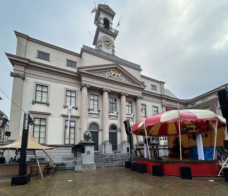
Stadhuis Marker image. Click for full size.
Photographed by Steve Stoessel, December 14, 2024
2. Stadhuis Marker
distance of this marker); De Gulden Os (about 90 meters away, measured in a direct line); Waalse Kerk (about 90 meters away); Arij Scheffer (about 240 meters away); Rondeel Engelenborch (approx. 0.3 kilometers away); Huis van Gijn (approx. 0.3 kilometers away); Huize Paul / Group Paul (approx. 0.3 kilometers away). Touch for a list and map of all markers in Dordrecht.
 
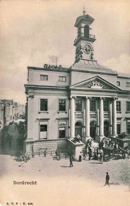
Stadhuis image. Click for full size.
Photographed by A.G.v-D, circa 1905
3. Stadhuis
 
 
Credits. This page was last revised on January 16, 2025. It was originally submitted on January 11, 2025, by Steve Stoessel of Niskayuna, New York. This page has been viewed 113 times since then and 21 times this year. Photos:   1, 2. submitted on January 11, 2025, by Steve Stoessel of Niskayuna, New York.   3. submitted on January 16, 2025.

m=264546

CeraNet Cloud Computing sponsors the Historical Marker Database.
This website earns income from purchases you make after using our links to Amazon.com. We appreciate your support.
Paid Advertisement
Nov. 18, 2026