
Historische Binnenstad in Dordrecht, South Holland, Netherlands — Northwestern Europe
Rondeel Engelenborch
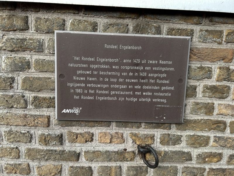
Photographed by Steve Stoessel, December 14, 2024
1. Rondeel Engelenborch Marker
“Het Rondeel Engelenborch” , anno 1429 uit zware Naamse natuursteen opgetrokken, was oorspronkelijk een vestingstoren, gebouwd ter bescherming van de in 1408 aangelegde Nieuwe Haven. In de loop der eeuwen heeft Het Rondeel ingrijpende verbouwingen ondergaan en vele doeleinden gediend. In 1983 is Het Rondeel gerestaureerd, met welke restauratie Het Rondeel Engelenborch zijn huidige uiterlijk verkreeg.
“Het Rondeel Engelenborch”, built in 1429 from heavy Namur natural stone, was originally a fortress tower, built to protect the New Harbour constructed in 1408. Over the centuries, Het Rondeel has undergone major renovations and served many purposes. In 1983, Het Rondeel was restored, with which restoration Het Rondeel Engelenborch acquired its current appearance.
Topics. This historical marker is listed in this topic list: Landmarks. A significant historical year for this entry is 1429.
Location. 51° 48.909′ N, 4° 39.651′ E. Marker is in Dordrecht, Zuid-Holland (South Holland). It is in Historische Binnenstad. It is at the intersection of Engelenburgerbrug and Korte Engelenburgerade on Engelenburgerbrug. Touch for map.
this page online

Regionally, it is in Europe, the European Union, Atlantic Europe, the Benelux Low Countries, the Schengen Area, Western Europe, and the Western World. Historically, it finds itself in what was once the Roman Empire and specifically also the Holy Roman Empire.
Other nearby markers. At least 8 other markers are within walking distance of this marker: Pand Grotekerksbuurt 6-8 / Grotekerksbuurt Buildings 6-8 (about 240 meters away, measured in a direct line); Huis van Gijn (approx. 0.2 kilometers away); Stadhuis (approx. 0.3 kilometers away); Museum 1940-1945 Dordrecht (approx. 0.3 kilometers away); De Grachtwacht (approx. 0.3 kilometers away); Huize Paul / Group Paul (approx. 0.3 kilometers away); De Gulden Os (approx. 0.3 kilometers away); Geboorthehuis van Aelbert Cuyp / Birthplace of Aelbert Cuyp (approx. 0.3 kilometers away). Touch for a list and map of all markers in Dordrecht.
Regarding Rondeel Engelenborch. "Het Rondeel Engelenborch" means The Round Angels Tower in a word by word
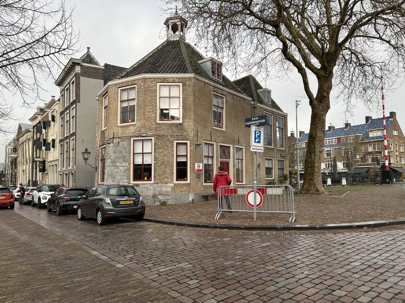
Photographed by Steve Stoessel, December 14, 2024
2. Rondeel Engelenborch Marker
Credits. This page was last revised on January 15, 2025. It was originally submitted on January 13, 2025, by Steve Stoessel of Niskayuna, New York. This page has been viewed 72 times since then and 8 times this year. Photos: 1, 2. submitted on January 13, 2025, by Steve Stoessel of Niskayuna, New York.
