Altstadt in Koblenz, Rhineland-Palatinate, Germany — Central Europe
Koblenz
1944 - 1984
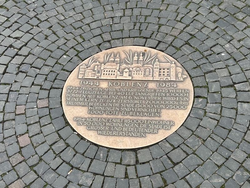
Photographed by Steve Stoessel, December 16, 2024
1. Koblenz Marker
1944 zwischen April und Kriegsende 1945 werfen 3772 Flugzeuge bei 40 Luftangriffen 10000t Bomben auf Koblenz. Am 6. November wird es in seinem Kern zu 87% zerstört 2000000 cbm Trummer bedecken die Stadt. 15.000 von 25.000 Wohnungen sind vernichtet, 1000 Tote zu beklagen. 1984 Koblenz zahlt 115000 Einwohner in 50.000 Wohnungen. Die Stadt ist grosser und bedeutender wiedererstanden.
Between April 1944 and the end of the war in 1945, 3,772 aircraft dropped 10,000 tons of bombs on Koblenz in 40 air raids. On November 6, 87% of the city was destroyed; 2,000,000 cubic meters of rubble covered the city. 15,000 of 25,000 homes were destroyed, and 1,000 people died. By 1984 Koblenz had 115,000 residents in 50,000 homes. The city was rebuilt larger and more significant.
Topics. This historical marker is listed in these topic lists: Disasters • War, World II. A significant historical year for this entry is 1944.
Location. 50° 21.632′ N, 7° 35.67′ E. Marker is in Koblenz, Rheinland-Pfalz (Rhineland-Palatinate). It is in Altstadt. It is on Am Plan, in the median. Touch for map. Marker is at or near this postal address: Marktstrasse,
this page online

Regionally, this marker is in the German Rhineland, in the Upper Middle Rhine Valley, and specifically in the Moselle Valley. Globally, it is in Europe, the European Union, Atlantic Europe, Central Europe, the Schengen Area, Western Europe, and the Western World. Historically, it finds itself in what was once the Roman Empire, the Holy Roman Empire, and the former West Germany.
Other nearby markers. At least 8 other markers are within walking distance of this marker: Vier Türme / Four Towers (a few steps from this marker); Site of Guardhouse (a few steps from this marker); Deutsches Rotes Kreuz / German Red Cross (within shouting distance of this marker); Liebfrauenkirche (about 90 meters away, measured in a direct line); Flora Daniel (about 90 meters away); Juliane Daniel (about 90 meters away); Otto Daniel (about 90 meters away); Zu Den Drei Reichskronen (about 120 meters away). Touch for a list and map of all markers in Koblenz.
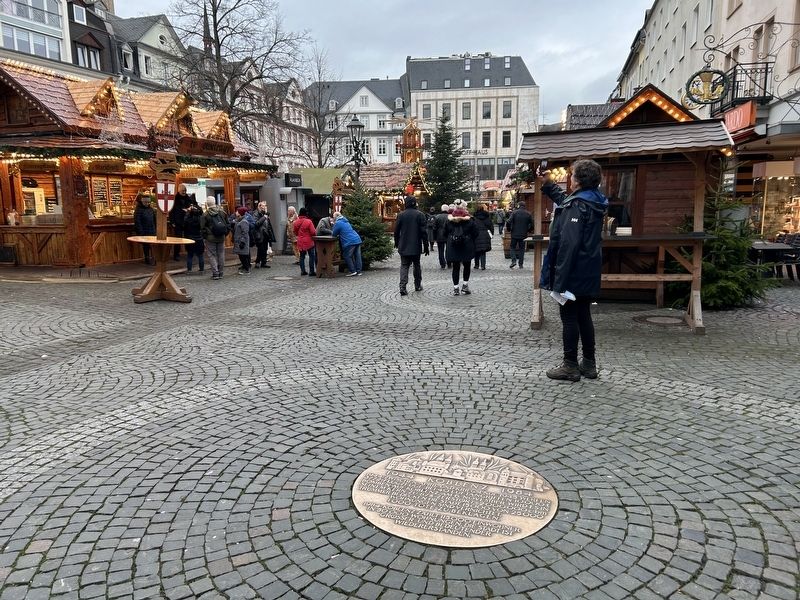
Photographed by Steve Stoessel, December 16, 2024
2. Koblenz Marker
Just entering the Christmas Market from Marktstrasse.
Credits. This page was last revised on January 15, 2025. It was originally submitted on January 14, 2025, by Steve Stoessel of Niskayuna, New York. This page has been viewed 176 times since then and 65 times this year. Photos: 1, 2. submitted on January 14, 2025, by Steve Stoessel of Niskayuna, New York.
