Visé in Liège, Wallonia, Belgium — Northwestern Europe
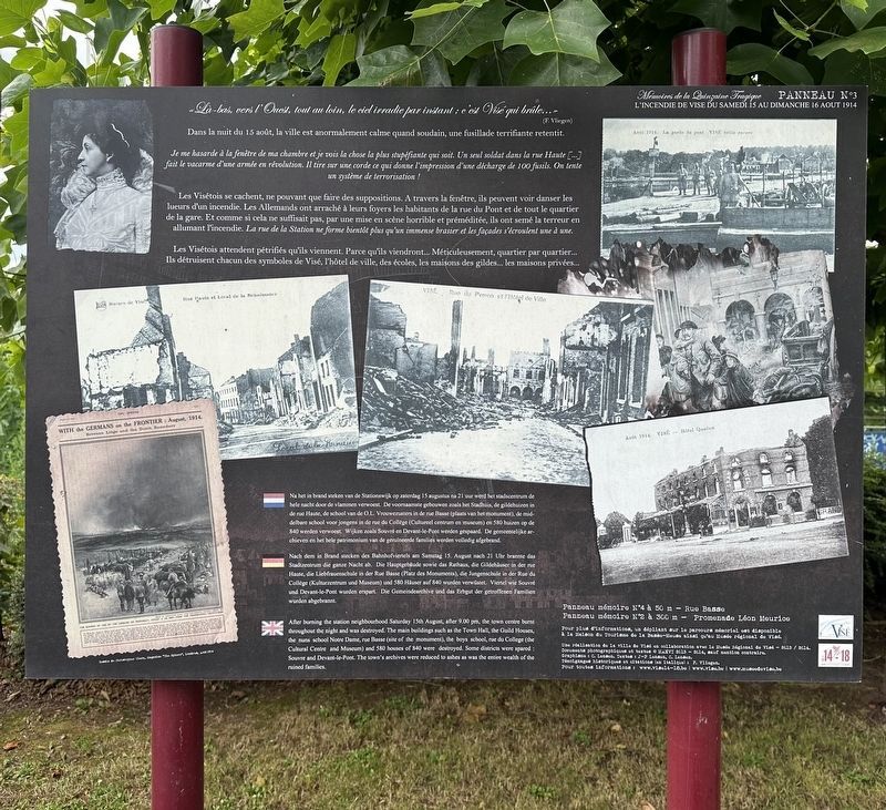
L’Incendie de Visé - Panneau 3
⎯⎯⎯
The Burning of Visé - Panel 3
| — | Mémoires de la Quinzaine Tragique 1914-2014 | — |
Photographed by Andrew Ruppenstein, July 13, 2024
1. L’Incendie de Visé - Panneau 3 / The Burning of Visé - Panel 3

(F. Vliegen)
Dans la nuit du 15 août, la ville est anormalement calme quand soudain, une fusillade terrifiante retentit.
Je me hasarde à la fenêtre de ma chambre et je vois la chose la plus stupéfiante qui soit. Un seul soldat dans la rue Haute [...] fait le vacarme d'une armée en révolution. Il tire sur une corde ce qui donne l'impression d'une décharge de 100 fusils. On tente un système de terrorisation!
Les Visétois se cachent, ne pouvant que faire des suppositions. A travers la fenêtre, ils peuvent voir danser les lueurs d'un incendie. Les Allemands ont arraché à leurs foyers les habitants de la rue du Pont et de tout le quartier de la gare. Et comme si cela ne suffisait pas, par une mise en scène horrible et préméditée, ils ont semé la terreur en allumant l'incendie. La rue de la Station ne forme bientôt plus qu'un immense brasier et les façades s'écroulent une à une.
Les Visétois attendent pétrifiés qu'ils viennent. Parce qu'ils viendront... Méticuleusement, quartier par quartier... Ils détruisent chacun des symboles de Visé, l'hôtel de ville, des écoles, les maisons des gildes... les maisons privées...
🇳🇱
this page online
Photographed by Andrew Ruppenstein, July 13, 2024
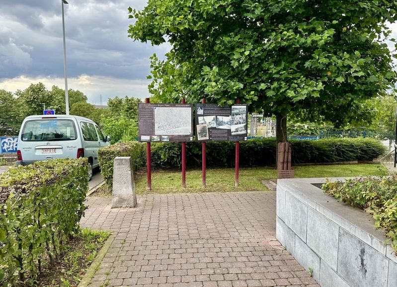
2. The Burning of Visé - Panel 3 - wide view
Erected 2014. (Marker Number 3.)
Topics. This historical marker is listed in these topic lists: Disasters • War, World I. A significant historical date for this entry is August 15, 1914.
Location. 50° 44.092′ N, 5° 41.607′ E. Marker is in Visé, Région Wallonne (Wallonia), in Liège. It is at the intersection of Rue des Récollets and Rue du Perron, on the right when traveling south on Rue des Récollets. The marker is just a few steps south of the Visé town hall. Touch for map. Marker is at or near this postal address: Rue des Récollets 1, Visé, Région Wallonne 4600, Belgium. Touch for directions.

Regionally, it is in Europe, the European Union, Atlantic Europe, the Benelux Low Countries, the Schengen Area, Western Europe, and the Western World. Historically, it finds itself in what was once the Roman Empire and specifically also the Holy Roman Empire.
Other nearby markers. At least 8 other markers
Photographed by Andrew Ruppenstein, July 13, 2024
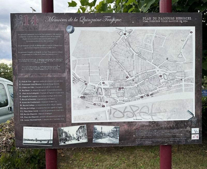
3. Map of the 18 Mémoires de la Quinzaine Tragique panels in Visé
Also see . . . Memories of the Tragic Fortnight of Visé (Land of Memory). Excerpt:
In just two weeks, the city of Visé was turned upside down at the beginning of the First World War. In fact, it was in this Belgian city that the first battle of the Great War in Europe took place. On August 4, 1914, it became the first martyred city of the conflict. The occupation of Visé was violent: 585 houses were burned on August 15, and 42 civilians were killed.(Submitted on January 14, 2025.)
Christopher Clark / The Sphere, August 22, 1914
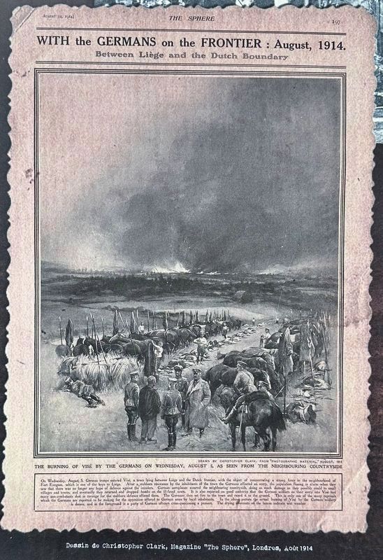
4. Marker photo: the Burning of Visé as depicted in The Sphere
Credits. This page was last revised on January 15, 2025. It was originally submitted on January 14, 2025, by Andrew Ruppenstein of Lamorinda, California. This page has been viewed 134 times since then and 15 times this year. Photos: 1, 2, 3, 4. submitted on January 14, 2025, by Andrew Ruppenstein of Lamorinda, California.
