
Riverview in Omaha in Douglas County, Nebraska — The American Midwest (Upper Plains)
Kenefick Park Canyon Wall
December 26, 2024
1. Kenefick Park Canyon Wall Marker One
First marker:
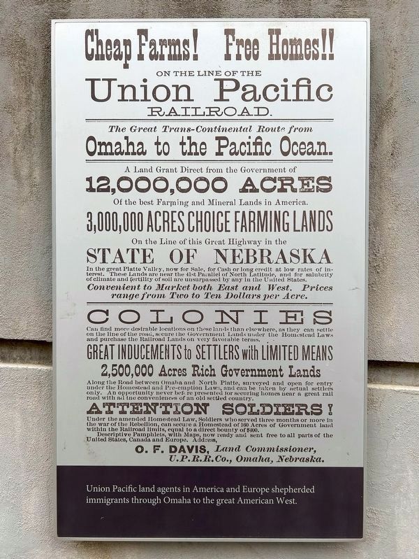
Cheap Farms! Free Homes!! On the line of the Union Pacific Railroad.Union Pacific land agents in America and Europe shepherded immigrants through Omaha to the great American West.
The Great Trans-Continental Route from Omaha to the Pacific Ocean.
A Land Grant Direct from the Government of 12,000,000 Acres Of the best Farming and Mineral Lands in America.
3,000,000 Acres Choice Farming Lands On the Line of this Great Highway in the State of Nebraska
In the great Platte Valley, now for Sale, for Cash or long credit at low rates of interest.
These Lands are near the 41st Parallel of North Latitude, and for salubrity of climate and fertility of soil are unsurpassed by any in the United States.
Convenient to Market both East and West. Prices range from Two to Ten Dollars per Acre.
Colonies Can find more desirable locations on these lands than elsewhere, as they can settle on the line of the road, secure the Government Lands under the Homestead Laws and purchase the Railroad Lands on very favorable terms.
Great Inducements to Settlers with Limited Means
2,500,000 Acres Rich Government Lands
Along the Road between Omaha and North Platte, surveyed and open for entry under the Homestead and Pre-emption Laws,and can be taken by actual settlers only. An opportunity never before presented for securing homes near a great rail road with all the conveniences of an old settled country.
Click or scan to see
this page online
Attention Soldiers! Under the amended Homestead Law, Soldiers who served three months or more in the war of the Rebellion, can secure a Homestead of 160 Acres of Government land within the Railroad limits, equal to a direct bounty of $400.
Descriptive Pamphlets, with Maps, now ready and sent free to all parts of the United States, Canada and Europe. Address,
O. F. Davis, Land Commissioner, U.P.R.R.Co., Omaha, Nebraska.
Second marker:
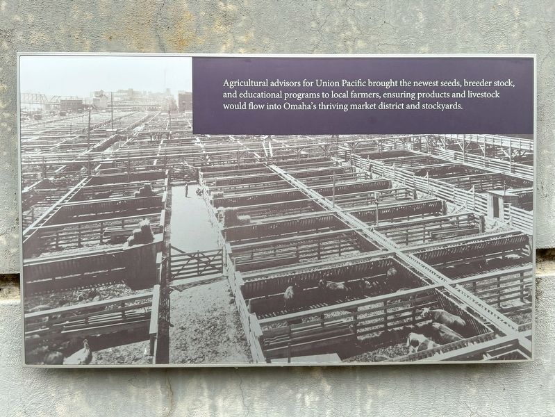
Agricultural advisors for Union Pacific brought the newest seeds, breeder stock, and educational programs to local farmers, ensuring products and livestock would flow into Omaha's thriving market district and stockyards.
Third marker:
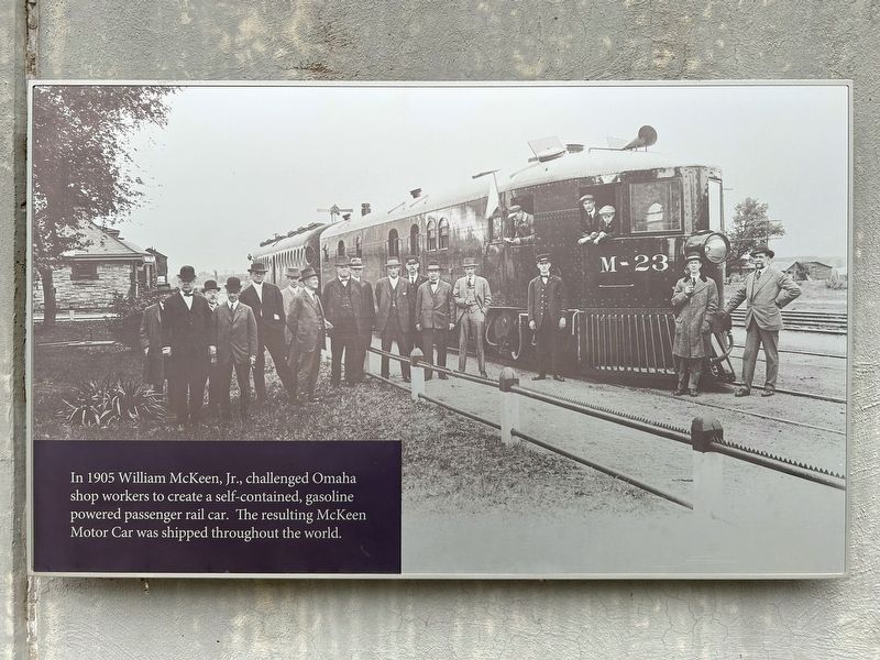
In 1905 William McKeen, Jr., challenged Omaha shop workers to create a self-contained, gasoline powered passenger rail car. The resulting McKeen Motor Car was shipped throughout
December 26, 2024
2. Kenefick Park Canyon Wall Marker Two
Fourth marker:
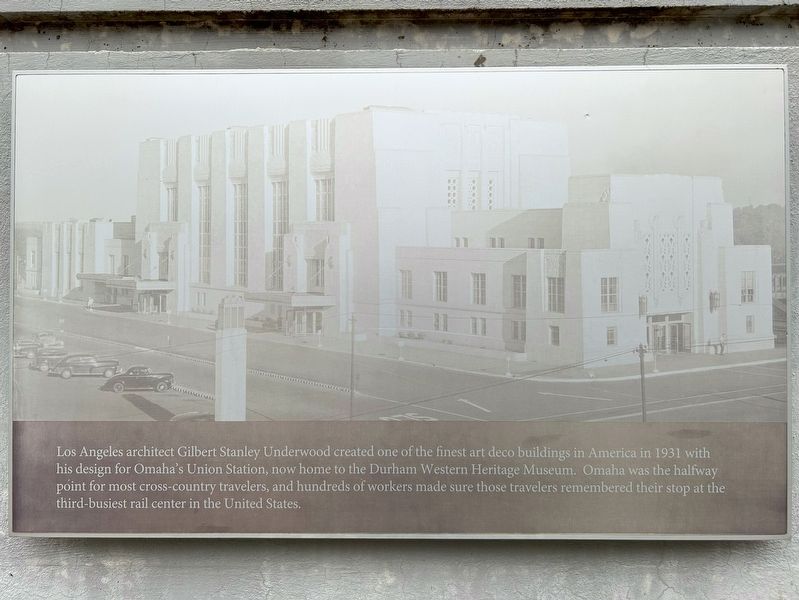
Los Angeles architect Gilbert Stanley Underwood created one of the finest art deco buildings in America in 1931 with his design for Omaha's Union Station, now home to the Durham Western Heritage Museum. Omaha was the halfway point for most cross-country travelers, and hundreds of workers made sure those travelers remembered their stop at the third-busiest rail center in the United States.
Fifth marker:
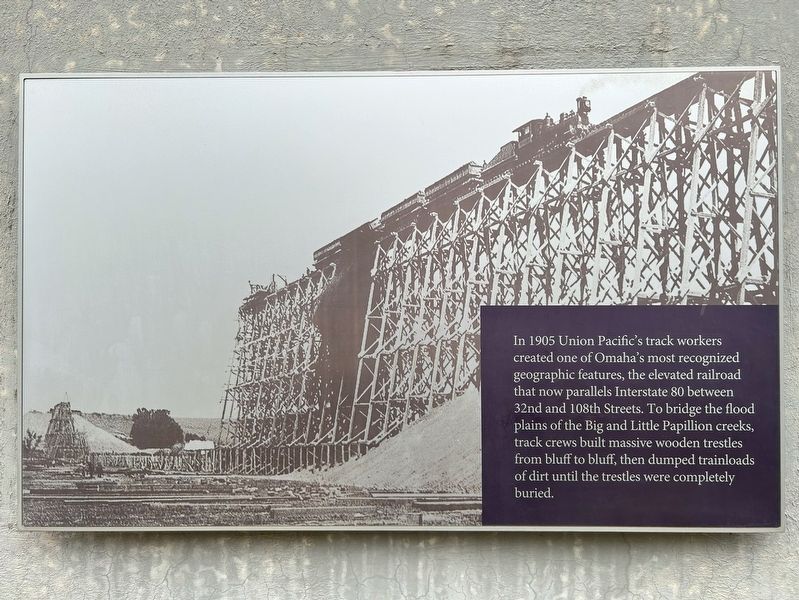
In 1905 Union Pacific's track workers created one of Omaha's most recognized geographic features, the elevated railroad that now parallels Interstate 80 between 32nd and 108th Streets. To bridge the flood plains of the Big and Little Papillion creeks, track crews built massive wooden trestles from bluff to bluff, then dumped trainloads of dirt until the trestles were completely buried.
Sixth marker:
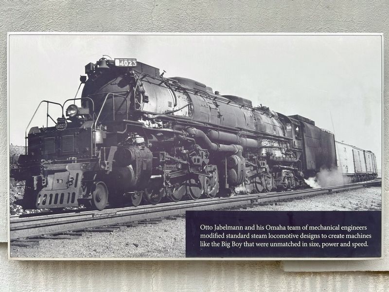
Otto Jabelmann and his Omaha team of mechanical engineers modified standard steam locomotive designs to create machines like the Big Boy that were unmatched in size, power and speed.
Seventh marker:
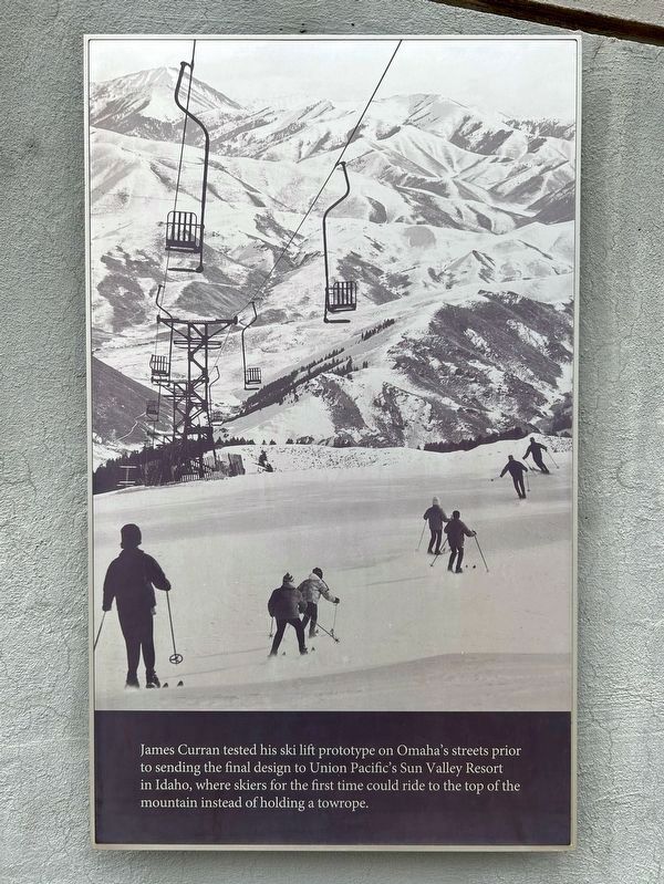
James Curran tested his ski lift prototype on Omaha's streets prior to sending the final design to Union
December 26, 2024
3. Kenefick Park Canyon Wall Marker Three
Eighth marker:
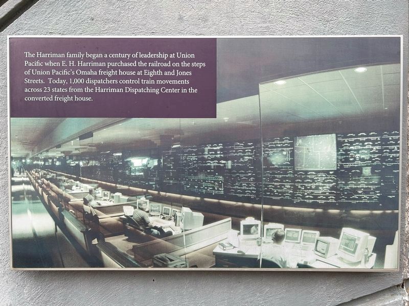
The Harriman family began a century of leadership at Union Pacific when E. H. Harriman purchased the railroad on the steps of Union Pacific's Omaha freight house at Eighth and Jones Streets. Today, 1,000 dispatchers control train movements across 23 states from the Harriman Dispatching Center in the converted freight house.
Topics. This historical marker is listed in this topic list: Railroads & Streetcars. A significant historical year for this entry is 1905.
Location. 41° 13.952′ N, 95° 55.075′ W. Marker is in Omaha, Nebraska, in Douglas County. It is in Riverview. It can be reached from Bancroft Street ¼ mile east of Bancroft Plaza. Located along the walkway between the mid and upper plazas of Kenefick Park. Touch for map. Marker is at or near this postal address: 100 Bancroft St, Omaha NE 68108, United States of America. Touch for directions.

Regionally, this marker is in Eastern Nebraska. It is also in the American Midwest, in the Lewis & Clark Corridor, in the Corn Belt,
December 26, 2024
4. Kenefick Park Canyon Wall Marker Four
Other nearby markers. At least 8 other markers are within walking distance of this marker: Union Pacific Railroad (within shouting distance of this marker); The Big Boy (within shouting distance of this marker); The Centennial (within shouting distance of this marker); History of Union Pacific and Omaha (within shouting distance of this marker); Legends of Union Pacific (about 300 feet away, measured in a direct line); Kenefick Park (about 500 feet away); A New World of Plants (about 600 feet away); Western Historic Trails Center; Starting the Journey (approx. one mile away in Iowa). Touch for a list and map of all markers in Omaha.
December 26, 2024
5. Kenefick Park Canyon Wall Marker Five
December 26, 2024
6. Kenefick Park Canyon Wall Marker Six
December 26, 2024
7. Kenefick Park Canyon Wall Marker Seven
December 26, 2024
8. Kenefick Park Canyon Wall Marker Eight
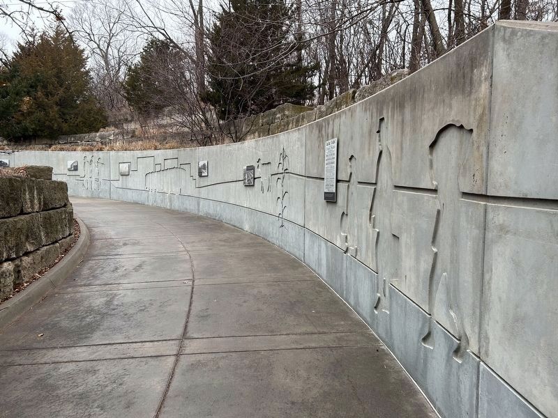
December 26, 2024
9. Kenefick Park Canyon Wall
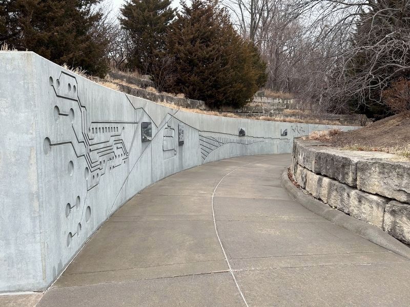
December 26, 2024
10. Kenefick Park Canyon Wall
Credits. This page was last revised on January 16, 2025. It was originally submitted on January 16, 2025. This page has been viewed 146 times since then and 24 times this year. Photos: 1, 2, 3, 4, 5, 6, 7, 8, 9, 10. submitted on January 16, 2025.
