
Historische Binnenstad in Dordrecht, South Holland, Netherlands — Northwestern Europe
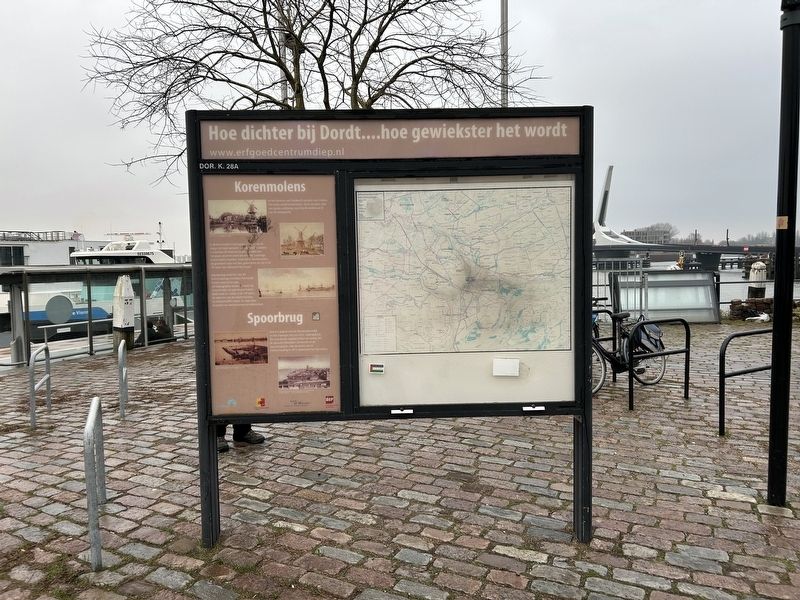
Hoe dichter bij Dordt....hoe gewiekster het wordt
Photographed by Steve Stoessel, December 14, 2024
1. Hoe dichter bij Dordt....hoe gewiekster het wordt Marker
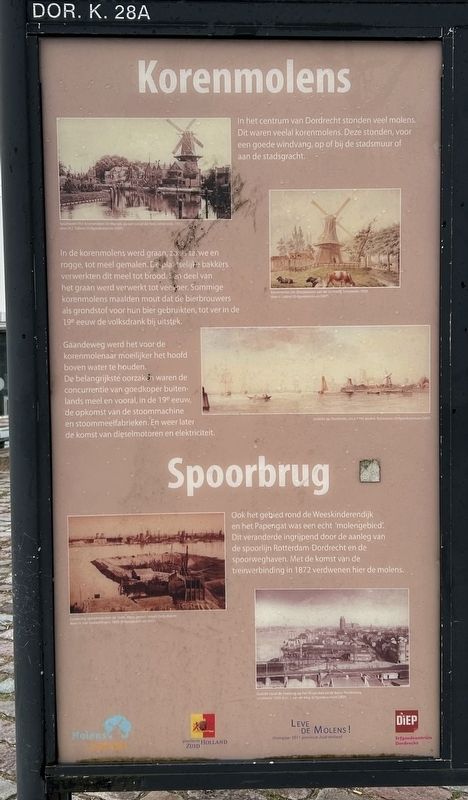
Korenmolens
In het centrum van Dordrecht stonden veel molens. Dit waren veelal korenmolens. Deze stonden, voor een goede windvang, op of bij de stadsmuur of aan de stadsgracht.
In de korenmolens werd graan, zv, is tarwe en rogge, tot meel gemalen. De plaatselijke bakkers verwerkten dit meel tot brood. Ken deel van het graan werd verwerkt tot veevoer. Sommige korenmolens maalden mout dat de bierbrouwers als grondstof voor hun bier gebruikten, tot ver in de 19e eeuw de volksdrank bij uitstek.
Gaandeweg werd het voor de korenmolenaar moeilijker het hoofd boven water te houden. De belangrijkste oorzaken waren de concurrentie van goedkoper buitenlands meel en vooral, in de 19e eeuw, de opkomst van de stoommachine en stoommeelfabrieken. En weer later de komst van dieselmotoren en elektriciteit.
Spoorbrug
Ook het gebied rond de Weeskinderendijk en het Papengat was een echt 'molengebied. Dit veranderde ingrijpend door de aanleg van de spoorlijn Rotterdam-Dordrecht en de spoorweghaven. Met de komst van de treinverbinding in 1872 verdwenen hier de molens.
Corn mills
There were many mills in the center of Dordrecht. These
this page online
In the corn mills, grain, such as wheat and rye, was ground into flour. The local bakers processed this flour into bread. A part of the grain was processed into cattle feed. Some corn mills ground malt that the beer brewers used as a raw material for their beer, the popular drink par excellence until well into the 19th century.
Gradually it became more difficult for the corn miller to keep his head above water. The main causes were the competition from cheaper foreign flour and especially, in the 19th century, the rise of the steam engine and steam flour mills. And later the arrival of diesel engines and electricity.
Railway bridge
The area around the Weeskinderendijk and the Papengat was also a real 'mill area'. This changed drastically due to the construction of the Rotterdam-Dordrecht railway line and the railway harbor. With the arrival of the train connection in 1872 the mills disappeared here.
[Photo and Drawing Captions]
Spuihaven miert korenmolen De Maigd, gezien vanaf de Vest, omstreeks
Spoihaven with corn mills De Maigd, seen from the Vest, around 1911 by M.1. Tollens
Korenmolen De Oranjeboom dan de Spuihveg ornstreeks 1850 .
Corn mill De Oranjeboom on the Spuined area by F. Lebret
Gezicht op Dordrecht, circa 1745
View of Dordrecht, around 1745
Fundering spoorbrug over de Oude Maus, gezien vanuit Zwijndrecht
Foundation of the railway bridge over the Oude Maus, seen from Zwijndrecht by H. van Howwelngen, 1866
Gezicht vanaf de Dokbrug op het Wilgenbos en de Korte Parallelweg omstreeks 1939 View of the Dokbrug on the Wilgenbos and the Korte Parallelweg. illustration 1939 by van de Wieg
[Side 2]
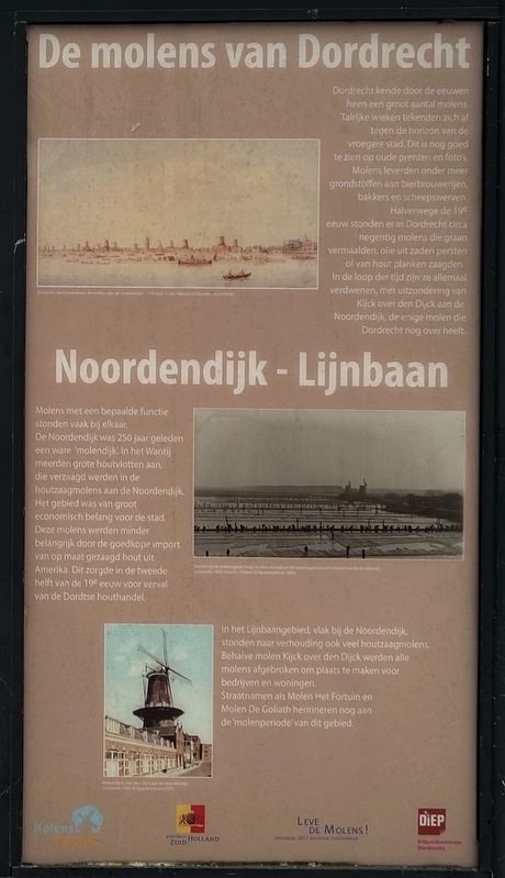
De molens van Dordrecht
Dordrecht
Photographed by Steve Stoessel, December 14, 2024
2. Hoe dichter bij Dordt....hoe gewiekster het wordt Marker
Noordendijk – Lijnbaan
Molens met een bepaalde functie stonden vaak bij elkaar. De Noordendijk was 250 jaar geleden een ware 'molendijk. In het Wantij meerden grote houtvlotten aan, die verzaagd werden in de houtzaagmolens aan de Noordendijk. Het gebied was van groot economisch belang voor de stad. Deze molens werden minder belangrijk door de goedkope import van op maat gezaagd hout uit Amerika. Dit zorgde in de tweede helft van de 19° eeuw voor verval van de Dordtse houthandel. In het Linbaangebied, vlak bij de Noordendijk, stonden naar verhouding ook veel houtzaagmolens. Behalve molen Kljck over den Dijck werden alle molens afgebroken om plaats te maken voor bedrijven en woningen. Straatnamen als Molen Het Fortuin en Molen De Goliath herinneren nog aan de 'molenperiode van dit gebied.
The mills of Dordrecht
Dordrecht has had a large number of mills throughout the centuries Numerous sails stood out against the horizon of the former city. This can still be clearly seen in old prints and photographs. Mills supplied raw materials to breweries, bakers and shipyards Halfway through the twentieth century, Dordrecht had approximately ninety mills that ground grain, pressed oil from seeds or sawed planks from wood. Over time, they have all disappeared, with the exception
Photographed by Steve Stoessel, December 14, 2024
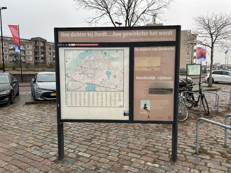
3. Hoe dichter bij Dordt....hoe gewiekster het wordt Marker
Mills with a specific function were often located together. The Noordendijk was a true 'mill dike' 250 years ago. In the Wantij large rafts of wood moored, which were sawn in the wood sawmills on the Noordendijk. The area was of great economic importance to the city. These mills became less important due to the cheap import of custom-sawn timber from America. This caused the decline of the Dordrecht timber trade in the second half of the 19th century. In the Linbaan area, near the Noordendijk, there were also relatively many sawmills. Except for the Kljck over den Dijck mill, all the mills were demolished to make way for businesses and homes. Street names such as Molen Het Fortuin and Molen De Goliath are reminders of the 'mill period' of this area.
Topics. This historical marker is listed in this topic list: Industry & Commerce. A significant historical year for this entry is 1872.
Location. 51° 49.152′ N, 4° 40.526′ E. Marker is in Dordrecht, Zuid-Holland (South Holland). It is in Historische Binnenstad. It is on Bleijenhoek. Touch for map. Marker is at or near this postal address: Bleijenhoek 2, Dordrecht, Zuid-Holland 3311 TA, Netherlands. Touch for directions.

Regionally, it is in Europe, the European Union, Atlantic Europe, the Benelux Low Countries, the Schengen Area, Western Europe, and the Western World. Historically, it finds itself in what was once the Roman Empire and specifically also the Holy Roman Empire.
Other nearby markers. At least 8 other markers are within walking distance of this marker: Veerhuis (within shouting distance of this marker); Schuttevaerkade (approx. 0.3 kilometers away); Groothoofdspoort (approx. 0.4 kilometers away); De Kyck over den Dyck (approx. half a kilometer
Photographed by Steve Stoessel, December 14, 2024
4. Hoe dichter bij Dordt....hoe gewiekster het wordt Marker
Credits. This page was last revised on January 24, 2025. It was originally submitted on January 21, 2025, by Steve Stoessel of Niskayuna, New York. This page has been viewed 86 times since then and 12 times this year. Photos: 1, 2, 3, 4. submitted on January 21, 2025, by Steve Stoessel of Niskayuna, New York.
