
Valkenburg in Valkenburg aan de Geul, Limburg, Netherlands — Northwestern Europe
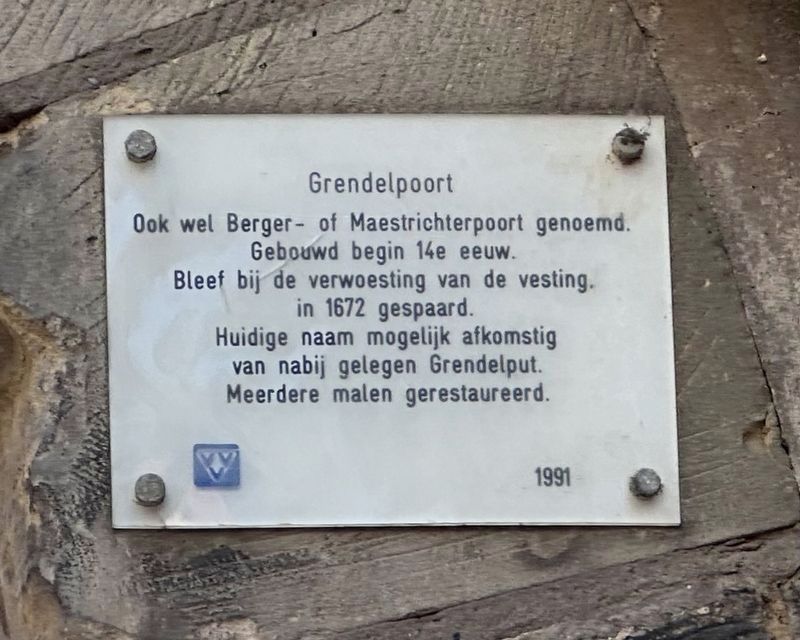
Grendelpoort
⎯⎯⎯
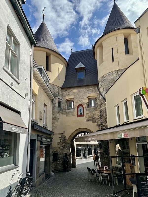
Grendel Gate
Photographed by Andrew Ruppenstein, May 28, 2024
1. Grendelpoort / Grendel Gate Marker

Also called Berger- or Maestrichterpoort. Built early 14th century. Was spared during the destruction of the fortress in 1672. Current name possibly derived from nearby Grendel well. Restored several times.
Erected 1991 by the VVV.
Topics. This historical marker is listed in this topic list: Forts and Castles. A significant historical year for this entry is 1672.
Location. 50° 51.783′ N, 5° 49.816′ E. Marker is in Valkenburg, Limburg, in Valkenburg aan de Geul. It is on Muntstraat, on the left when traveling west. Touch for map. Marker is at or near this postal address: Muntstraat 19, Valkenburg, Limburg 6301 BX, Netherlands. Touch for directions.

Regionally, it is in Europe, the European Union, Atlantic Europe, the Benelux Low Countries, the Schengen Area, Western Europe, and the Western World. Historically, it finds itself in what was once the Roman Empire and specifically also the Holy Roman Empire.
Other nearby markers. At least 8 other markers are within walking
this page online
Also see . . . Grendelpoort (Wikipedia, in Dutch). Excerpt (in translation):
The Grendelpoort is one of the three medieval city gates of the Dutch fortified town of Valkenburg. The heavily restored gate made of Limburg marl has been protected as a national monument since 1967.(Submitted on January 22, 2025.)
The gate was built in the years after 1329, probably around 1335.[1] The gate was initially called something else, Bergerpoort, Maastrichtse Poort or Trichterpoort, after the places where the road led through the gate. On the outside of the gate was a small gate, behind which there used to be a well; the Grendelput. This welldisappeared a long time ago, but the name of the gate has remainedPhotographed by Andrew Ruppenstein, May 28, 20242. Grendelpoort / Grendel Gate and MarkerThe marker is on the north side of the gate, on the right side of the gateway, about two meters above the ground. It is visible here just below the awning on the right.
Photographed by Andrew Ruppenstein, May 28, 2024
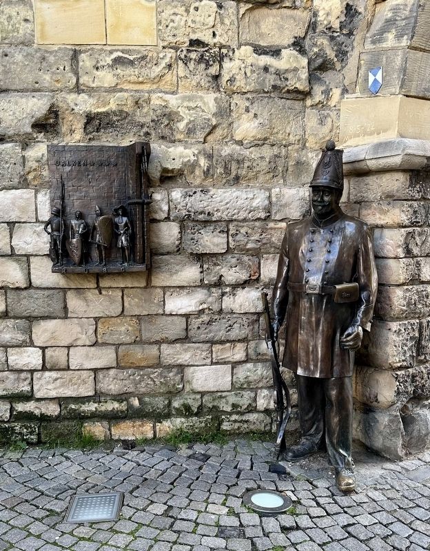
3. Grendelpoort - bronze statue of gate keeper
On the left side of the gateway is a bronze statue of a gate keeper; to the left of that, mounted to the wall, is a tableau of (seemingly) gate keepers from earlier periods.
Photographed by Andrew Ruppenstein, May 28, 2024
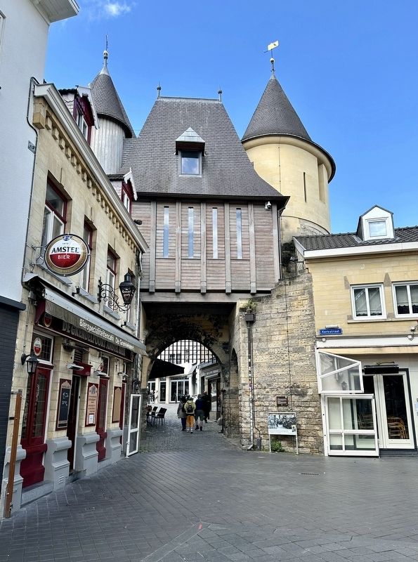
4. Grendelpoort - south side of the gate
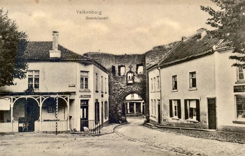
Photographed by G. Meussen, Valkenburg, circa 1920
5. Grendelpoort - north side
Credits. This page was last revised on January 22, 2025. It was originally submitted on January 22, 2025, by Andrew Ruppenstein of Lamorinda, California. This page has been viewed 133 times since then and 11 times this year. Photos: 1, 2, 3, 4, 5. submitted on January 22, 2025, by Andrew Ruppenstein of Lamorinda, California.
