Central East Austin in Travis County, Texas — The American South (West South Central)
Simpson United Methodist Church
Photographed by Keith Peterson, November 25, 2007
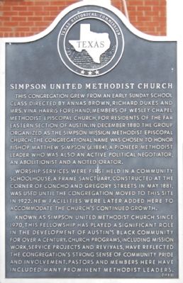
1. Simpson United Methodist Church Marker
This congregation grew from an early Sunday school class directed by Annas Brown, Richard Dukes and Mrs. Vina Harris Forehand, members of Wesley Chapel Methodist Episcopal Church, for residents of the far eastern section of Austin. In December 1880 the group organized as the Simpson Mission Methodist Episcopal Church. The congregation name was chosen to honor Bishop Matthew Simpson (d. 1884), a pioneer Methodist leader who was also an active political negotiator, an abolitionist and a noted orator.
Worship services were first held in a community schoolhouse. A frame sanctuary, constructed at the corner of Concho and Gregory Streets in May 1881, was used until the congregation moved to this site in 1922. New facilities were later added here to accommodate the church's continued growth.
Known as Simpson United Methodist Church since 1970, this fellowship has played a significant role in the development of Austin's black community for over a century. Church programs, including mission work, service projects and revivals, have reflected the congregation's strong sense of community pride and involvement. Pastors and members here have included many prominent Methodist leaders.
Erected 1982 by Texas Historical Commission. (Marker Number 14406.)
Topics and series. This historical marker is listed in these topic lists: African Americans • Religion & Religious Structures. In addition, it is included in the United Methodist Church Historic Sites series list. A significant historical month for this entry is May 1881.
Location. 30° 16.4′ N, 97° 43.309′ W. Marker is in Austin, Texas, in Travis County. It is in Central East Austin. It is at the intersection of East 12th Street and Leona Street, on the right when traveling east on East 12th Street. Touch for map. Marker is at or near this postal address: 1701 E 12th
this page online

Regionally, this marker is in Central Texas. It is also in the American South. Globally, it is in North America, a Gulf of Mexico state, the Western Hemisphere, the Western World, and the Anglosphere. Historically, it finds itself in what was once New Spain, the Republic of Texas, one of the Confederate States of America, and the Antebellum South.
Other nearby markers. At least 8 other markers are within walking distance of this marker: James L. Farmer, Jr. (about 500 feet away, measured in a direct line); Southgate-Lewis House (about 600 feet away); Site of Old Anderson High School / Kealing Jr. High School (about 700 feet away); Laurine Cecil Anderson (approx. 0.2 miles away); Desegregation of Texas Public Schools (approx. ¼ mile away); King-Tears Mortuary (approx. ¼ mile away); Peter Henry Oberwetter (approx. ¼ mile away); George Washington Carver Branch Library (approx. 0.3 miles away). Touch for a list and map of all markers in Austin.
Regarding Simpson United Methodist Church. It is United Methodist Church Registered Historic Site No.
Photographed by Larry D. Moore, September 13, 2019
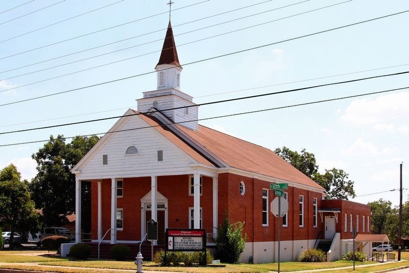
2. Simpson United Methodist Church Marker Area
Photographed by Keith Peterson, November 25, 2007
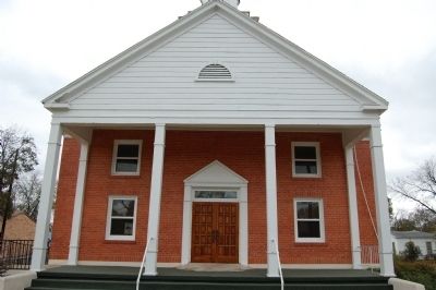
3. Simpson United Methodist Church
Credits. This page was last revised on August 20, 2023. It was originally submitted on January 17, 2010, by Keith Peterson of Cedar Park, Texas. This page has been viewed 1,977 times since then and 68 times this year. Photos: 1. submitted on January 17, 2010, by Keith Peterson of Cedar Park, Texas. 2. submitted on September 13, 2019, by Larry D. Moore of Del Valle, Texas. 3. submitted on January 17, 2010, by Keith Peterson of Cedar Park, Texas. • Bill Pfingsten was the editor who published this page.
