Voormezele near Ypres in West-Vlaanderen, Flanders, Belgium — Northwestern Europe
Kraterwand The Bluff 1916
2014-18
| — | 100 jaar Groote Oorlog | — |
Photographed by Steve Stoessel, November 14, 2024
1. Kraterwand The Bluff 1916 Marker
Kraterwand The Bluff 1916
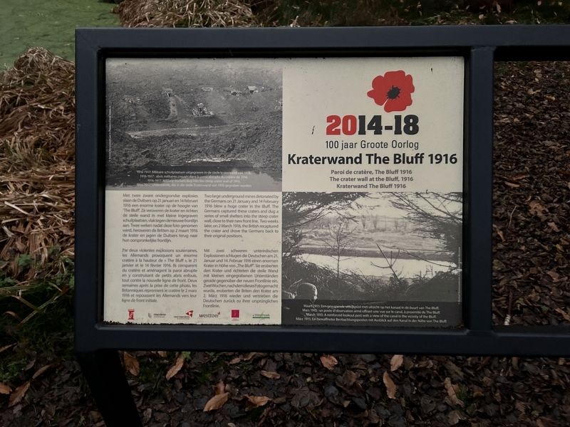
Met twee zware ondergrondse explosies slaan de Duitsers op 21 januari en 14 februari 1916 een enorme krater op de hoogte van "The Bluff. Ze veroveren de krater en richten de steile wand in met kleine ingegraven schuilplaatsen, vlak tegen denieuwe frontlijn aan. Twee weken nadat deze foto genomen werd, heroveren de Britten op 2 maart 1916 de krater en jagen de Duitsers terug naar hun oorspronkelijke frontlijn.
Paroi de cratère, The Bluff 1916
Par deux violentes explosions souterraines, les Allemands provoquent un énorme cratère à la hauteur de « The Bluff », le 21 janvier et le 14 février 1916. Ils s'emparent du cratère et aménagent la paroi abrupte en y construisant de petits abris enfouis tout contre la nouvelle ligne de front. Deux semaines après la prise de cette photo, les Britanniques reprennent le cratère le 2 mars 1916 et repoussent les Allemands vers leur ligne de front initiale.
The crater wall at the Bluff, 1916
Two large underground mines detonated by the Germans on 21 January and 14 February 1916 blew a huge crater in the Bluff. The Germans captured these craters
this page online
Kraterwand The Bluff 1916
Mit zwei schweren unterirdischen Explosionen schlugen die Deutschen am 21. Januar und 14. Februar 1916 einen enormen Krater in Höhe von The Bluff". Sie eroberten den Krater und richteten die steile Wand mit kleinen eingegrabenen Unterständen gerade gegenüber der neuen Frontlinie ein. Zwei Wochen, nachdem dieses Foto gemacht wurde, eroberten die Briten den Krater am 2. März 1916 wieder und vertrieben die Deutschen zurück zu ihrer ursprünglichen Frontlinie.
[Photo Captions:]
1916-1917: Militaire schuilplaatsen uitgegraven in de steile kraterwand van 1916
1916-1917 : abris militaires creusés dans la paroi abrupte du cratère de 1916
1916-1917 : Military shelters dug into the steep crater wall of 1916.
1916-1917 : Unterstande die in die steil Kraterwand von 1916 gegraben wurden
Maart 1915: Een gewapende vitlijkpost met uitzicht op het kanaal in de buurt van The Bluff.
Mars 1915: un poste d'observation armé offrant une vue sur le canal, à proximité de The Bluff.
March 191S; A reinforced lookout post with a view of the canal in the vicinity of the Bluff.
März 1915: Ein bewaffneter Beobachtungsposten mit Ausblick auf den Kanal in der Nähe von The Bluff.
Topics.
Photographed by Steve Stoessel, November 14, 2024
2. Kraterwand The Bluff 1916 Marker
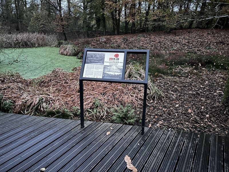
In the background, the pond in the crater can be seen. Some of the crater rim can also be seen.
Location. 50° 48.891′ N, 2° 54.933′ E. Marker is near Ypres, Vlaanderen (Flanders), in West-Vlaanderen. It is in Voormezele. It can be reached from Bernikkewallestraat. Marker is in Palingbeek Park on the Roi des Prusse Trail. Touch for map. Marker is at or near this postal address: Bernikkewallestraat 6, Ypres, Vlaanderen 8902, Belgium. Touch for directions.

Regionally, it is in Europe, the European Union, Atlantic Europe, the Benelux Low Countries, the Schengen Area, Western Europe, and the Western World. Historically, it finds itself in what was once the Roman Empire and specifically also the Holy Roman Empire.
Other nearby markers. At least 8 other markers are within walking distance of this marker: The Frontline at the Bluff, 1915 (about 90 meters away, measured in a direct line); The Bluff in the 'Palingbeek' provincial park (about 120 meters away); De Ondergrondse Oorlog (about 120 meters away); Pierre Marchand Lucien Olivier (approx. 1.3 kilometers away); 15th Battalion Canadian Infantry (approx. 1.3 kilometers away); In Memory of the 14th Light Division (approx. 1.4 kilometers away); Hill 60 (approx. 1.4 kilometers away); 1st Australian Tunneling Company (approx. 1.4 kilometers away). Touch for a list and map of all markers in Ypres.
Also see . . . The Bluff (Wikipedia). (Submitted on January 30, 2025, by Steve Stoessel of Niskayuna, New York.)
Credits. This page was last revised on March 11, 2025. It was originally submitted on January 29, 2025, by Steve Stoessel of Niskayuna, New York. This page has been viewed 146 times since then and 12 times this year. Photos: 1, 2. submitted on January 29, 2025, by Steve Stoessel of Niskayuna, New York.
