Ripa in Roma in Città metropolitana di Roma Capitale, Latium, Rome, Italy — Central Italy (Tyrrhenian Coast)
Ripa
Rione XII
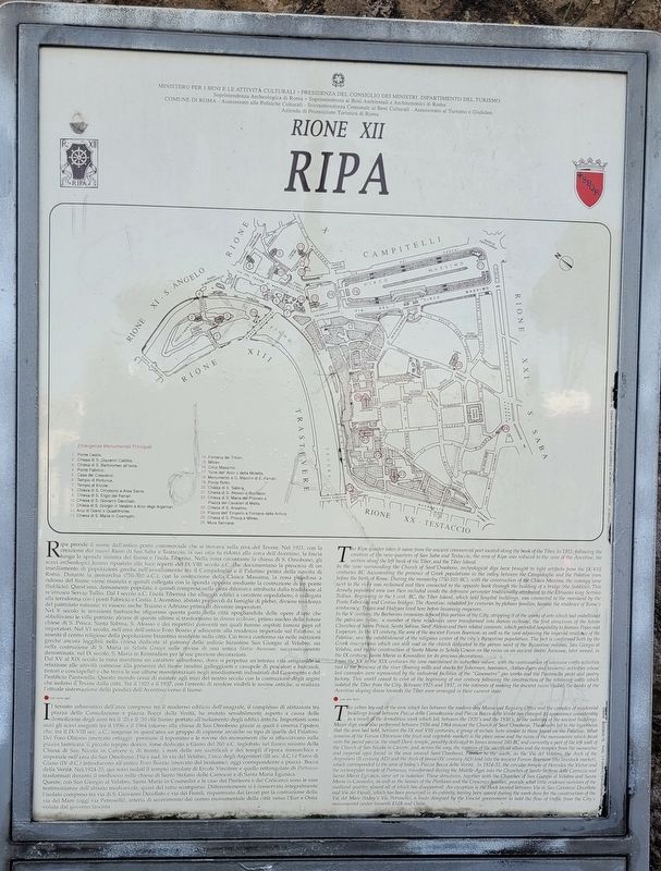
Photographed by James Hulse, March 5, 2024
1. Ripa Marker

Ripa prende il nome dall'antico porto commerciale che si trovava sulla riva del Tevere. Nel 1921, con la creazione dei nuovi Rioni di San Saba e Testaccio, la sua area fu ridotta alla zona dell'Aventino, la fascia lungo la sponda sinistra del fiume e l'isola Tiberina. Nella zona circostante la chiesa di S. Omobono, gli scavi archeologici hanno riportato alla luce reperti del IX-VIII secolo a.C. che documentano la presenza di un insediamento di popolazioni greche nell'avvallamento tra il Campidoglio e il Palatino prima della nascita di Roma. Durante la monarchia (750-510 a.C.), con la costruzione della Cloaca Massima, la zona paludosa a ridosso del fiume viene risanata e quindi collegata con la sponda opposta mediante la costruzione di un ponte (Sublicio). Quest'area, densamente popolata, è quindi compresa nella cinta difensiva attribuita dalla tradizione al re etrusco Servio Tullio. Dal I secolo a.C. l'isola Tiberina che alloggia edifici a carattere ospedaliero, è collegata alla terraferma con i ponti Fabricio e Cestio. L'Aventino, abitato per secoli da famiglie di plebei, diviene residenza del patriziato romano; vi vissero anche Traiano e Adriano prima
this page online
Nel V secolo le invasioni barbariche sfigurano questa parte della città spogliandola delle opere d'arte che abbellivano le ville patrizie; alcune di queste ultime si trasformano in domus ecclesiae, primo nucleo delle future chiese di S. Prisca, Santa Sabina, S. Alessio e dei rispettivi conventi nei quali furono ospitati famosi papi ed imperatori. Nel VI secolo, nell'area dell'antico Foro Boario e adiacente alla residenza imperiale sul Palatino, si assesta il centro religioso della popolazione bizantina residente nella città. Ciò trova conferma sia nelle iscrizioni greche ancora leggibili nella chiesa dedicata al patrono delle milizie bizantine San Giorgio al Velabro, sia nella costruzione di S. Maria in Schola Graeca sulle rovine di una antica Statio Annonae, successivamente denominata, nel IX secolo, S. Maria in Kosmidion per le sue preziose decorazioni.
Dal XV al XIX secolo la zona mantiene un carattere suburbano, dove si perpetua un'intensa vita artigianale in relazione alle attività connesse alla presenza del fiume (mulini galleggianti e casupole di pescatori e barcaioli, tintori e conciapelle) e che trova le sue ultime manifestazioni negli insediamenti
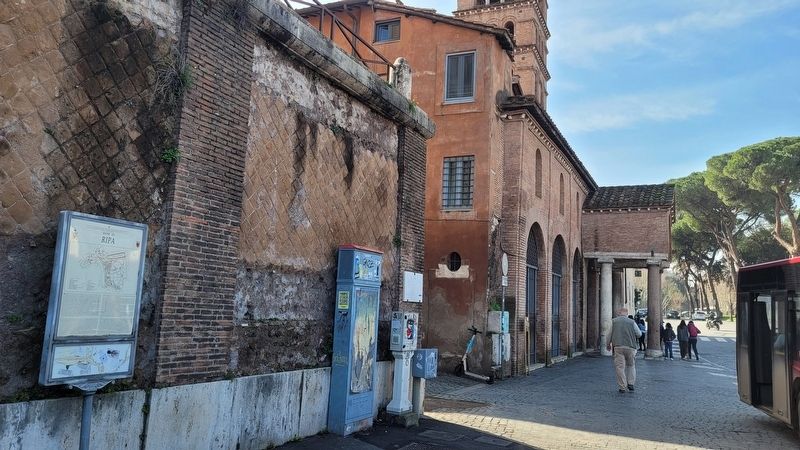
Photographed by James Hulse, March 5, 2024
2. The view of the Ripa Marker along the street
Il tessuto urbanistico dell'area compresa tra il moderno edificio dell'anagrafe, il complesso di abitazioni tra piazza della Consolazione e piazza Bocca della Verità, ha mutato sensibilmente aspetto a causa delle demolizioni degli anni tra il '20 e il '30 che hanno portato all'isolamento degli edifici antichi. Importanti sono stati gli scavi eseguiti tra il 1936 e il 1964 intorno alla chiesa di San Omobono grazie ai quali è emersa l'ipotesi che, tra il IX-VIII sec. a.C., sorgesse in quest'area un gruppo di capanne arcaiche su tipo di quelle del Palatino. Del Foro Olitorio (mercato ortaggi) permane il toponimo e le rovine dei monumenti che si affacciavano sulla piazza lastricata: il piccolo tempio dorico, forse dedicato a Giano del 260 a.C. inglobato nel fianco sinistro della Chiesa di San Nicola in Carcere e, di fronte, i resti delle are sacrificali
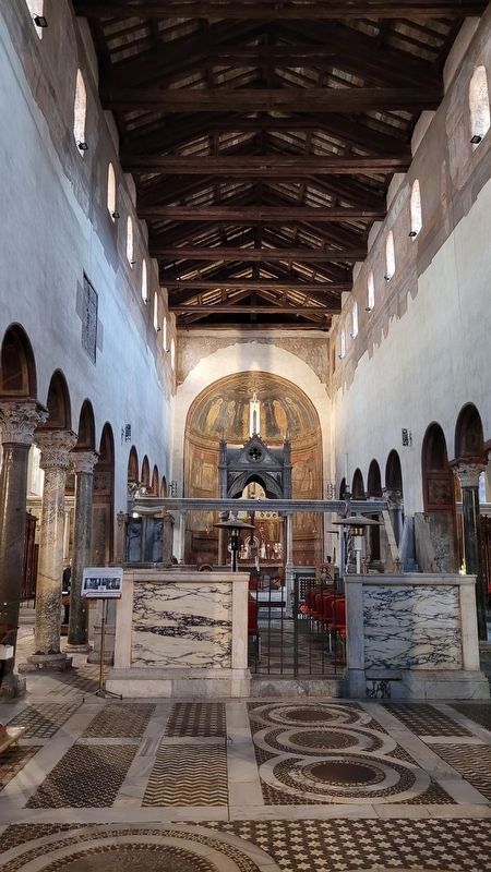
Photographed by James Hulse, March 5, 2024
3. The inside view of the Basilica di Santa Maria in Cosmedin
The church is number 13 on the map.
Queste, con San Giorgio al Velabro, Santa Maria in Cosmedin e le case dei Pierleoni e dei Crescenzi sono le rare testimonianze dell'abitato medioevale, quasi del tutto scomparso. Differentemente si è conservato integralmente l'isolato compreso tra via di S. Giovanni Decollato e via dei Fienili, risparmiato dai lavori per la costruzione della via del Mare (oggi via Petroselli), arteria di scorrimento dal centro monumentale della città verso l'Eur e Ostia voluta dal governo fascista.
The Ripa quarter takes it name from the ancient commercial port located along the bank of the Tiber. In 1921, following the creation of the new quarters of San Saba and Testaccio, the area of Ripa was reduced to the zone of the Aventine, the section along the left bank of the Tiber, and the Tiber Island.
In the zone surrounding the Church of Sant'Omobono, archeological digs have brought to light artifacts from the IX-VIII centuries BC documenting the presence of Greek populations in the valley between the Campidoglio and the Palatine before the birth of Rome. During the monarchy (750-510 BC), with the construction even of the Cloaca Maxima, the swampy zone next to the river was reclaimed and then connected to the opposite bank through the building of a bridge (the Sublicio). This densely populated area was then included inside the defensive perimeter traditionally attributed to the Etruscan king
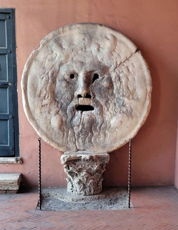
Photographed by James Hulse, March 5, 2024
4. Bocca della Verità (Mouth of Truth)
This famous ancient sculpture is located in the portico of the church of Santa Maria in Cosmedin. It’s a large, circular marble disk with a face carved into it, believed by some to be the face of a river god or a sea god, although its exact origin remains uncertain. According to Roman legend, it was said to be a lie detector. If someone accused of a crime or dishonesty placed their hand inside the mouth, the statue would bite off their hand if they were lying.
In the V century, the Barbarian invasions defaced this portion of the patrician villas; a number of the City, stripping it of the works of arts which had embellished these residences were transformed into domus ecclesiae, the first structures of the future Churches of Santa Prisca, Santa Sabina, Sant'Alessio and their related convents, which provided hospitality to famous Popes and Emperors. In the VI century, the area of the ancient Forum Boarium, as well Palatine, saw the establishment of the religious center as the zone adjoining the imperial residence of the of the city's Byzantine population. The fact is confirmed both by the Greek inscriptions which can still read in the church dedicated to the patron saint of the Byzantine militias, San Giorgio al Velabro, and by the construction of Santa Maria in Schola Graeca on the ruins on an ancient Statio Annonae,
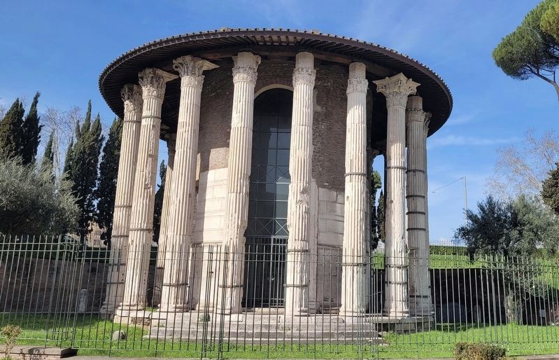
Photographed by James Hulse, March 5, 2024
5. Fountain of the Tritons
The fountain is number 14 on the map.
From the XV to the XIX centuries the zone maintained its suburban nature, with the continuation of intensive crafts activities tied to the presence of the river (floating mills and shacks for fishermen, boatsmen, clothes-dyers and tanners): activities whose last examples were represented by the industrial facilities of the "Gasometro" gas works and the Pantanella pasta and pastry factory. This world ceased to exist at the beginning of our century following the construction of the retaining walls which isolated the Tiber from the City. Between 1925 and 1937, in the interests of making the ancient ruins visible, the banks of the Aventine sloping down towards the Tiber were arranged in their current state.
The urban lay-out of the area which lies between the modern-day Municipal Registry Office and the complex of residential buildings found between Piazza della Consolazione and Piazza Bocca della Verità has changed its appearance considerably as a result of the demolition work which led, between the 1920's and the 1930's, to the isolation of the ancient buildings. Major digs were also performed
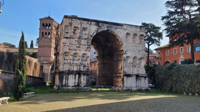
Photographed by James Hulse, March 5, 2024
6. Arco di Giano (Arch of Janus)
The arch is number 12 on the map.
Erected by Ministry for Cultural Heritage and Activities * Presidency of the Council of Ministers - Department of Tourism Superintendency for Archaeological Heritage of Rome Superintendency for Environmental and Architectural Heritage of Rome Municipality of Rome - Department of Cultural Policies - Municipal Superintendency for Cultural Heritage - Department of Tourism and Jubilee Tourism Promotion Agency of Rome.
Topics. This historical marker is listed in this topic list: Notable Places. A significant historical year for this entry is 1921.
Location. 41° 53.304′ N, 12° 28.901′ E. Marker is in Roma, Lazio (Latium, Rome), in Città metropolitana di Roma Capitale. It is in Ripa. It is on Piazza della Bocca della Verità just north of Via della Greca, on the right when traveling north. The marker is located along the corner of the building. Touch for map. Marker is at or near this postal address: Piazza della Bocca della Verità 16, Roma, Lazio 00186, Italy. Touch for directions.

Regionally, it is in Europe, the European Union, the Schengen Area, a coastal Mediterranean country, and the Western World. Historically, it finds itself in what was once the Roman Empire.
Other nearby markers. At least 8 other markers are within walking distance of this marker: Vacanze Romane / Roman Holiday (within shouting distance of this marker); Chiesa di San Giorgio al Velabro / Church of Saint George at the Velabrum (about 180 meters away, measured in a direct line); Chiesa di Sant'Anastasia / Church of St. Anastasia (about 180 meters away); Area Sacra di S. Omobono / S. Omobono Sanctuary (about 210 meters away); Terme di età Imperiale / Imperial Period Baths (approx. 0.3 kilometers away); Bernardino Bolasco (approx. 0.3 kilometers away); Clivus Victoriae e Fontana / Clivus Victoriae and Fountain (approx. 0.3 kilometers away); Villaggio di Capanne / Hut Village (approx. 0.3 kilometers away). Touch for a list and map of all markers in Roma.
Credits. This page was last revised on February 1, 2025. It was originally submitted on January 30, 2025, by James Hulse of Medina, Texas. This page has been viewed 111 times since then and 13 times this year. Photos: 1, 2, 3, 4, 5, 6. submitted on February 1, 2025, by James Hulse of Medina, Texas.
