Geluveld near Zonnebeke in West-Vlaanderen, Flanders, Belgium — Northwestern Europe
Black Watch Corner
Nonnebossen Wandelroute
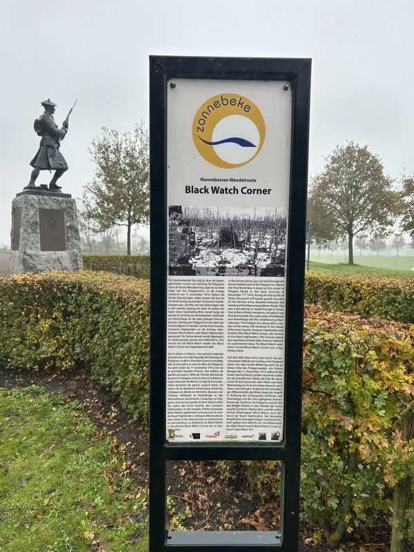
Photographed by Steve Stoessel, November 14, 2024
1. Black Watch Corner Marker
Op bovenstaande foto kijk je door de kapotgeschoten muren van herberg De Polygone. Voor de Eerste Wereldoorlog staat ze op deze hoek van het Polygoonbos. In de vroege ochtend van 11 november 1914, tijdens de Eerste Slag bij leper, vallen tussen het bos en de Meenseweg duizenden Pruisische Gardetroepen aan, de elite van het Duitse leger. Het is een laatste poging om door te stoten tot leper. Door hardnekkig Brits verzet buigt de aanval af richting de kasteelparken Veldhoek en Herenthage en de nabij gelegen Nonnebossen. Herberg De Polygone en een deel van het bos blijven in handen van de Scots Guards, Cameron Highlanders en de Schotse elitetroepen Black Watch, ook Royal Highlanders genoemd. De Duitse aanval wordt afgeslagen en beide partijen graven zich definitief in. Het verzet van de Black Watch maakt van Black Watch Corner een legendarische plek.
Sur la photo ci-dessus, vous pouvez regarder à travers les murs déchiquetés de l'auberge De Polygone. Avant la Première Guerre mondiale, elle se trouvait à ce coin du Bois du Polygone. Au petit matin du 11 novembre 1914, lors de la première bataille d'Ypres, des milliers
this page online
In the picture above, you can look through the bomb-shelled walls of the Polygon Inn. Before the First World War, it stood on this corner of Polygon Wood. In the early morning of November 11* 1914, during the first battle of Ypres, thousands of Prussian guards, the elite of the German army, attacked between the woods and the Meenseweg (Menin Road). This was a last attempt to break through to Ypres. Due to fierce British
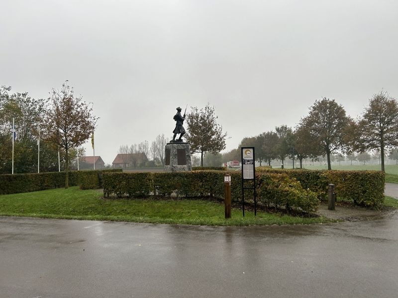
Photographed by Steve Stoessel, November 14, 2024
2. Black Watch Corner Marker
Auf dem Bild oben kann man durch die zerschossenen Wände von Gasthaus De Polygone sehen. Vor dem Ersten Weltkrieg steht sie an dieser Ecke des Polygonwaldes. Am frühen Morgen des 11. November 1914, während der Ersten Ypernschlacht, greifen tausende Soldaten der preußischen Garde, die Elite der deutschen Armee, zwischen dem Wald und dem Meenseweg an. Es ist ein letzter Versuch, nach Ypern vorzudringen. Aufgrund des hartnäckigen Widerstandes der Briten biegt der Angriff in Richtung der Schlossparks Veldhoek und Herenthage und der nahe gelegenen Nonne-bossen ab. Gasthaus De Polygone und ein Teil des Waldes bleiben in den Händen der Scots Guards, Cameron Highlanders und der schottischen Elitetruppen Black Watch, auch bekannt als Royal Highlanders. Der deutsche Angriff wird zurückgeschlagen und beide Parteien graben sich definitiv ein. Der Widerstand der Black Watch macht Black Watch Corner zu einem legendären Ort.
Erected by Zonnebeke.
Topics. This historical marker is listed in this topic list: War, World I. A significant historical date for this entry is November 11, 1914.
Location. 50° 50.908′ N, 2° 58.917′ E. Marker is near Zonnebeke, Vlaanderen (Flanders), in West-Vlaanderen. It is in Geluveld. It is at the intersection of Oude Kortrijkstraat and Lotegalstraat, on the left when traveling west on Oude Kortrijkstraat. Touch for map. Marker is at or near this postal address: Oude Kortrijkstraat 93, Zonnebeke, Vlaanderen 8980, Belgium. Touch for directions.

Regionally, it is in Europe, the European Union, Atlantic Europe, the Benelux Low Countries, the Schengen Area, Western Europe, and the Western World. Historically, it finds itself in what was once the Roman Empire and specifically also the Holy Roman Empire.
Other nearby markers. At least 8 other markers are within walking distance of this marker: A different marker also named Black Watch Corner (a few steps from this marker); a different marker also named Black Watch Corner (a few steps from this marker); Polygons Ruiterpad (approx. 0.6 kilometers away); Scott Post (approx. 0.7 kilometers away); Polygon Wood (approx. 0.8 kilometers away); New Zealand Bunkers (approx. 0.8 kilometers away); Glencorse Wood- Nonnebossen (approx. 0.9 kilometers away); Buttes New British Cemetery (approx. one kilometer away). Touch for a list and map of all markers in Zonnebeke.
Credits. This page was last revised on February 1, 2025. It was originally submitted on January 31, 2025, by Steve Stoessel of Niskayuna, New York. This page has been viewed 104 times since then and 17 times this year. Photos: 1, 2. submitted on January 31, 2025, by Steve Stoessel of Niskayuna, New York.
