Upper Sandusky in Wyandot County, Ohio — The American Midwest (Great Lakes)
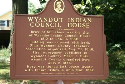
Wyandot Indian Council House
of Wyandot Indian Council House
1819 to Jan. 16, 1850.
Building was covered with bark.
First Wyandot County Teachers
Association organized Aug. 25, 1848.
First newspaper published in
Wyandot County March 1, 1845.
Wyandot County organized here
July 2, 1845.
Here was signed last peace treaty
with Indian tribes in Ohio Mar., 1842.
Erected 1956 by Wyandot County Historical Society.
Topics. This historical marker is listed in this topic list: Native Americans. A significant historical date for this entry is March 1, 1812.
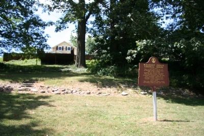
Location. 40° 49.59′ N, 83° 16.525′ W. Marker is in Upper Sandusky, Ohio, in Wyandot County. Marker can be reached from East Wyandot Avenue, on the right when traveling east. This historical marker is located in a city park just east of the Upper Sandusky downtown area, along the old US 30 (the Old Lincoln Highway), and just west of the Sandusky River. It is located at the base of a hill along the western boundary of the city park. Touch for map. Marker is in this post office area: Upper Sandusky OH 43351, United States of America. Touch for directions.
Other nearby markers. At least 8 other markers are within walking distance of this marker. Wyandot County Veterans Memorial (within shouting distance of this marker); Wyandot County War of 1812 Veterans Memorial Flagpole (about 300 feet away, measured in a direct line); Tschanen Elm (about 300 feet away); Col. William Crawford (about 300 feet away); Co. B 2nd O.V.I. Veterans Memorial (about 400 feet away); Robbins Post No. 91 G.A.R. Grove (about 700 feet away); Fort Ferree - Overland Inn - Indian Spring (about 700 feet away); Harrison Smith Park Veterans Memorial (about 700 feet away). Touch for a list and map of all markers in Upper Sandusky.
Credits. This page was last revised on June 16, 2016. It was originally submitted on January 17, 2010, by Dale K. Benington of Toledo, Ohio. This page has been viewed 1,610 times since then and 39 times this year. Photos: 1, 2. submitted on January 17, 2010, by Dale K. Benington of Toledo, Ohio.

