Zillebeke near Ieper in West-Vlaanderen, Flanders, Belgium — Northwestern Europe
Hill 60
2014-18
| — | 100 jaar Groote Oorlog | — |
Photographed by Steve Stoessel, November 14, 2024
1. Hill 60 Marker

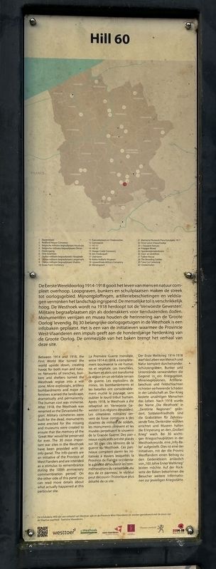
De Eerste Wereldoorlog 1914-1918 gooit het leven van mens en natuur compleet overhoop. Loopgraven, bunkers en schuilplaatsen maken de streek tot oorlogsgebied. Mijnontploffingen, artilleriebeschietingen en veldslagen verminken het landschap ingrijpend. De menselijke tol is verschrikkelijk hoog. De Westhoek wordt na 1918 herdoopt tot de 'Verwoeste Gewesten. Militaire begraafplaatsen zijn als dodenakkers voor tienduizenden doden. Monumenten verrijzen en musea houden de herinnering aan de 'Groote Oorlog' levendig. Bij 30 belangrijke oorlogsgetuigen in de Westhoek is een infobaken geplaatst. Het is een van de initiatieven waarmee de Provincie West-Vlaanderen een impuls geeft aan de honderdjarige herdenking van de Groote Oorlog. De ommezijde van het baken brengt het verhaal van deze site.
this page online
Photographed by Steve Stoessel, November 14, 2024
2. Hill 60 Marker
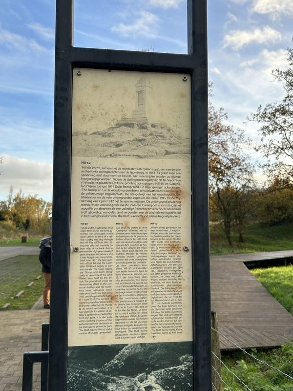
Hill 60

Photographed by Steve Stoessel, November 14, 2024
3. Hill 60 Marker
Hill 60 and the Caterpillar mine crater form one of the three authentic war landscapes in the leper Salient. In 1853-54 a railway cutting was dug through the hill. The sail from this cutting was piled up unevenly on both sides of the track. During the war this high ground was of great strategic importance and it was fought over many times. Until June 1917, the twin summits of Hill 60 and the Caterpillar remained largely in German hands. The lower slopes, the 'Dump' and Larch Wood (with its cemetery of the same name) were held by the British. The ground still shows the devastating effect of the continual shellfire and the numerous mine explosions, which
Photographed by Steve Stoessel, November 14, 2024
4. Hill 60 Marker
Aux côtés du cratère de mine 'Caterpillar' (chenille), 'Hill 60' compte parmi les trois vestiges authentiques de la guerre du Saillant d'Ypres. En 1853-1854, une voie de chemin de fer a été creusée dans la colline. La hauteur de ses versants est irrégulière, raison pour laquelle ces endroits, théâtres de violents combats, étaient considérés comme des sites stratégiques durant la guerre des positions. Les deux principaux terre-pleins, 'Hill 60' et 'Caterpillar, sont restés derrière la ligne de front allemande jusqu'en juin 1917. Les terre-pleins situés plus en contrebas, 'The Dump' et 'Larch Wood, ont quant à eux servi d'abri aux Britanniques. Le cimetière du même nom a été aménagé à côté. Le site témoigne des tirs d'artillerie incessants et des nombreuses explosions souterraines à l'origine de la destruction du terrain entre 1915 et le 7 juin 1917, date de la Bataille des Mines. Le sous-sol contient encore les restes de nombreux soldats. Les aménagements réalisés permettent d'explorer ce site tel une zone de front intégrale. En outre, il se situe à deux pas du domaine de Palingbeek (The Bluff, Ravine Wood, petits cimetières) contenant d'authentiques vestiges.
"Hill 60" bildet, gemeinsam mit dem Minenkrater „Caterpillar" (Raupe), eines der drei authentischen Kriegsrelikte des Ypern-bogens. In den Jahren 1853 bis 1854 wurde eine Eisenbahn-trasse durch den Hügel gegraben. So entstanden an beiden Seiten unterschiedlich hohe Aufschüttungen. Während des Stellungskrieges waren dies heftig umkämpfte strategische Plätze. Die zwei höchsten Aufschüttungen, „Hill 60% und „Caterpillar", blieben bis. Juni 1917 deutsches Frontgebiet. Die tiefer gelegenen Aufschüttungen, „The Dump" und „Larch Wood", wurden britische Unterstände, mit dem daran anschließenden, gleichnamigen Friedhof. Die Stätte zeugt vom anhaltenden Artilleriebeschuss und den vielen unterirdischen Explosionen, die von 1915 bis zur Minenschlacht am 7. Juni 1917 das Gelände zerstörten. Unter der Erde befinden sich die Überreste vieler gefallener Soldaten. Die Stätte wurde neu eingerichtet und kann jetzt als vollständiger Frontbereich besucht werden. Von hier aus können Sie die originalen Kriegsrelikte in der Palingbeek-Domane (The Bluff, Ravine Wood, kleine Friedhöfe) leicht zu Fuß erreichen.
Topics. This historical marker is listed in this topic list: War, World I. A significant historical month for this entry is June 1917.
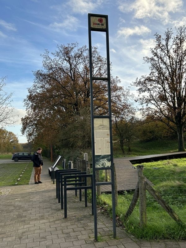
Location. 50° 49.477′ N, 2° 55.813′ E. Marker is near Ieper, Vlaanderen (Flanders), in West-Vlaanderen. It is in Zillebeke. It is on Zwarteleenstraat east of Wervikstraat, on the right when traveling east. Touch for map. Marker is at or near this postal address: Zwarteleenstraat 32, Ieper, Vlaanderen 8902, Belgium. Touch for directions.

Regionally, it is in Europe, the European Union, Atlantic Europe, the Benelux Low Countries, the Schengen Area, Western Europe, and the Western World. Historically, it finds itself in what was once the Roman Empire and specifically also the Holy Roman Empire.
Other nearby markers. At least 8 other markers are within walking distance of this marker: Hill 60 en the Caterpillar (here, next to this marker); Queen Victoria’s Rifles (within shouting distance of this marker); Mijnkrater Hill 60 (about 120 meters away, measured in a direct line); 1st Australian Tunneling Company (about 150 meters away); a different marker also named 1st Australian Tunneling Company (about 150 meters away); a different marker also named Hill 60 (about 150 meters away); In Memory of the 14th Light Division (about 150 meters away); Pierre Marchand Lucien Olivier (about 180 meters away). Touch for a list and map of all markers in Ieper.
Also see . . . Hill 60 (Wikipedia). (Submitted on February 5, 2025, by Steve Stoessel of Niskayuna, New York.)
Credits. This page was last revised on February 6, 2025. It was originally submitted on February 5, 2025, by Steve Stoessel of Niskayuna, New York. This page has been viewed 183 times since then and 21 times this year. Photos: 1, 2, 3, 4. submitted on February 5, 2025, by Steve Stoessel of Niskayuna, New York.
