Zillebeke near Ieper in West-Vlaanderen, Flanders, Belgium — Northwestern Europe
Hill 60 en the Caterpillar
2014-18
| — | 100 jaar Groote Oorlog | — |
Photographed by Steve Stoessel, November 14, 2024
1. Hill 60 en the Caterpillar Marker

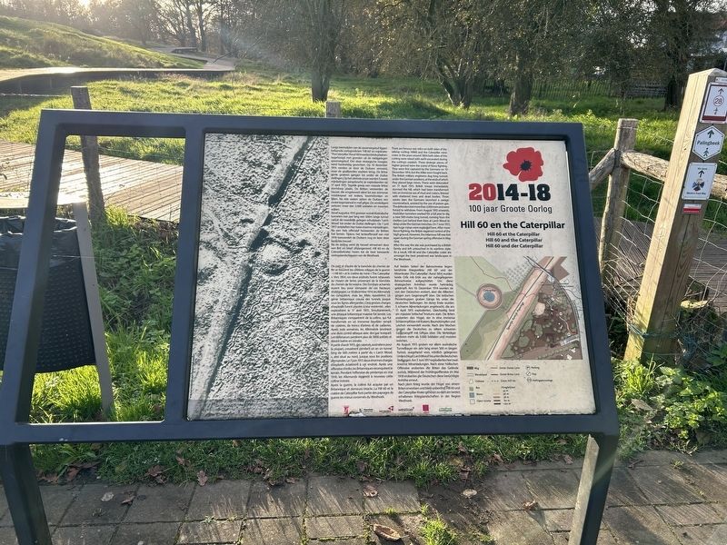
Langs weerszijden van de spoorwegsleuf liggen befaamde oorlogsrelicten: 'Hill 60' en mijnkrater The Caterpillar'. Rond 1854werden beide plaatsen opgehoogd met gronden uit de nabijgelegen spoorwegsleuf. Om deze strategische hoogtes werd hardnekkig gevochten. Op 10 december 1914 werden ze door de Duitsers veroverd, maar de geallieerden vochten terug. De Britse genie groeven gangen tot onder de Duitse stellingen, Op het uiteinde ervan werden 5 zware mijnladingen aangebracht, ze explodeerden op 17 april 1915. Tegelijk greep een massale Britse stormloop plaats. De Britten veroverden de heuvel, die omgetoverd werd tot een immense modderpoel vol kraters, boomstronken en lijken. Na drie weken zetten de Duitsers een zware tegenaanval in met gifgas. De verdedigers verloren meer dan 3.000 soldaten en moesten wijken.
Vanaf augustus 1915 groeven vooral Australische tunnelers een jaar lang een 500m lange tunnel vanuit de noordelijk gelegen schuilplaats 'Larch Wood' tot onder de Duitse stellingen. Op 7 juni 1917 ontploften hier twee enorme mijnladingen. Na een hels offensief heroverden de Britten het terrein. Tijdens het lenteoffensief
this page online
Na de oorlog werd de heuvel verworven door een Brit en bleef onaangeroerd. Hill 60 en de Caterpillarkrater horen tot de best bewaarde oorlogslandschappen van de Westhoek.
De part et d'autre de la tranchée du chemin de fer se trouvent les célèbres reliques de la guerre : « Hill 60 » et le cratère de mine « The Caterpillar ». Vers 1854, ces deux endroits furent rehaussés au moyen de terres provenant de la tranchée du chemin de fer voisine. Des combats acharnés eurent lieu pour s'emparer de ces hauteurs stratégiques. Le 10 décembre 1914, les Allemands les conquirent, mais les Alliés ripostèrent. Le génie britannique creusa des tunnels jusque sous les lignes allemandes. Cinq grosses charges d'explosifs furent placées à leur extrémité ; elles explosèrent le 17 avril 1915. Simultanément, une attaque britannique massive fut lancée. Les Britanniques s'emparèrent de la colline, qui fut transformée en un immense bourbier' rempli de cratères, de troncs d'arbres et de cadavres. Après trois semaines, les Allemands lancèrent une dure contre-attaque
Photographed by Steve Stoessel, November 14, 2024
2. Hill 60 en the Caterpillar Marker
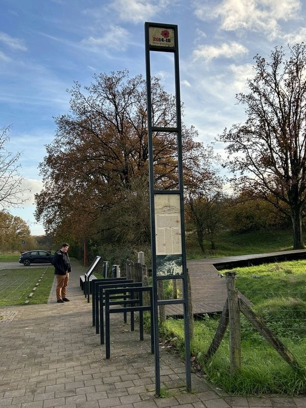
Mark is looking at the “Hill 60 and the Caterpillar” marker, which is at the start of the boardwalk trail through the area.
A partir d'août 1915, des sapeurs, australiens pour la plupart, creusèrent pendant un an un tunnel long de 500 mètres à partir du « Larch Wood », abri situé au nord, jusque sous les positions allemandes. Le 7 juin 1917, deux énormes charges d'explosifs éclatèrent à cet endroit. Après une offensive d'enfer, les Britanniques reconquirent le terrain. Pendant l'offensive de printemps en mai 1918, les Allemands reprirent à nouveau cette colline notoire.
Après la guerre, la colline fut acquise par un Britannique et demeura intacte. La Hill 60 et le cratère de Caterpillar font partie des paysages de guerre les mieux conservés du Westhoek.
There are famous war relics on both sides of the railway cutting: Hill 60 and the Caterpillar mine craters. In the years around 1854 both sides of this cutting were raised with earth excavated during the cutting's creation. These strategic pieces of higher ground were the scene of fierce fighting. They were first captured by the Germans on 10 December 1914, but the Allies soon fought back. The British military engineers dug long tunnels under the German positions, at the ends of which they placed large mines. These were detonated on 17 April 1915. British troops immediately stormed the hill, which had been transformed into an immense sea of mud and craters, littered with shattered trees and dead bodies. Three weeks later, the Germans launched a savage counterattack, assisted by the use of poison gas. The defenders lost more than 3,000 men and were forced to withdraw. From August 1915 onwards, Australian tunnelers worked for a full year to dig a new 500-metre long tunnel, running from the shelters just behind their lines at Larch Wood deep under the German trenches. On 7 June 1917, two huge mines were exploded here. After more fierce fighting, the British regained control of the high ground. However, the infamous hill was lost again during the German spring offensive in May 1918.
After the war, the site was purchased by a British family and left untouched in its wartime state. As a result, Hill 60 and the Caterpillar crater are amongst the best preserved war landscapes in the Westhoek.
Auf beiden Seiten der Bahnschneise liegen berühmte Kriegsrelikte: Hill 60' und der Minenkrater ,The Caterpillar. Rund 1854 wurden beide Orte mit Erde aus der nahegelegenen Bahnschneise aufgeschüttet. Um diese strategischen Anhöhen wurde hartnäckig gekämpft. Am 10. Dezember 1914 wurden sie von den Deutschen erobert, aber die Alliierten gingen zum Gegenangriff über. Die britischen Pioniertruppen gruben Gänge bis unter die deutschen Stellungen. An deren Ende wurden 5, schwere. Minenladungen angebracht, die am 17. April 1915 explodierten. Gleichzeitig fand ein massiver britischer Ansturm statt. Die Briten eroberten den Hügel, der in eine, immense Schlammpfütze mit Kratern; Baumstümpfen und Leichen verwandelt wurde. Nach drei Wochen gingen die Deutschen zu einem schweren Gegenangriff mit Giftgas über. Die Verteidiger verloren mehr als 3.000 Soldaten und mussten weichen.
Ab August 1915 gruben vor allem australische Tunnelbauer ein Jahr lang einen 500 m langen Tunnel, ausgehend vom, nördlich gelegenen Unterschlupf, Larch Wood bis unter die deutschen Stellungen. Am 7.Juni 1917 explodierten hier zwei. enorme Minenladungen. Nach einer höllischen Offensive eroberten die Briten das Gelände zurück. Während der Frühlingsoffensive im Mai 1918 eroberten die Deutschen diese berüchtigte Anhöhe erneut.
Nach dem Krieg wurde der Hügel von einem Briten erworben und blieb unberührt. Hill 60 und der Caterpillar-Krater gehören zu dem am besten erhaltenen Kriegslandschaften in der Region Westhoek.
Topics. This historical marker is listed in this topic list: War, World I. A significant historical date for this entry is April 17, 1915.
Location. 50° 49.474′ N, 2° 55.817′ E. Marker is near Ieper, Vlaanderen (Flanders), in West-Vlaanderen. It is in Zillebeke. It is on Zwarteleenstraat east of Wervikstraat, on the right when traveling west. Marker is at the parking area for the Hill 60 area. It is the introduction to the trail through the Hill 60 area. Touch for map. Marker is at or near this postal address: Zwarteleenstraat 59, Ieper, Vlaanderen 8902, Belgium. Touch for directions.

Regionally, it is in Europe, the European Union, Atlantic Europe, the Benelux Low Countries, the Schengen Area, Western Europe, and the Western World. Historically, it finds itself in what was once the Roman Empire and specifically also the Holy Roman Empire.
Other nearby markers. At least 8 other markers are within walking distance of this marker: Hill 60 (here, next to this marker); Queen Victoria’s Rifles (within shouting distance of this marker); Mijnkrater Hill 60 (about 120 meters away, measured in a direct line); 1st Australian Tunneling Company (about 150 meters away); a different marker also named 1st Australian Tunneling Company (about 150 meters away); a different marker also named Hill 60 (about 150 meters away); In Memory of the 14th Light Division (about 150 meters away); Pierre Marchand Lucien Olivier (about 180 meters away). Touch for a list and map of all markers in Ieper.
Credits. This page was last revised on February 6, 2025. It was originally submitted on February 5, 2025, by Steve Stoessel of Niskayuna, New York. This page has been viewed 98 times since then and 12 times this year. Photos: 1, 2. submitted on February 5, 2025, by Steve Stoessel of Niskayuna, New York.
