Zillebeke near Ieper in West-Vlaanderen, Flanders, Belgium — Northwestern Europe
Mijnkrater Hill 60
2014-18
| — | 100 jaar Groote Oorlog | — |
Photographed by Steve Stoessel, November 14, 2024
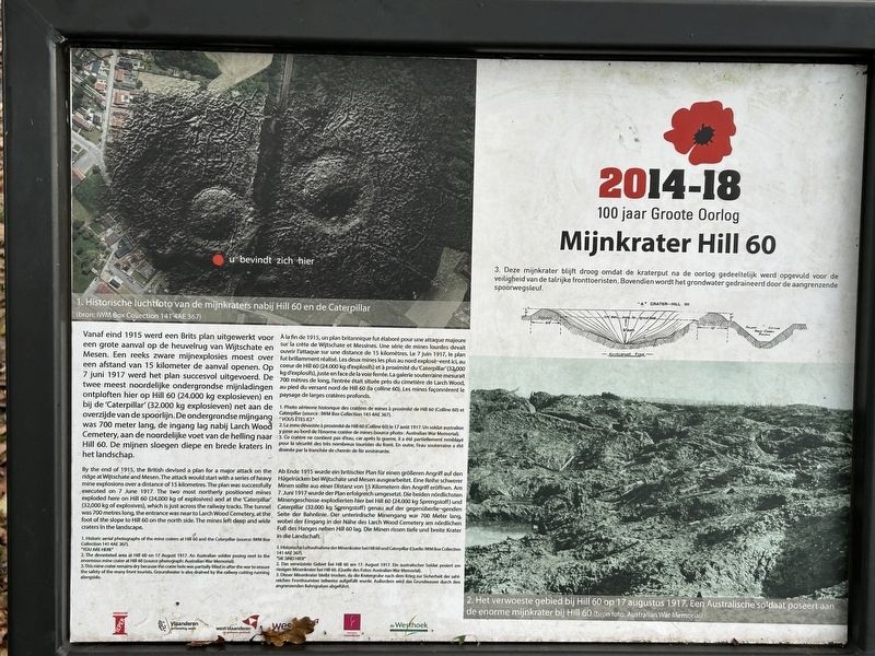
1. Mijnkrater Hill 60 Marker

1. Historische luchtfoto van de mijnkraters nabij Hill 60 en de Caterpillar. • U bevindt zich hier[rode stip]
2. Het verwoeste gebied bij Hill 60 op 17 augustus 1917. Een Australische soldaat poseert aan de enorme mijnkrater bij Hill 60 (bron foto: Australian War Memorial)
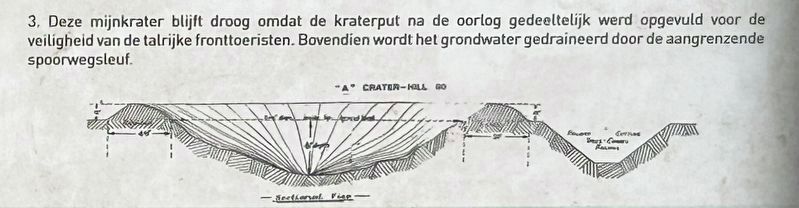
3. Deze mijnkrater blijft droog omdat de kraterput na de oorlog gedeeltelijk werd opgevuld voor de veiligheid van de talrijke fronttoeristen. Bovendien wordt het grondwater gedraineerd door de aangrenzende spoorwegsleuf.
this page online
1. Historic aerial photographs of the mine craters at Hill 60 and the Caterpillar. • "YOU ARE HERE" [red dot]
2. The devastated area at Hill 60 on 17 August 1917. An Australian soldier posing next to the enormous mine crater at Hill 60 (source photograph: Australian War Memorial). 3. This mine crater remains dry because the crater hole was partially filed in after the war to ensure the safety of the many front tourists. Groundwater is also drained by the railway cutting running alongside.
November 14, 2024
2. Illustration on the Marker - Close Up.
1. Photo aérienne historique des cratères de mines à proximité de Hill 60 et Caterpillar. (Source : IWM Box Collection 141 4AE 367). • "Vous étés ici" [point rouge]
2. La zone dévastée à proximité de HE 60 (Coline 60) le 17 août 1917. Un soldat australien y pose su bord de l’énorme cratère de mines. (Source photo : Australian War Memorial). 3. Ce cratère ne contient pas d'eau, car après la guerre, il a été par tièdement remblayé pour la sécurité des tris nombreux touristes du front. En outre, l’eau souterraine a été drainée par la tranchée de chemin de fer avoisinante.
Photographed by Steve Stoessel, November 14, 2024
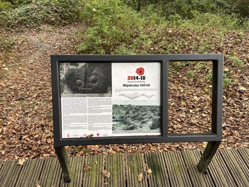
3. Mijnkrater Hill 60 Marker
1. Historische Luftaufnahme der Minenkrater bei Hill 60 und Caterpillar (Quelle: IM Box Collection 141 4A2 3472). • Sie sind hier [roter Punkt]
2. Das verwüstete Gebiet bei Hal 60 an 17, August 1917, Ein australischer Soldat posiert am riesigen Minenkrater bei Hill 60), (Quelle des Fotos: Australian War Memorial.) 3. Dieser Minenkrater bleits trocken, da die Kratergrube nach dem Krieg zur Sicherheit der zahlreichen Fronttouristen teilweise aufgefüllt wurde. Außerdem wird das Grundwasser durch des anregenden Bahngraben abgeführt.
Topics.
Photographed by Steve Stoessel, November 14, 2024
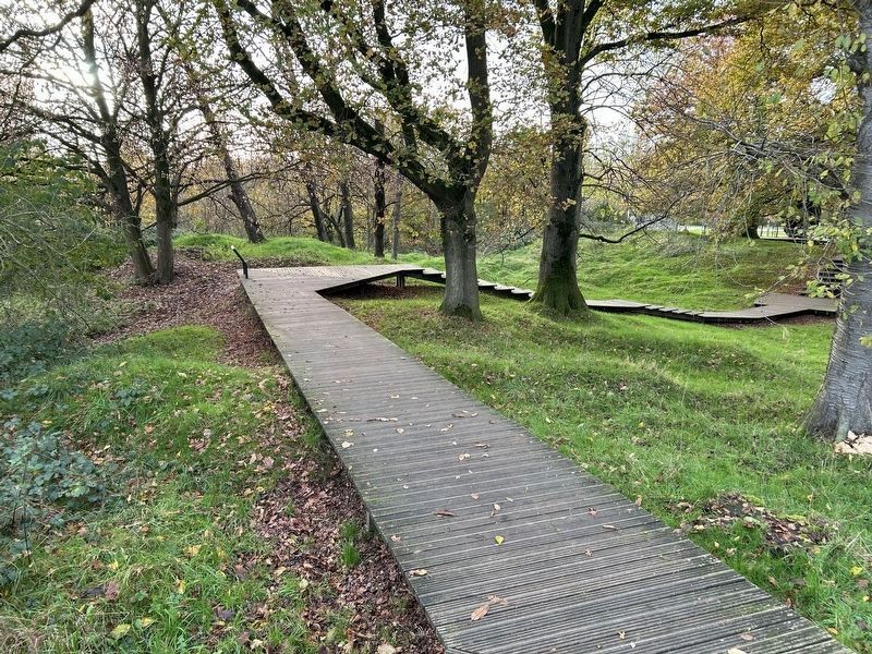
4. Hill 60 Path, Viewed from Marker
Location. 50° 49.435′ N, 2° 55.735′ E. Marker is near Ieper, Vlaanderen (Flanders), in West-Vlaanderen. It is in Zillebeke. It can be reached from Zwarteleenstraat. Marker is on the foot trail through the area. Touch for map. Marker is at or near this postal address: Zwarteleenstraat 60, Ieper, Vlaanderen 8902, Belgium. Touch for directions.

Regionally, it is in Europe, the European Union, Atlantic Europe, the Benelux Low Countries, the Schengen Area, Western Europe, and the Western World. Historically, it finds itself in what was once the Roman Empire and specifically also the Holy Roman Empire.
Other nearby markers. At least 8 other markers are within walking distance of this marker: 1st Australian Tunneling Company (within shouting distance of this marker); a different marker also named 1st Australian Tunneling Company (within shouting distance of this marker); In Memory of the 14th Light Division (within shouting distance of this marker); Hill 60 (within shouting distance of this marker); Queen Victoria’s Rifles
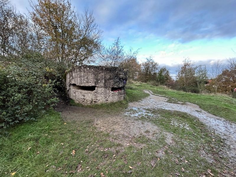
Photographed by Steve Stoessel, November 14, 2024
5. Former British Pillbox in the Crater
A trail starting at the marker - leading away from boardwalk- has sites from the war.
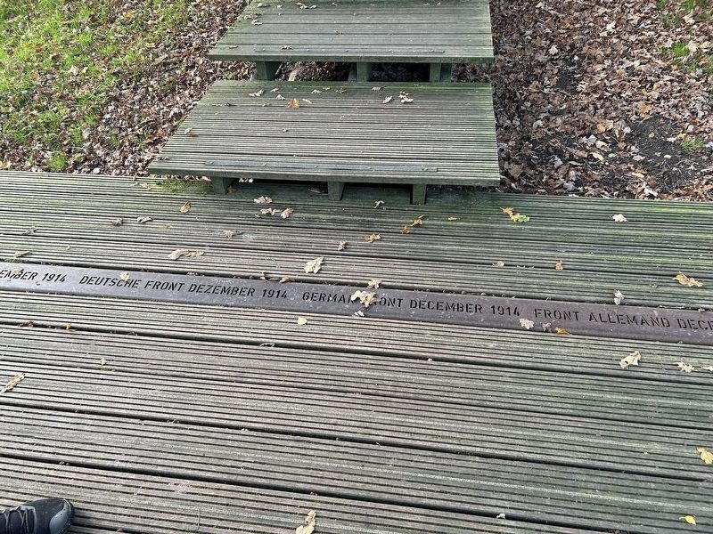
Photographed by Steve Stoessel, November 14, 2024
6. Hill 60 Marker Former Front Line
Credits. This page was last revised on February 6, 2025. It was originally submitted on February 5, 2025, by Steve Stoessel of Niskayuna, New York. This page has been viewed 147 times since then and 30 times this year. Photos: 1. submitted on February 5, 2025, by Steve Stoessel of Niskayuna, New York. 2. submitted on February 5, 2025. 3, 4, 5, 6. submitted on February 5, 2025, by Steve Stoessel of Niskayuna, New York.
