Ancaster in Hamilton, Ontario — Central Canada (North America)
Mills of Ancaster
Photographed by Tim Boyd, February 7, 2025
1. Mills of Ancaster Marker
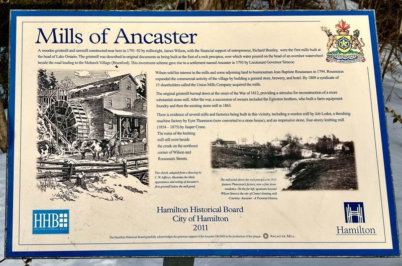
A wooden gristmill and sawmill constructed near here in 1791-92 by millwright, James Wilson, with the financial support of entrepreneur, Richard Beasley, were the first mills built at the head of Lake Ontario. The gristmill was described in original documents as being built at the foot of a rock precipice, over which water poured on the head of an overshot waterwheel beside the road leading to the Mohawk Village (Brantford). This investment scheme gave rise to a settlement named Ancaster in 1793 by Lieutenant Governor Simcoe.
Wilson sold his interest in the mills and some adjoining land to businessman Jean Baptiste Rousseaux in 1794. Rousseaux expanded the commercial activity of the village by building a general store, brewery, and hotel. By 1809 a syndicate of 15 shareholders called the Union Mills Company acquired the mills.
The original gristmill burned down at the onset of the War of 1812, providing a stimulus for reconstruction of a more substantial stone mill. After the war, a succession of owners included the Egleston brothers, who built a farm equipment foundry and then the existing stone mill in 1863.
There
this page online
Erected 2011 by City of Hamilton.
Topics. This historical marker is listed in these topic lists: Industry & Commerce • Settlements & Settlers • War of 1812. A significant historical year for this entry is 1791.
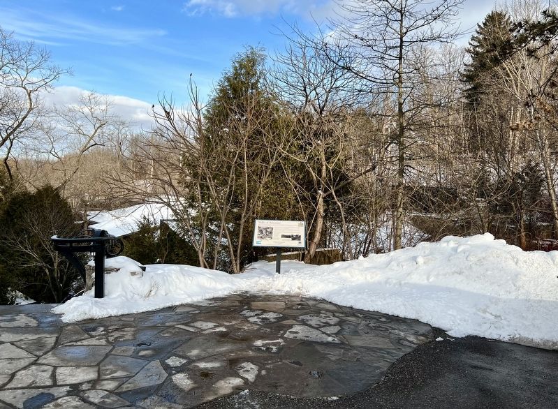
Location. 43° 14.004′ N, 79° 58.443′ W. Marker is in Hamilton, Ontario. It is in Ancaster. It is on Old Dundas Road 0.3 kilometers west of Wilson Street East, on the right when traveling east. Marker is located at the western end of the upper parking lot of the Ancaster Old Mill property. Touch for map. Marker is at or near this postal address: 544 Old Dundas Rd, Hamilton ON L9G 3J3, Canada. Touch for directions.

Regionally, this marker is on the Golden Horseshoe, in the Hamilton-Halton-Brant Area, and specifically in the
Photographed by Tim Boyd, February 7, 2025
2. Mills of Ancaster Marker
Other nearby markers. At least 8 other markers are within walking distance of this marker: Ancaster Old Mill (within shouting distance of this marker); Marr-Phillipo House (approx. 0.6 kilometers away); The Red Mill (approx. 0.7 kilometers away); “The Bloody Assize” 1814 (approx. 0.7 kilometers away); Richardson-Farmer-Ashworth House (approx. 0.8 kilometers away); Ancaster Township Hall (approx. 0.9 kilometers away); The Founding of Ancaster (approx. 0.9 kilometers away); The Gore Gazette (approx. one kilometer away). Touch for a list and map of all markers in Hamilton.
Photographed by Tim Boyd, February 7, 2025
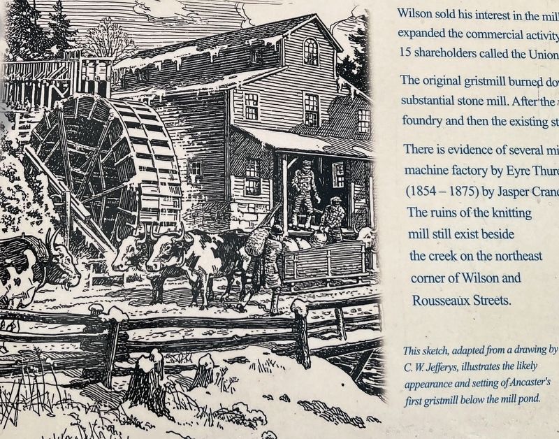
3. Mills of Ancaster marker photo and caption detail
Sketch of the original mill by C.W. Jeffries
Photographed by Tim Boyd, February 7, 2025
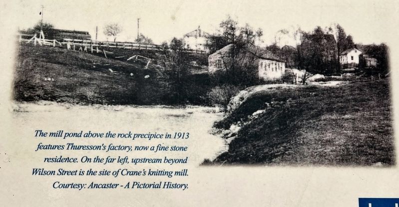
4. Mills of Ancaster marker photo and caption detail
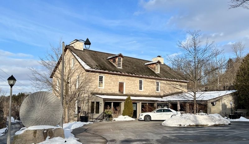
Photographed by Tim Boyd, February 7, 2025
5. The Ancaster Mill (1863), 2025
Currently the Old Mill Restaurent
Credits. This page was last revised on February 9, 2025. It was originally submitted on February 7, 2025, by Tim Boyd of Hamilton, Ontario. This page has been viewed 317 times since then and 77 times this year. Photos: 1, 2, 3, 4, 5. submitted on February 7, 2025, by Tim Boyd of Hamilton, Ontario. • Andrew Ruppenstein was the editor who published this page.
