Near Zonnebeke in West-Vlaanderen, Flanders, Belgium — Northwestern Europe
Glencorse Wood- Nonnebossen
11 November 1914
Photographed by Steve Stoessel, November 14, 2024
1. Glencorse Wood Nonnebossen Marker

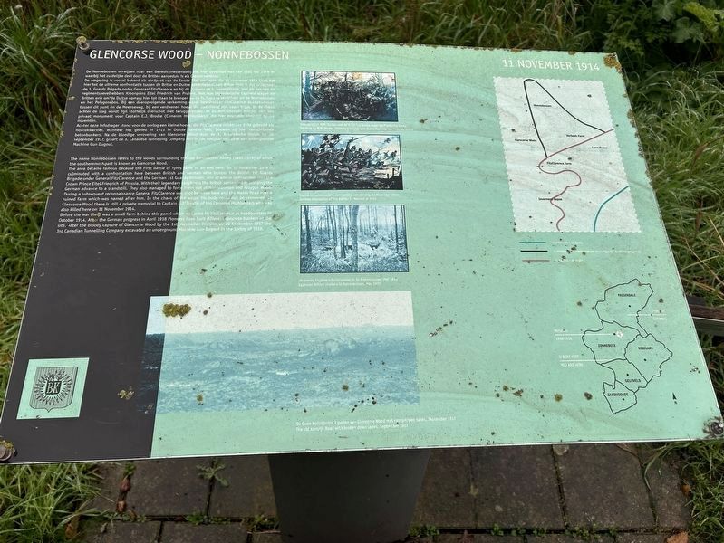
De Nonnebossen verwijzen naar een Benedictinessenabdij die hier gevestigd was van 1101 tot 1579 en waarbij het zuidelijke deel door de Britten aangeduid is als Glencorse Wood.
De omgeving is vooral bekend als eindpunt van de Eerste Slag om leper. Op 11 november 1914 komt .het hier tot de ultieme confrontatie tussen de Britse en Duitse elitetroepen. Aan Britse zijde is dat ondermeer de 1. Guards Brigade onder General FitzClarence en bij de Duitsers de 1. Garde Divisie, met als een van de regimentsbevelhebbers Kroonprins Eitel Friedrich van Pruisen. Met hun legendarische taaiheid slagen de Britten erin on de Duitse opmars hier tot staan te brengen en de Duitsers te verdrijven uit de Nonnebossen en het Polygonebos. Bij een daaropvolgende verkenning wordt bevelhebber FitzClarence doodgeschoten tussen dit punt en de Meenseweg, bij een verdwenen hoeve die naderhand-zijn naam krijgt. In de chaos achter de slag wordt zin stoffelijk overschot niet teruggevonden. In de Nonnebossen bevindt zich een privaat monument voor Captain E.J. Brodie (Cameron Highlanders), die hier eveneens sneuvelt op 11 november.
Achter deze infodrager
this page online
The area became famous because the First Battle of Ypres came to an end here. On 11 November 1914 it culminated with a confrontation here between British and German elite troops: the British 1st Guards Brigade under General FitzClarence and the German 1st Guards Division, one of whose commanders was the Crown Prince Eitel Friedrich of Prussia. With their legendary toughness the British succeeded in bringing the German advance to a standstill. They also managed to force them out of Nonnebossen and Polygon Wood. During a subsequent reconnaissance General FitzClarence was shot between here and the Menin Road
Photographed by Steve Stoessel, November 14, 2024
2. Glencorse Wood Nonnebossen Marker
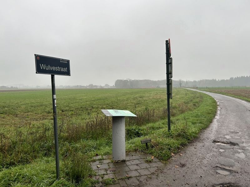
Before the war there was a small farm behind this panel which was used by FitzClarence as headquarters in October 1914. After the German progress in April 1918 Pioneers have built different concrete bunkers at the site. After the bloody capture of Glencorse Wood by the 1st Australian Division on 20 September 1917 the 3rd Canadian Tunnelling Company excavated an underground Machine Gun Dugout in the Spring of 1918.
[Photo and Illustration Captions:]
Duitse aanschouwelijke voorstelling van de slag, 11 November 1914
German impression of the battle, 11 November 1914.
Schijterij van W.B. Woller met de 2/0x and Bucks tegen de Pruisische Garde
Painting by W.B. Wollen showing the 2/0x and Bucks fighting the Prussian Guard
Topics. This historical marker is listed in this topic list: War, World I. A significant historical date for this entry is November 11, 1914.
Location. 50° 50.763′ N, 2° 58.191′ E. Marker is near Zonnebeke, Vlaanderen (Flanders), in West-Vlaanderen. It is at the intersection of Sprookjesbosdreef, on the right on Sprookjesbosdreef. Touch for map. Marker is at or near this postal address: Sprookjesbosdreef 1, Zonnebeke, Vlaanderen 8980, Belgium. Touch for directions.

Regionally, it is in Europe, the European Union, Atlantic Europe, the Benelux Low Countries, the Schengen Area, Western Europe, and the Western World. Historically, it finds itself in what was once the Roman Empire and specifically also the Holy Roman Empire.
Other nearby markers. At least 8 other markers are within 3 kilometers of this marker, measured as the crow flies: Black Watch Corner (approx. 0.9 kilometers away); a different marker also named Black Watch Corner (approx. 0.9 kilometers away); a different marker also named Black Watch Corner (approx. 0.9 kilometers away); Polygons Ruiterpad (approx. 1.1 kilometers away); Scott Post (approx. 1.5 kilometers away); New Zealand Bunkers (approx. 1.6 kilometers away); Polygon Wood (approx. 1.6 kilometers away); Buttes New British Cemetery (approx. 1.8 kilometers away). Touch for a list and map of all markers in Zonnebeke.
Credits. This page was last revised on December 23, 2025. It was originally submitted on February 8, 2025, by Steve Stoessel of Niskayuna, New York. This page has been viewed 233 times since then and 39 times this year. Photos: 1, 2. submitted on February 8, 2025, by Steve Stoessel of Niskayuna, New York.
