
Trevi in Roma in Città metropolitana di Roma Capitale, Latium, Rome, Italy — Central Italy (Tyrrhenian Coast)
Trevi-Pantheon Route
Photographed by James Hulse, February 28, 2024
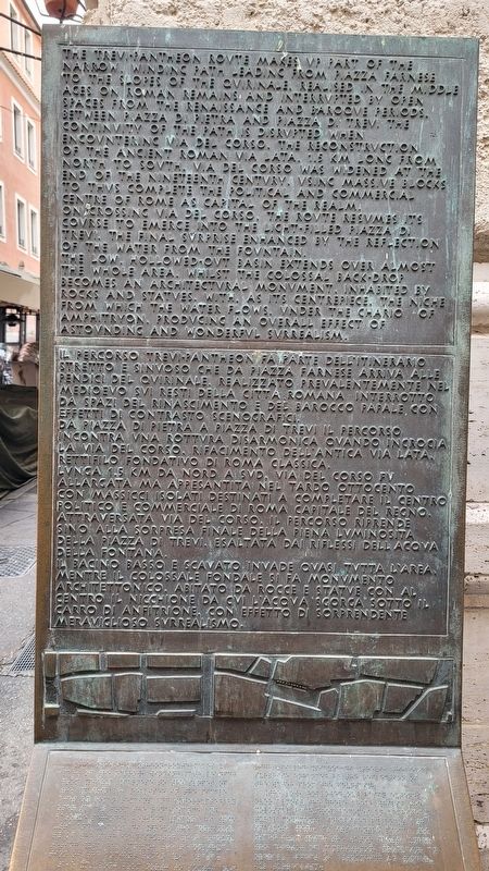
1. Trevi-Pantheon Route Marker

The Trevi-Pantheon route makes up part of the narrow, winding path leading from Piazza Farnese to the slopes of the Quirinale, realised in the Middle Ages on Roman remains and interrupted by open spaces from the Renaissance and Baroque periods. Between Piazza di Pietra and Piazza di Trevi the continvity of the path is disrupted when encountering Via del Corso. The reconstruction of the ancient Roman via Lata, 1.5 km long from north to south, Via del Corso was widened at the end of the Nineteenth Century, using massive blocks to thus complete the political and commercial centre of Rome as capital of the realm.
On crossing Via del Corso, the route resumes its course to emerge into the light-filled Piazza di Trevi. The final surprise enhanced by the reflection of the water from the fountain.
The low, hollowed-out basin extends over almost the whole area, whilst the colossal back-drop becomes an architectural monument, inhabited by rocks and statues. With, as its centrepiece, the niche from which the water flows, under the chario of amphitryon, producing an overall effect of astounding and wonderful surrealism.
Italian:
Da piazza di Pietra a piazza di Trevi il percorso incontra vna rottvra disarmonica ovando incrocia la via del Corso, rifacimento dell'antica via Lata rettifilo fondativo di Roma classica, lvnga 1.5 km da nord a svd, Via del Corso fv allargata ma appesantita nel tardo ottocento con massicci isolati destinati a completare il centro politico e commerciale di Roma capitale del regno.
this page online
Il bacino basso e scavato invade ovasi tvtta l'area mentre il colossale fondale si fa monvmento architettonico. Abitato da rocce e statve con al centro il nicchione da cvi l'acova scorga sotto il carro di anfitrione con effetto di sorprendente meraviglioso svrrealismo.
Topics. This historical marker is listed in these topic lists: Architecture • Arts, Letters, Music • Industry & Commerce.
Location. 41° 54.027′ N, 12° 28.944′ E. Marker is in Roma, Lazio (Latium, Rome), in Città metropolitana di Roma Capitale. It is in Trevi. It is at the intersection of Via delle Muratte and Via delle Vergini, on the left when traveling west on Via delle Muratte. The marker is located at the corner of the building. Touch for map. Marker is in this post office area: Roma, Lazio 00187, Italy. Touch for directions.

Regionally, it is in Europe, the European Union, the Schengen Area, a coastal Mediterranean country, and the

Photographed by James Hulse, February 28, 2024
2. The view of the Trevi-Pantheon Route Marker along the street
Other nearby markers. At least 8 other markers are within walking distance of this marker: Gaetano Donizetti (within shouting distance of this marker); a different marker also named Trevi-Pantheon Route (within shouting distance of this marker); Chiesa di Santa Maria in Trivio / Church of Santa Maria in Trivio (within shouting distance of this marker); Oratorio del SS. Crocifisso / Oratory of the Holy Crucifix (about 90 meters away, measured in a direct line); Chiesa di Santa Rita delle Vergini / Church of Santa Rita of the Virgins (about 90 meters away); Chiesa di Santa Maria dell'Umiltà / Church of Santa Maria of Humility (about 120 meters away); a different marker also named Trevi-Pantheon Route (about 120 meters away); Pietro Raimondi (about 120 meters away). Touch for a list and map of all markers in Roma.
More about this marker. The marker is one of several similar markers that highlights the specific route between the Trevi Fountain and the Pantheon.
Photographed by James Hulse, February 28, 2024
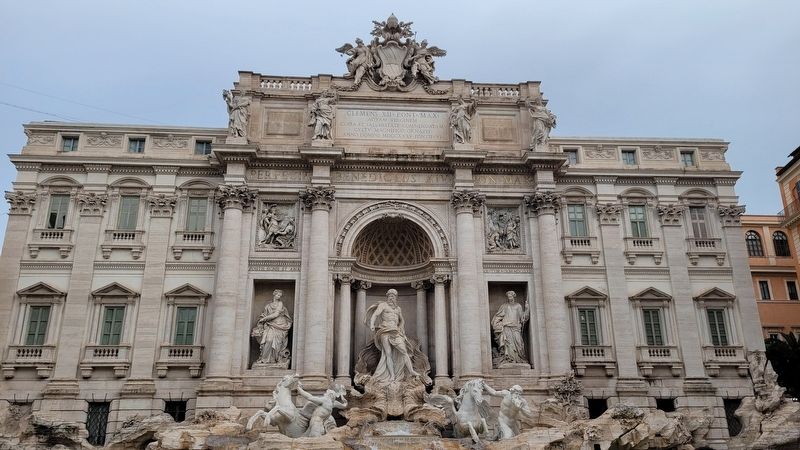
3. The Trevi Fountain
Credits. This page was last revised on February 10, 2025. It was originally submitted on February 10, 2025, by James Hulse of Medina, Texas. This page has been viewed 102 times since then and 11 times this year. Photos: 1, 2, 3. submitted on February 10, 2025, by James Hulse of Medina, Texas.
