
Guilford Center in South Central Region, Connecticut — The American Northeast (New England)
Railroads in Guilford Photos
Key to Photos Overhead

Photographed by Conrad Ward, April 22, 2024
1. Railroads in Guilford Photos Marker
(Illustration caption)
Bird's-eye view of Guilford train station, 1881
Panel A (left to right)
1. Civil War veterans departing for Niantic to serve in National Guard, ca. 1899.
2. Railroad employees in front of passenger depot, ca. 1905
3. Passenger depot (razed 2000) looking east, with water tower and switching tower in background, before 1902
4. Delivery wagon drawn by "Old Dan," 1896
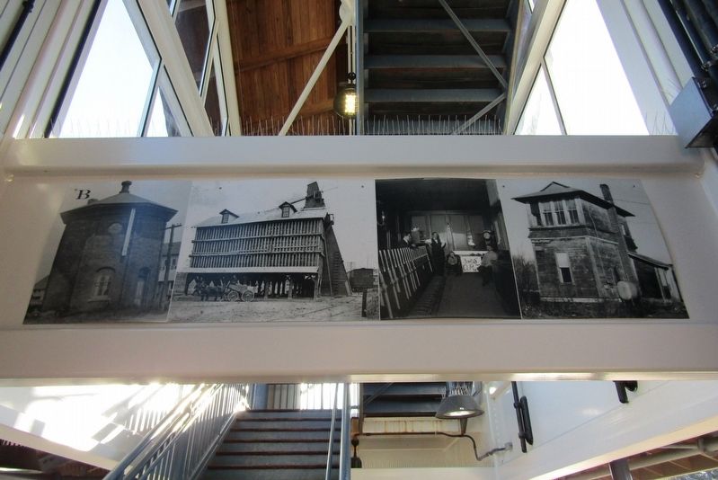
Panel B
1. Water tower with Knowles-Lombard pumpkin and tomato canning
plant (razed 1975) in background
2. Knowles-Lombard coal-storage pocket with loaded coal car, ca. 1905 (razed 1965)
3. Inside switching tower, ca. 1905: Ed Husted, Wen Smith. unnamed boy, and Bill Sennet
4. Switching tower no. 92, 1972 (razed 1973)
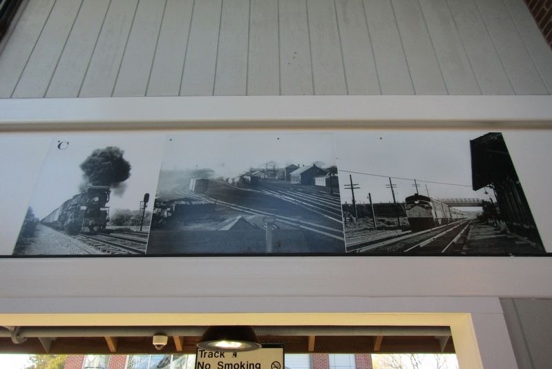
Panel C
1. New Haven Railroad locomotive (class R-2-a, type 4-8-2), 1947
2. Guilford train station complex, 1940s
3. The Merchants Limited en route to Boston, 1969
The Connecticut Department of Transportation;
Guilford Free Library, Edith B. Nettleton Historical Room;
J.W. Swanberg Collection; Richard A. Fleischer;
Guilford Keeping Society Library Collection;
Archives and Special Collections, Thomas J. Dodd Research Center,
University of Connecticut Libraries;
New Haven Railroad Historical and Technical Association.
Exhibit Design by Dempsey Fitton
Erected by Guilford Preservation Alliance.
Topics. This historical marker is listed in this topic list: Railroads & Streetcars.
Location. 41° 16.539′ N, 72° 40.416′ W. Marker is in Guilford in South Central Region, Connecticut. It is in Guilford Center. It is on Old Whitefield Street near Drive Way, on the left when traveling south. Located on the platform at Guilford Station. Touch for map. Marker is at or near this postal address: 325 Old
this page online

Regionally, this marker is in the Connecticut River Valley, on the Connecticut Shoreline, and in Greater New Haven. It is also in the American Northeast, in New England, and on the Eastern Seaboard. Globally, it is in the North Atlantic Region, North America, the Western Hemisphere, the Western World, and the Anglosphere. Historically, it finds itself in what was once New Haven County and also one of the original Thirteen Colonies.
Other nearby markers. At least 8 other markers are within walking distance of this marker: Railroads in Guilford (here, next to this marker); Made In Guilford (a few steps from this marker); Harmon B. Johnson (within shouting distance of this marker); Reverend Henry Whitfield (approx. 0.2 miles away); Whitfield House (approx. 0.2 miles away); Home of Rev. Henry Whitfield (approx. 0.2 miles away); Visitor Center (approx. 0.2 miles away); War of 1812 Cannon (approx. 0.2 miles away). Touch for a list and map of all markers in Guilford.
Also see . . . Guilford Preservation Alliance. (Submitted on February 22, 2025, by Michael Herrick of Southbury, Connecticut.)

Photographed by Conrad Ward, April 22, 2024
2. Panel A
Photographed by Conrad Ward, April 22, 2024
3. Panel B
Photographed by Conrad Ward, April 22, 2024
4. Panel C

Photographed by Conrad Ward, September 14, 2024
5. Railroads in Guilford Photos Marker

Photographed by Conrad Ward, April 22, 2024
6. Guilford Station
Credits. This page was last revised on May 19, 2026. It was originally submitted on February 16, 2025, by Conrad Ward of Guilford, Connecticut. This page has been viewed 201 times since then and 34 times this year. Photos: 1, 2, 3, 4, 5, 6. submitted on February 16, 2025, by Conrad Ward of Guilford, Connecticut. • Michael Herrick was the editor who published this page.
