The Heights in Houston in Harris County, Texas — The American South (West South Central)
Mulcahy House
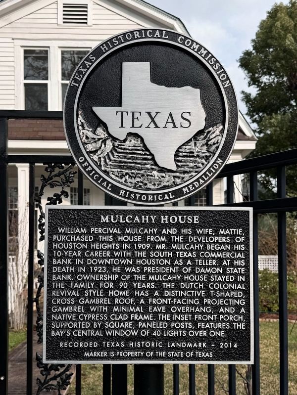
Photographed by Alex Brogan, February 15, 2025
1. Mulcahy House Marker
Erected 2014 by Texas Historical Commission. (Marker Number 17912.)
Topics. This historical marker is listed in this topic list: Notable Buildings. A significant historical year for this entry is 1909.
Location. 29° 47.43′ N, 95° 23.777′ W. Marker is in Houston, Texas, in Harris County. It is in The Heights. It is at the intersection of Harvard Street and E 11th St, on the right when traveling north on Harvard Street. Touch for map. Marker is at or near this postal address: 1046 Harvard,
this page online

Regionally, this marker is in the American South and on the Gulf Coast. Globally, it is in North America, a Gulf of Mexico state, the Western Hemisphere, the Western World, and the Anglosphere. Historically, it finds itself in what was once New Spain, the Republic of Texas, one of the Confederate States of America, and the Antebellum South.
Other nearby markers. At least 8 other markers are within walking distance of this marker: John Milroy House (about 400 feet away, measured in a direct line); Houston Heights City Hall and Fire Station (approx. 0.2 miles away); Grace United Methodist Church (approx. ¼ mile away); Houston Heights Odd Fellows Lodge No. 225 Hall (approx. 0.4 miles away); Dr. B.F. and Ethel Reed Coop House (approx. 0.6 miles away); Heights Church of Christ (approx. 0.6 miles away); David Barker House (approx. 0.7 miles away); Reagan Masonic Lodge No. 1037 A.F. & A.M. (approx. 0.7 miles away). Touch for a list and map of all markers in Houston.

Photographed by Alex Brogan, February 15, 2025
2. Mulcahy House

Photographed by Alex Brogan, February 15, 2025
3. Mulcahy House
Credits. This page was last revised on February 18, 2025. It was originally submitted on February 18, 2025, by Alex Brogan of Houston, Texas. This page has been viewed 209 times since then and 28 times this year. Photos: 1, 2, 3. submitted on February 18, 2025, by Alex Brogan of Houston, Texas. • James Hulse was the editor who published this page.
