Zillebeke near Ypres in West-Vlaanderen, Flanders, Belgium — Northwestern Europe
Bellewaarde Ridge: a fiercely contest position, both above and below ground
2014-18
| — | 100 jaar Groote Oorlog | — |
Photographed by Steve Stoessel, November 14, 2024
1. Bellewaarde Ridge: a fiercely contest position, both above and below ground Marker

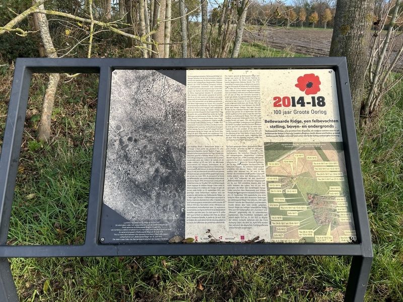
De hoog gelegen plaatsen 'Bellewaarde Ridge' en 'Hooge' behoren tot de felst bevochten posities binnen de Ieperboog. De Britse troepen hielden stand in het nabijgelegen Begijnenbos (Railway Wood'). De '177th Tunnelling Company' richtten er ondergrondse kwartieren voor duizenden soldaten en een medische post in. Op 13 mei 1915 joegen de Duitsers de Britse troepen achteruit, de Britse tegenaanval mislukte. Er sneuvelden 320 mannen, 1.400 werden gewond of vermist. Op 24 en 25 mei voeren de Duitsers een grote gasaanval uit, echter zonder veel terreinwinst. Op 2 juni 1915 veroverden ze de Bellewaerdehoeve, een Britse tegenaanval op 16 juni 1915 mislukte maar kostte bijna 4,000 man. Op 19 juli 1915 lieten de Britten de beruchte Hooge Crater exploderen tussen de Meenseweg en kasteel Hooge, de terreinwinst bleef beperkt. Op 25 september 191g ontplofte een eerste Britse mijn onder de Duitse stellingen op Bellewaarde Ridge. De Britse '14th Light Division' heroverde de hoeve, maar moest die spoedig terug prijsgegeven. Daarna volgde een hevige ondergrondse
this page online
Les endroits élevés « Bellewaarde Ridge » et « Hooge » font partie des positions les plus âprement disputées dans le Saillant d'Ypres. Les troupes britanniques tinrent bon dans le Bois des Béguines proche (« Railway Wood ») La « 177th, Tunnelling Company » y construisit des quartiers souterrains pour des milliers de soldats et un poste médical. Le 13 mai 1915, les Allemands repoussèrent. les troupes britanniques et la contre-attaque britannique échoua. 320 hommes furent tués, 1.400 blessés ou portés disparus. Les 24 et 25 mai, les Allemands lancèrent une grande. attaque aux gaz, sans toutefois gagner beaucoup de terrain. Le 2 juin 1915, Ils conquirent la ferme de Bellewaarde, une contre-attaque britannique, lancée le 16 juin 1915, échoua
Photographed by Steve Stoessel, November 14, 2024
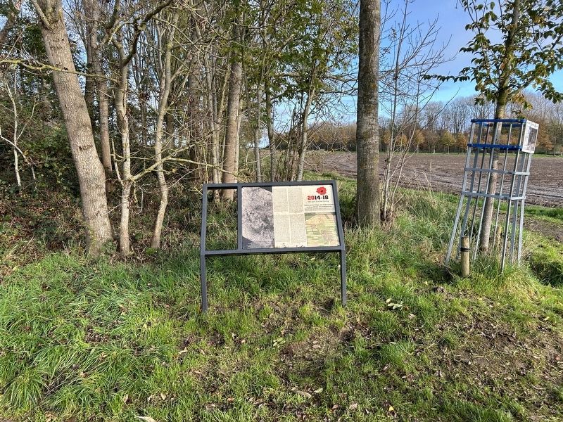
2. Bellewaarde Ridge: a fiercely contest position, both above and below ground Marker
The higher ground at Bellewaarde Ridge and Hooge saw some of the fiercest fighting in the Ieper Salient. The British troops held the nearby Begijnenbos (Railway Wood). The 177th Tunnelling Company dug underground quarters here for thousands of troops and a medical post. On 13 May 1915, the Germans forced the British back; a British counter-attack was repulsed. 320 men were killed; 1,400 were wounded or missing On 24 and 25-May, the Germans launched a major gas attack, but gained little ground. On 2 June, they captured Bellewaarde Farm. A British attempt to take it back on 16 June 1915 failed at a cost of almost 4,000 men. On 19 July 1915, the British detonated the mine between the Menin Road and Hooge Chateau that later became known as the notorious Hooge Crater, but little ground was gained. On 25 September 1915, the British exploded a first mine under the German positions on Bellewaarde Ridge. The 14th Light Division recaptured Bellewaarde Farm, but was quickly forced out again. This was the prelude to a long and bitter underground war between the British Tunnellers' and the German 'Mineure'. In 1916 and 1917, no fewer than 33 mines were exploded, but the position of the front lines hardly changed. It was only on 31 July 1917, with the opening of the Third Battle of Ieper, that the front moved eastwards again. However, after 26 April 1918 the fighting returned, when the Germans launched their Spring Offensive.
Die hoch gelegenen Plätze „Bellewaarde Ridge" und „Hooge" gehörten zu den am heftigsten umkämpften Positionen Innerhalb des Ypernbogens. Die britischen Truppen hielten am nahegelegenen „Begijnenbos" (Railway Wood*) stand. Die „177th Tunnelling Company" errichtete hier einen medizinischen Posten und unterirdische Opartiere für Tausende Soldaten. Am 13. Mai 1915 verjagten die-Deutschen die britischen Truppen, der britische Gegenangriff scheiterte, 320 Männer fielen, t,400 wurden verletzt oder vermisst. Am 24. und 25. Mai führten die Deutschen einen großen Gasangriff durch, jedoch ohne viel Bodengewinn. Am 2 Juni, 1915 eroberten sie den Bauernhof „Bellewaerdehoeve", ein britischer Gegenangriff am 16, Juni 1915 scheiterte, kostete aber fast 4.000 Soldaten das Leben. Am 19. Juli 1915 sprengten die Briten den berüchtigten Hooge Crater zwischen dem Meenseweg und Schloss Hooge, der Bodengewinn war jedoch beschränkt. Am 25. September 1915 explodierte eine erste britische Mine unter den deutschen Stellungen auf „Bellewaarde Ridge". Die britische „14th Light Division" konnte den Bauernhof zurückerobern, musste diesen aber bald wieder aufgeben. Danach folgte ein heftiger unterirdischer Krieg, 1916 und 1917 bekämpften sich „Tunnelers" und „Mineure"" gegenseitig mit 33 unterirdischen Explosionen. Die Frontlinien bewegten sich jedoch kaum. Erst am 31. Juli 1917, zu Beginn der dritten Schlacht, verschob sich die Front Richtung Osten. Ab dem 26. April 1918 wurden hier während der deutschen Frühlingsoffensive erneut Kämpfe ausgetragen.
[Photo Captions]
Topics. This historical marker is listed in this topic list: War, World I. A significant historical date for this entry is May 13, 1915.
Location. 50° 51.029′ N, 2° 56.355′ E. Marker is near Ypres, Vlaanderen (Flanders), in West-Vlaanderen. It is in Zillebeke. It can be reached from Bellewaardestraat. Touch for map. Marker is at or near this postal address: Bellewaardestraat 7, Ypres, Vlaanderen 8902, Belgium. Touch for directions.

Regionally, it is in Europe, the European Union, Atlantic Europe, the Benelux Low Countries, the Schengen Area, Western Europe, and the Western World. Historically, it finds itself in what was once the Roman Empire and specifically also the Holy Roman Empire.
Other nearby markers. At least 8 other markers are within walking distance of this marker: The Liverpool Scottish (about 210 meters away, measured in a direct line); Pte John William Ogley (about 210 meters away); R.E. Grave and Liverpool Scottish Stone (about 210 meters away); 177th Tunneling Company Royal Engineers Memorial (approx. 0.2 kilometers away); Hooge Crater Cemetery (approx. half a kilometer away); Kastelenin de Ieperboog (approx. 0.6 kilometers away); Kasteeldomeinen Worden Front (approx. 0.6 kilometers away); Kasieeldumeinen na de Oorlog (approx. 0.6 kilometers away). Touch for a list and map of all markers in Ypres.
Also see . . . Hooge in WW! (Wikipedia). (Submitted on February 21, 2025, by Steve Stoessel of Niskayuna, New York.)
Credits. This page was last revised on December 23, 2025. It was originally submitted on February 20, 2025, by Steve Stoessel of Niskayuna, New York. This page has been viewed 165 times since then and 27 times this year. Photos: 1, 2. submitted on February 20, 2025, by Steve Stoessel of Niskayuna, New York.
