Weatherford in Custer County, Oklahoma — The American South (West South Central)
Blair Cabin
Photographed by Jason Armstrong, August 13, 2023
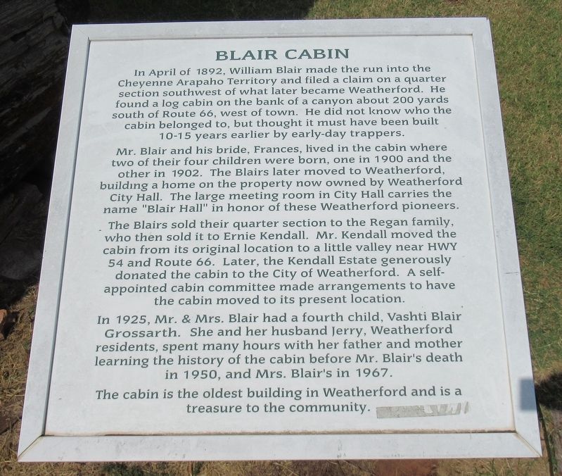
1. Blair Cabin Marker
In April of 1892, William Blair made the run into the Cheyenne Arapaho Territory and filed a claim on a quarter section southwest of what later became Weatherford. He found a log cabin on the bank of a canyon about 200 yards south of Route 66, west of town. He did not know who the cabin belonged to, but thought it must have been built 10-15 years earlier by early-day trappers.
Mr. Blair and his bride, Frances, lived in the cabin where two of their four children were born, one in 1900 and the other in 1902. The Blairs later moved to Weatherford, building a home on the property now owned by Weatherford City Hall. The large meeting room in City Hall carries the name "Blair Hall" in honor of these Weatherford pioneers.
The Blairs sold their quarter section to the Regan family, who then sold it to Ernie Kendall. Mr. Kendall moved the cabin from its original location to a little valley near HWY 54 and Route 66. Later, the Kendall Estate generously donated the cabin to the City of Weatherford. A self-appointed cabin committee made arrangements to have the cabin moved to its present location.
In 1925, Mr. & Mrs. Blair
this page online
The cabin is the oldest building in Weatherford and is a treasure to the community.
Erected by Western Oklahoma Historical Center.
Topics. This historical marker is listed in this topic list: Settlements & Settlers. A significant historical month for this entry is April 1892.
Location. 35° 31.619′ N, 98° 42.445′ W. Marker is in Weatherford, Oklahoma, in Custer County. It is at the intersection of East Franklin Avenue and Custer Street, on the right when traveling east on East Franklin Avenue. Touch for map. Marker is at or near this postal address: 106 E Franklin Ave, Weatherford OK 73096, United States of America. Touch for directions.

Regionally, this marker is in Southwest Oklahoma. It is also in the American South, specifically on the prairies, and on the Southern Plains. Globally, it is in North America, the Western Hemisphere, the Western World, and the Anglosphere. Historically, it finds

Photographed by Jason Armstrong, August 13, 2023
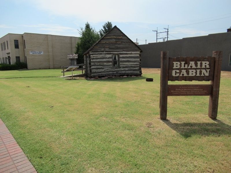
2. Blair Cabin and Marker
Other nearby markers. At least 8 other markers are within 7 miles of this marker, measured as the crow flies: McDonnell-Douglas F-4C Phantom II (approx. 2.2 miles away); Lockheed T-33 "Shooting Star" (approx. 2.4 miles away); Fairchild-Republic A-10 "Thunderbolt II" (approx. 2.4 miles away); Revolutionary War Patriots (approx. 2.4 miles away); Apollo Command Module (approx. 2.4 miles away); Lockheed F-104C "Starfighter" (approx. 2.4 miles away); Lt. Gen. Thomas P. Stafford (approx. 2.4 miles away); The History of Lucille's (approx. 6.7 miles away). Touch for a list and map of all markers in Weatherford.
Photographed by Jason Armstrong, August 13, 2023
3. Blair Cabin Side View
Credits. This page was last revised on February 21, 2025. It was originally submitted on February 21, 2025, by Jason Armstrong of Talihina, Oklahoma. This page has been viewed 150 times since then and 22 times this year. Photos: 1, 2, 3. submitted on February 21, 2025, by Jason Armstrong of Talihina, Oklahoma. • J. Makali Bruton was the editor who published this page.
