Passendale near Zonnebeke in West-Vlaanderen, Flanders, Belgium — Northwestern Europe
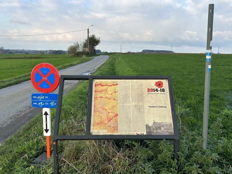
Flandern I-stellung
2014-18
| — | 100 jaar Groote Oorlog | — |

Photographed by Steve Stoessel, November 12, 2024
1. Flandern I-stellung Marker

Wanneer midden 1917 de strijd losbarstte, was deze stelling nog in volle aanbouw. Ze liep min of meer in noord-zuidelijke richting. Verschillende "Mittelriegels' en de Flandern II-stelling sloten er op aan. Naar het noorden (aan uw rechterkant) liep ze voorbij Westrozebeke en Houthulst tot aan Zarren. Zuidelijk gaat het richting Broodseinde, voorbij Beselare, Kruiseke en Wervik tot over de Franse grens. In feite werden enkel de delen nabij Passendale, Zonnebeke en Beselare min of meer afgewerkt. Dat kwam omdat de Duitsers wisten dat de heuvelrug bij een aanval van groot belang zou zijn. Ze wilden die dan ook als eerste afwerken. De overige delen bestonden midden 1917 grotendeels uit namaak loopgraven en constructies om devijandtemisleiden. De bunkers op Tyne Cot Cemetery vormden onderdeel van de Flandern I-stelling. De hoger gelegen positie
this page online
Lorsqu'au milieu de l'année 1917, la bataille éclata, cette position était encore en cours, de construction. Elle était orientée plus ou moins du nord au sud. Plusieurs « Mittelriegels » et la position Flandern II y étaient rattachées, Vers le nord (à votre droite), elle passait par Westrozebeke et Houthulst, jusqu'à Zarren. Au sud, elle se dirigeait vers Broodseinde, en passant par Beselare, Kruiseke et Wervik, jusqu’au-delà
Photographed by Steve Stoessel, November 12, 2024
2. Flandern I-stellung Marker
Photographed by Steve Stoessel, November 12, 2024
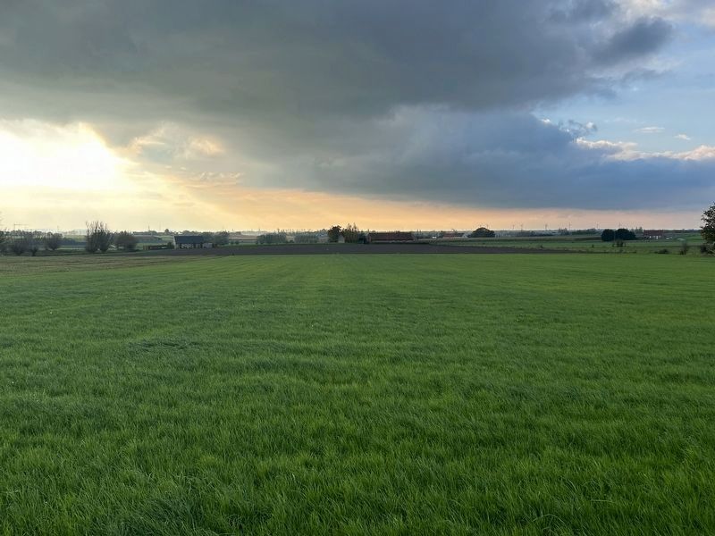
3. View Towards Ypres From Marker
Various defensive lines and the Flandern II position connected to it. To the north (on your right), it ran past Westrozebeke and Houthulst to Zarren. To the south it continues in the direction of Broodseinde, past Beselare, Kruiseke and Wervik over the border into France. In fact only the parts near to Passchendaele, Zonnebeke and Beselare were more or less finished. This was because the Germans knew that the ridge would be important in case of an attack so they wanted to finish that bit first. Mid 1917, the other parts consisted mainly of fake trenches and constructions to mislead the enemy. The bunkers on Tyne Cot Cemetery were part of Flandern I. The higher position offered perfect defence. During the shelling on 4 October 1917, German troops took shelter there. Thanks to the holes in the bunker, that were used only for observing, they were able to keep a close eye on the battlefield. After the shelling, the machine guns were quickly placed on top of or next
Photographed by Steve Stoessel, November 11, 2024
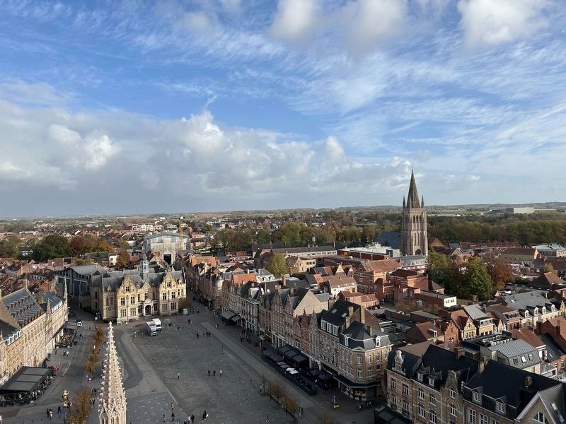
4. Looking East from the Cloth Tower Towards Tyne Cot.
Note the ridge on the horizon.
Als Mitte 1917 der Kampf ausbrach, war diese Stellung noch voll im Bau. Sie verlief mehr oder weniger im nord-südlicher Richtung. Mehrere 'Mittelriegels‘ und die Flandern I-Stellung schlossen daran an. In den Norden (auf ihrer rechten Seite) führte sie an Westrozebeke und Houthulst vorbei bis Zarren. Südlich geht es in Richtung Broodseinde, an Beselare, Kruiseke und Wervik vorbei, bis über die französische Grenze. Faktisch wurden lediglich die Teile in der Nähe von Passendale, Zonnebeke und Beselare mehr oder weniger fertiggestellt. Der Grund dafür war, dass die Deutschen wussten, dass der Hügelkamm bei einem Angriff von großer Bedeutung sein würde Deshalb wollten sie ihn als ersten fertigstellen. Die restlichen Teile bestanden Mitte 1917 größtenteils aus Imitationen von Schützengraben und Konstruktionen, um den Gegner in die Irre zu führen. Die Bunker, am Tyne Cot Cemetery Waren am Bestandteil der, Flandern I-Stellung Die höher gelegene Position bot eine perfekte Verteidigung, Während der Beschießungen vom 4. Oktober 1917 versteckten sich dort deutsche Truppen. Von den Öffnungen im Bunker, die rein zur Beobachtung dienten, haben Sie eine gute Sicht auf das Schlachtfeld. Nach' dem Bombardement wurden Maschinengewehre rasch auf oder neben dem Bunker aufgestellt.
Captions
Topics and series. This historical marker is listed in this topic list: War, World I. In addition, it is included in the The Cross of Sacrifice series list. A significant historical date for this entry is October 4, 1917.
Location. 50° 53.27′ N, 2° 59.85′ E. Marker is near Zonnebeke, Vlaanderen (Flanders), in West-Vlaanderen. It is in Passendale. It is on Tynecotstraat north of Vijfwegestraat, on the right when traveling north. Touch for map. Marker is at or near this postal address: Tynecotstraat 24, Zonnebeke, Vlaanderen 8980, Belgium. Touch for directions.

Regionally, it is in Europe, the European Union, Atlantic Europe, the Benelux Low Countries, the Schengen Area, Western Europe, and the Western World. Historically, it finds itself in what was once the Roman Empire and specifically also the Holy Roman Empire.
Other nearby markers. At least 8 other markers are within walking distance of this marker: Tyne Cot Cemetery (about 90 meters away, measured in a direct line); Tyne Cot Cemetery & Memorial (about 90 meters away); a different marker also named Tyne Cot Cemetery & Memorial (about 90 meters away); Tyne Cot Blockhouse (about 150 meters away); New Zealand Memorial (about 180 meters away); Bedfordshire Regiment (about 210 meters away); In Memory of the King’s Own Yorkshire Light Infantry (about 210 meters away); Sherwood Forresters (about 210 meters away). Touch for a list and map of all markers in Zonnebeke.
Credits. This page was last revised on February 24, 2025. It was originally submitted on February 21, 2025, by Steve Stoessel of Niskayuna, New York. This page has been viewed 190 times since then and 52 times this year. Photos: 1, 2. submitted on February 21, 2025, by Steve Stoessel of Niskayuna, New York. 3, 4. submitted on February 23, 2025, by Steve Stoessel of Niskayuna, New York.
