La Conner in Skagit County, Washington — The American West (Northwest)
The Tillinghast Beech

Photographed by Ann S., February 21, 2025
1. The Tillinghast Beech Marker
Planted circa 1890 by A.G. Tillinghast
With a girth of 12’ it is the largest European Beech known on the West Coast.
Topics. This historical marker is listed in this topic list: Horticulture & Forestry. A significant historical year for this entry is 1890.
Location. 48° 23.545′ N, 122° 29.348′ W. Marker is in La Conner, Washington, in Skagit County. It can be reached from the intersection of Morris Street and Maple Avenue. It is surrounded by the deck of the Tillinghast Seed Company building, which was founded in 1863, located at the street intersection. Touch for map. Marker is at or near this postal address: 623 Morris St, La Conner WA 98257, United States of America. Touch for directions.

Regionally, this marker is in Washington’s Puget Sound Region. It is also on the American Pacific Coast, in the Pacific Northwest, and in the Lewis & Clark Corridor. Globally, it is in North America, in the Cascade Range, in the Inside Passage, on the Ring of Fire, in the Pacific Rim, in the Western Hemisphere, in the Western World, and in the Anglosphere.
Other nearby markers. At least 8 other markers are within
this page online
More about this marker. The marker is low on the tree, almost below the deck that surrounds the tree.
Regarding The Tillinghast Beech. The tree is next to the building that once housed Tillinghast Seeds, a prominent seed distributor to the surrounding agricultural community.
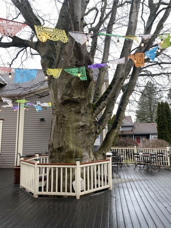
Photographed by Ann S., February 21, 2025
2. The Tillinghast Beech Marker
Credits. This page was last revised on February 26, 2025. It was originally submitted on February 22, 2025, by Ann S. of Bellingham, Washington. This page has been viewed 316 times since then and 104 times this year. Photos: 1, 2. submitted on February 22, 2025, by Ann S. of Bellingham, Washington. • J. Makali Bruton was the editor who published this page.
