
Steinau an der Straße in Main-Kinzig-Kreis, Hesse, Germany — Central Europe
Stadtmauer und „Unterthor“
⎯⎯⎯
City Walls and the “Lower Gate”
Photographed by Andrew Ruppenstein, January 31, 2025
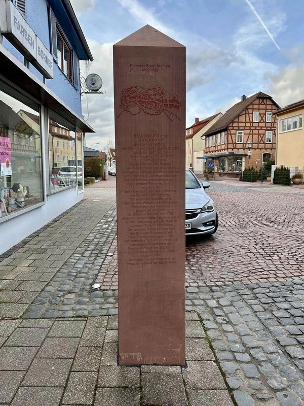
1. City Walls and the “Lower Gate” Marker - south stela, east face

Bereits kurz nach der Stadtrechteverleihung Steinaus 1290 wurde mit dem Bau der Wehrmauern rund um den Stadtberg begonnen Zusammen mit den Warten, den 5 Stadttoren und insgesamt 24 Türmen verfügte die Stadt Steinau am Ende des 15 Jahrhunderts über eine ansehnliche Stadtbefestigung, die in großen Teilen heute noch erhalten ist.
Seit dieser Zeit war das „Unterthor“ zur Vorstadt „am Steinweg“ der westliche Stadteingang, den die aus Westen ankommenden Reisenden und Kaufleute passieren mussten.
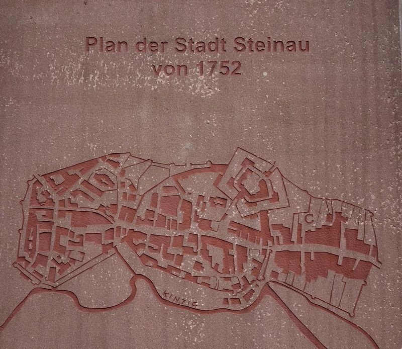
Im historischen Plan von 1752 erkennt man ein doppeltes Zwingertor, dessen verstärkte östliche Mauern, auf einen Torturm hindeuten. Die Umrisse dieser Anlage sind der heutigen Pflasterung als helle Flächen nachgezeichnet. der vermutete Torturm zeichnet sich als Basaltpflasterfläche ab. Fundamentreste des Stadttores wurden beim Straßenbau 2004 aufgefunden.
Die beiden Stelen markieren in etwa den Verlauf der Stadtmauer.
City Walls and the Lower Gate
Shortly after Steinau was granted town rights in 1290, construction began on the defensive walls around the town hill. Together with the watchtowers, the 5 town gates and a total of 24 towers, the town of Steinau had
this page online
Since then, the "Untertor" to the suburb "am Steinweg" was the western town entrance, which travelers and merchants arriving from the west had to pass through.
In the historical plan from 1752, one can see a double Zwinger gate, the reinforced eastern walls of which indicate a gate tower. The outlines of this structure are traced as light areas on the current paving. The presumed gate tower is visible as a basalt paving surface. The remains of the foundations of the city gate were found during road construction in 2004.
The two steles roughly mark the course of the city wall.
Topics. This historical marker is listed in this topic list: Forts and Castles. A significant historical year for this entry is 1290.
Location. 50° 18.704′ N, 9° 27.461′ E. Marker is in Steinau an der Straße, Hessen (Hesse), in Main-Kinzig-Kreis. It is on Brüder-Grimm-Straße, on the left when traveling west. Touch for map. Marker is at or near this postal address: Brüder-Grimm-Straße 109, Steinau an der Straße HE 36396, Germany. Touch for directions.

Regionally, it is in Europe, the European Union, Atlantic Europe, Central Europe, the Schengen Area, Western Europe, and the
Photographed by Andrew Ruppenstein, January 31, 2025
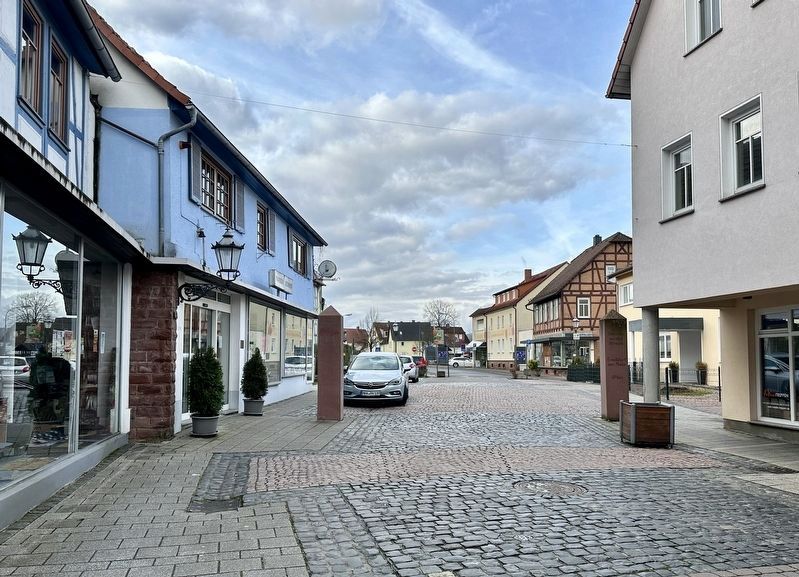
2. City Walls and the Lower Gate Marker - looking west
The south stela (with marker text and map) is on the left. On the opposite side of the stela, the distance to Leipzig is indicated as 332 km., while on the north stela (right), the distance to Frankfurt is given as 69 km. Steinau was located between the two cities, with all three along the Via Regia road, a more than 2,000 year old trade route connecting eastern and western Europe. A 5 meter segment of the road was excavated from nearby and then reinstalled on the grounds of the Brothers Grimm House Museum, some 150 meters due east of this marker.
Other nearby markers. At least 6 other markers are within walking distance of this marker: Märchenhafter Kräutergarten / Fairytale Herb Garden (about 210 meters away, measured in a direct line); Via Regia (about 210 meters away); Originaler Straßenbelag / Original Road Surface (about 210 meters away); Brüder Grimm-Haus / Brothers Grimm House (about 210 meters away); Spätmittelalterliches Bürger- und Handwerker Haus / Late Medieval Townhouse (approx. 0.4 kilometers away); Huttensche Kemenete, Lutherisches Pfarrhaus / von Hutten Home, Lutheran Parsonage (approx. 0.4 kilometers away).
Photographed by Andrew Ruppenstein, January 31, 2025
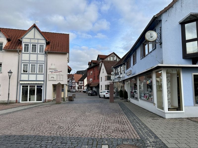
3. City Walls and the “Lower Gate” Marker - looking east into the old town
Photographed by Andrew Ruppenstein, January 31, 2025
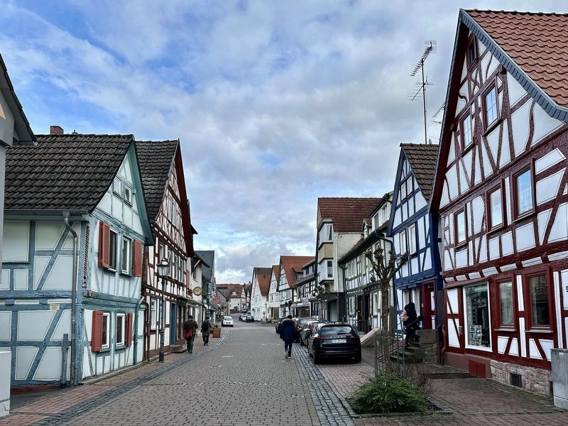
4. Old town Steinau, as seen from ca. 50 meters east of the marker
Photographed by Andrew Ruppenstein, January 31, 2025
5. Marker map: Steinau in 1752 (note north is towards the bottom on this map)
Credits. This page was last revised on February 27, 2025. It was originally submitted on February 27, 2025, by Andrew Ruppenstein of Lamorinda, California. This page has been viewed 92 times since then and 20 times this year. Photos: 1, 2, 3, 4, 5. submitted on February 27, 2025, by Andrew Ruppenstein of Lamorinda, California.
