Boise in Ada County, Idaho — The American West (Mountains)
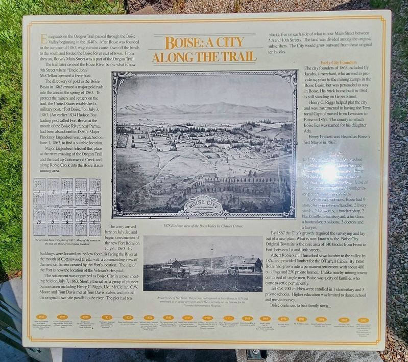
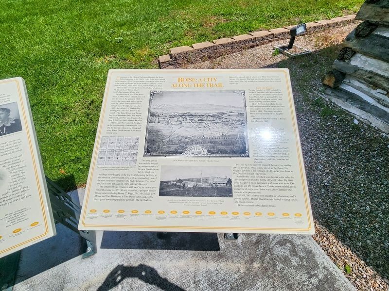
Boise: A City Along the Trail
Photographed by Douglass Halvorsen, June 26, 2023
1. Boise: A City Along the Trail Marker
The trail later crossed the Boise River below what is now 9th Street where “Uncle John” McClellan operated a ferry boat.
The discovery of gold in the Boise Basin in 1862 created a major gold rush into the area in the spring of 1863. To protect the miners and settlers on the trail, the United State established a military post, “Fort Boise,” on July 3, 1863. (An earlier 1834 Hudson Bay trading post called Fort Boise, at the mouth of the Boise River, near Parma, had been abandoned in 1856.) Major Pinckney Lugenbeel was dispatched on June 1, 1863, to find a suitable location.
Major Lugenbeel selected this place at the river crossing of the Oregon Trail and the trail up Cottonwood Creek and along Robie Creek into the Boise Basin mining area.
The army arrived here on July 3rd and began construction of the new Fort Boise on July 6, 1863. Its
this page online
The settlement was organized as Boise City in a town meeting held on July 7, 1863. Shortly thereafter, a group of pioneer businessmen including Henry C. Riggs, J.M. McClellan, C.W. Moore and Tom Davis met at Tom Davis’ cabin, and plotted the original town site parallel to the river. The plot had ten blocks, five on each side of what is now Main Street between 5th and 10th Streets. The land was divided among the original subscribers. The City would grow outward from these original ten blocks.
Early City Founders
The city founders of 1863 included Cy Jacobs, a merchant, who arrived to provide supplies to the mining camps in the Boise Basin, but was persuaded to stay in Boise. His brick home built in 1864, is still standing on Grove Street.
Henry C. Riggs helped plat the city and was instrumental in having the Territorial Capitol moved from Lewiston to Boise in 1864. The county in which Boise
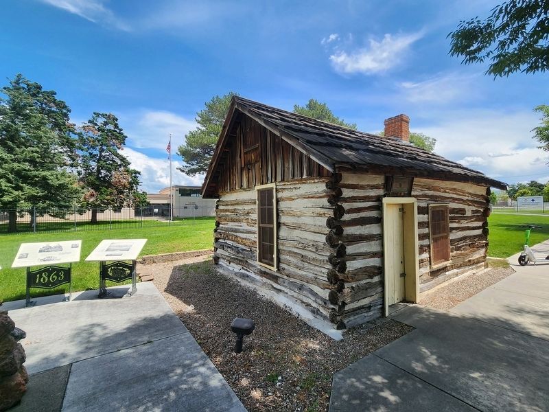
Photographed by Douglass Halvorsen, June 26, 2023
2. Boise: A City Along the Trail Marker
Henry Prickett was elected as Boise’s first Mayor in 1867.
The City
In 1864, Boise’s population reached [illegible] Most of the structures were made of lumber interspersed with [illegible] or logs.
Aside from residences, Boise had 9 stores for general merchandise, 2 livery stables, 2 breweries, 1 butcher shop, 2 blacksmiths, a lumberyard, a tin store, a bootmaker, 5 saloons, 3 doctors and a lawyer.
By 1867, the City’s growth required the surveying and layout of a new plan. What is now known as the Boise City Original Townsite is the core area of 140 blocks from Front to Fort, between 1st and 16th streets.
Albert Robie's mill furnished sawn lumber to the valley by 1864 and provided lumber for the O’Farrell Cabin. By 1868 Boise had grown into a permanent settlement with about 400 buildings and 350 private homes. Unlike nearby mining towns comprised of single men, Boise was a city of families who came to settle permanently.
1n 1860, 200 children were enrolled in 1 elementary and 3 private schools. Higher education was limited to dance school and music courses.
Boise continues to be a family
Photographed by Douglass Halvorsen, June 26, 2023
3. Boise: A City Along the Trail Marker
Erected by City of Boise Parks and Recreation Department.
Topics and series. This historical marker is listed in this topic list: Settlements & Settlers. In addition, it is included in the Oregon Trail series list. A significant historical date for this entry is June 1, 1863.
Location. 43° 37.131′ N, 116° 11.663′ W. Marker is in Boise, Idaho, in Ada County. It is on West Fort Street, on the left when traveling south. Touch for map. Marker is at or near this postal address: 450 W Fort St, Boise ID 83702, United States of America. Touch for directions.

Regionally, this marker is on the Snake River Plain. It is also in the American Mountain West. Globally, it is in North America, the Western Hemisphere, the Western World, and the Anglosphere.
Other nearby markers. At least 8 other markers are within walking distance of this marker: The O’Farrells (here, next to this marker); The O’Farrell Cabin (here, next to this marker); a different marker also named The O'Farrell Cabin (here, next to this marker); First Home in Boise (here, next to this marker); Fort Boise (about 300 feet away, measured in a direct line); Memorial Park (approx. 0.2 miles away); In Recognition of the First Teacher in Space (approx. ¼ mile away); Oregon Trail Monument (approx. ¼ mile away). Touch for a list and map of all markers in Boise.
Credits. This page was last revised on July 2, 2025. It was originally submitted on February 27, 2025, by Douglass Halvorsen of Klamath Falls, Oregon. This page has been viewed 369 times since then and 72 times this year. Photos: 1. submitted on March 2, 2025. 2, 3. submitted on February 27, 2025, by Douglass Halvorsen of Klamath Falls, Oregon. • J. Makali Bruton was the editor who published this page.
