
Hammond in Lake County, Indiana — The American Midwest (Great Lakes)
Mt. Zion M.B. Church
Photographed by Trevor L Whited, March 2, 2025
1. Mt. Zion M.B. Church Marker
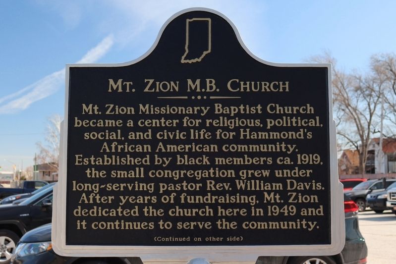
Mt. Zion Missionary Baptist Church became a center for religious, political, social, and civic life for Hammond's African American community. Established by black members ca. 1919, the small congregation grew under long-serving pastor Rev. William Davis. After years of fundraising, Mt. Zion dedicated the church here in 1949 and it continues to serve the community.
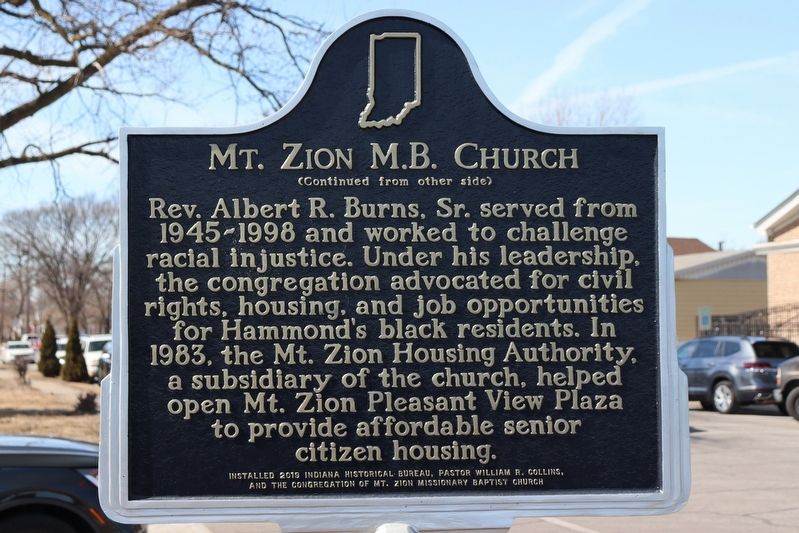
Rev. Albert R. Burns, Sr. served from 1945-1998 and worked to challenge racial injustice. Under his leadership, the congregation advocated for civil rights, housing, and job opportunities for Hammond's black residents. In 1983, the Mt. Zion Housing Authority, a subsidiary of the church, helped open Mt. Zion Pleasant View Plaza to provide affordable senior citizen housing.
Erected 2019 by Indiana Historical Bureau, Pastor William R. Collins, And The Congregation of Mt. Zion Missionary Baptist Church. (Marker Number 45.2019.3.)
Topics and series. This historical marker is listed in these topic lists: African Americans • Religion & Religious Structures. In addition, it is included in the Indiana Historical Bureau Markers series list. A significant historical year for this entry is 1949.
Location. 41° 35.95′ N,
this page online

Regionally, this marker is in Northwest Indiana and in the Calumet Region. It is also in the American Midwest and in the Corn Belt. Globally, it is in North America, on the Great Lakes, in the Western Hemisphere, in the Western World, and in the Anglosphere. Historically, it finds itself in what was once the territory of the Mississippian Culture and also the Northwest Territory.
Other nearby markers. At least 8 other markers are within 3 miles of this marker, measured as the crow flies: Origins of Calumet City and Abraham Lincoln Funeral Train (approx. 2 miles away in Illinois); Site of Brass Tavern (approx. 2.7 miles away); Stallbohm Barn-Kaske House (approx. 2.7 miles away); A Blooming Town (approx. 2.7 miles away); Native Plants of Heritage Park & Bieker Woods (approx. 2.7 miles away);
Photographed by Trevor L Whited, March 2, 2025
2. Mt. Zion M.B. Church Marker
Photographed by Trevor L Whited, March 2, 2025
3. Mt. Zion M.B. Church Marker
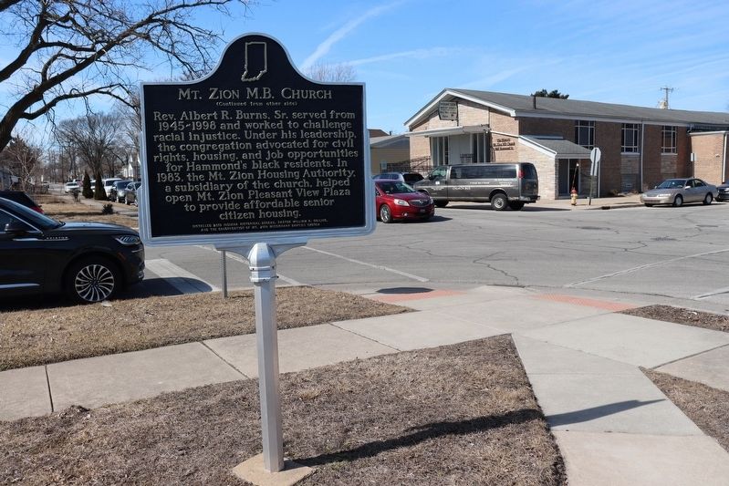
Looking west on Kenwood Street with Mt. Zion Missionary Baptist Church in the background
Credits. This page was last revised on March 3, 2025. It was originally submitted on March 2, 2025, by Trevor L Whited of Kokomo, Indiana. This page has been viewed 153 times since then and 28 times this year. Photos: 1, 2, 3. submitted on March 2, 2025, by Trevor L Whited of Kokomo, Indiana. • Devry Becker Jones was the editor who published this page.
