Gause in Milam County, Texas — The American South (West South Central)
Sugarloaf Bridge, Milam County
Texas Historic Bridge
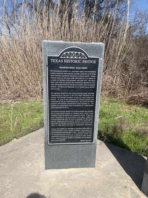
Photographed by Morgan Petermann, March 4, 2025
1. Sugarloaf Bridge, Milam County Marker
The original bridge on the Bryan-Caldwell Road had been constructed at the site of the Pitts Ferry Crossing by the Brazos River Bridge Company as part of a multi-span toll bridge. In 1909 it was purchased by Brazos County and continued in use as a free bridge until 1930, when the Texas Highway Department constructed Highway 21. The bridge was abandoned upon completion of a new Brazos River crossing on SH 21.
Meanwhile in Milam County the Faubion Bridge was located on an early route known as "Ramons Road" about a mile upstrem from the present day Sugarloaf Bridge. It was the only crossing of the Little River in the area. After the Faubion Bridge
this page online
In 2006 this bridge was restored by the Texas Department of Transportation using Federal Highway Transportation Enhancement funds. The bridge continues its transportation legacy as a pedestrian bridge and continues to stand as an early landmark of Texas history with a heritage proudly shared by the people of both Brazos and Milam Counties.
Erected 2006.
Topics. This historical marker is listed in this topic list: Bridges & Viaducts.
Location. 30° 49.512′ N, 96° 44.619′ W. Marker is in Gause, Texas, in Milam County. It is on County Road 264 north of County Road 364, on the right when traveling north. Touch for map. Marker is at or near this postal address: 5213 Co Rd 264, Gause TX 77857, United States of America. Touch for directions.

Regionally, this marker is in the Prairies & Lakes Region. It is also in the American South. Globally, it is in North America, a Gulf
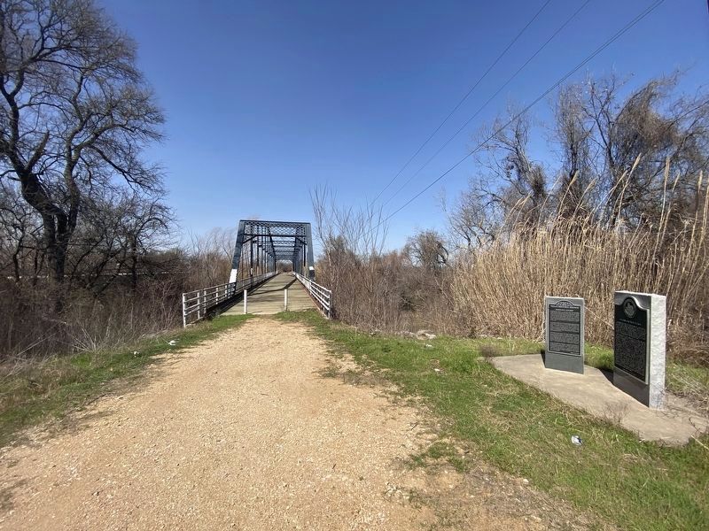
Photographed by Morgan Petermann, March 4, 2025
2. Sugarloaf Bridge, Milam County Marker
Other nearby markers. At least 8 other markers are within 9 miles of this marker, measured as the crow flies: Sugarloaf Mountain (here, next to this marker); Gause Baptist Church (approx. 2.9 miles away); The Town of Gause (approx. 3.1 miles away); Port Sullivan (approx. 4.3 miles away); Port Sullivan Cemetery (approx. 4.7 miles away); Site of the Town of Nashville (approx. 5.4 miles away); DAR Centennial Park (approx. 5.4 miles away); Camp Hearne World War II Prisoner of War Camp (approx. 8½ miles away). Touch for a list and map of all markers in Gause.
Also see . . . Sugarloaf Bridge Historical Marker - Milam County Historical Commission. Compilation of articles and related readings put together by the Milam County Historical Commission. Contains photos depicting this marker's original location next to the bridge, before its rededication and movement to the current site in 2010. (Submitted on March 6, 2025, by Morgan Petermann of Hurst, Texas.)
Credits. This page was last revised on March 8, 2025. It was originally submitted on March 5, 2025, by Morgan Petermann of Hurst, Texas. This page has been viewed 240 times since then and 53 times this year. Photos: 1, 2. submitted on March 5, 2025, by Morgan Petermann of Hurst, Texas. • James Hulse was the editor who published this page.
