Near Southport in Brunswick County, North Carolina — The American South (South Atlantic)
Robert Howe
1732-1786

Photographed by Duane and Tracy Marsteller, November 25, 2024
1. Robert Howe Marker
Erected by North Carolina Office of Archives and History. (Marker Number D 24.)
Topics and series. This historical marker is listed in this topic list: War, US Revolutionary. In addition, it is included in the North Carolina Division of Archives and History series list.
Location. 33° 59.271′ N, 78° 1.952′ W. Marker is near Southport, North Carolina, in Brunswick County. It is on River Road Southeast (North Carolina Route 133) 0.2 miles north of George II Highway Southeast ( Route 87), on the left when traveling north. Touch for map. Marker is at or near this postal address: 7518 River Rd SE, Southport NC 28461, United States of America. Touch for directions.

Regionally, this marker is in the Coastal Plain and on the Cape Fear Coast. It is also in the American South, specifically in the Upper South, in the Tidewater, and on the Eastern Seaboard. Globally, it is in the North Atlantic Region, North America, the Western
this page online
Other nearby markers. At least 8 other markers are within 5 miles of this marker, measured as the crow flies: Stede Bonnet (approx. 4.3 miles away); Deep Water Point 1812-1814 (approx. 4½ miles away); Railroad & Religion on Rhett Street (approx. 4.7 miles away); Franklin Square (approx. 4.7 miles away); Old Jail (approx. 4.7 miles away); Smithville Burying Ground (approx. 4.8 miles away); Robert Ruark (approx. 4.8 miles away); Southport’s First Fire Alarm (approx. 4.8 miles away). Touch for a list and map of all markers in Southport.
Another marker is no longer nearby. Fort Caswell (was approx. 2.6 miles away but has been confirmed missing).
Also see . . .
1. Howe, Robert. Robert Howe, planter, soldier, and politician, was born in New Hanover (later Brunswick) County, the son of Job Howe (Howes), who moved to North Carolina from Charleston, S.C., and settled on

Photographed by Duane and Tracy Marsteller, November 25, 2024
2. Robert Howe Marker
2. Robert Howe (Continental Army officer). Wikipedia entry on the general, who also served in the legislative bodies of both the colonial and state governments of North Carolina. (Submitted on March 5, 2025, by Duane and Tracy Marsteller of Murfreesboro, Tennessee.)
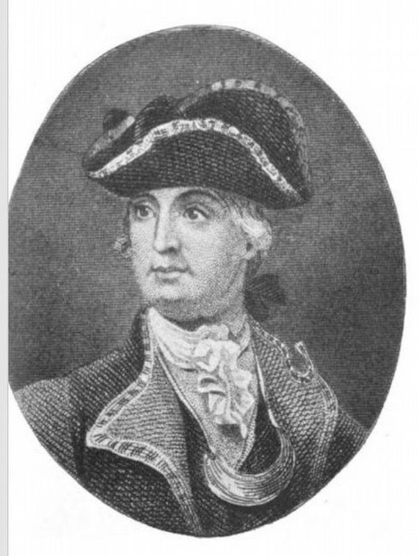
A Brief History of the North Carolina Troops…, Charles L. Davis (1896); via Google Books (Public Domain)
3. Maj. Gen. Robert Howe
He was one of five generals, and the only major general, from North Carolina in the Continental Army.
Credits. This page was last revised on March 5, 2025. It was originally submitted on March 5, 2025, by Duane and Tracy Marsteller of Murfreesboro, Tennessee. This page has been viewed 200 times since then and 40 times this year. Photos: 1, 2, 3. submitted on March 5, 2025, by Duane and Tracy Marsteller of Murfreesboro, Tennessee.
