Green Sea in Horry County, South Carolina — The American South (South Atlantic)
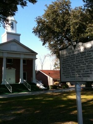
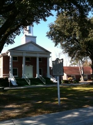
Green Sea Baptist Church
This church, known as Honey Camp Baptist Church until 1924, was founded in 1807. It is the mother church to several Baptist churches in eastern S.C., including Spring Branch (1830), Pleasant View (1875), Mt. Zion (1887), Mt. Olive (1890), Dogwood (1896), Carolina (1902), and Grassy Bay (1905). It was first located a few miles southwest, near Honey Camp Swamp.
[Marker Reverse]
Admitted to the Cape Fear (N.C.) Association in 1822, then to the Waccamaw Association in 1876, this congregation worshipped near Honey Camp Swamp until 1869, when J.H. Derham donated this site. The first sanctuary here, a frame building, was replaced by a larger one in 1886. It burned in 1931 and was replaced by the present brick sanctuary, completed in 1932.
Erected 2003 by the Congregation. (Marker Number 26-10.)
Topics. This historical marker is listed in this topic list: Churches & Religion. A significant historical year for this entry is 1924.
Location. 34° 7.737′ N, 78° 58.525′ W. Marker is in Green Sea, South Carolina, in Horry County. Marker is at the intersection of Green Sea Road (State Highway 410) and Fair Bluff Highway (State Highway S-26-33), on the left when traveling north on Green Sea Road. Touch for map. Marker is at or near this postal address: 1241 Green Sea Rd, Green Sea SC 29545, United States of America. Touch for directions.
Other nearby markers. At least 4 other markers are within 12 miles of this marker, measured as the crow flies. Mt. Tabor (approx. 6.1 miles away in North Carolina); Loris Training School (approx. 6.6 miles away); The Tabor City Tribune (approx. 6.7 miles away in North Carolina); Drowning Creek (approx. 11.7 miles away).
Credits. This page was last revised on June 16, 2016. It was originally submitted on January 22, 2010, by David Bullard of Seneca, South Carolina. This page has been viewed 1,154 times since then and 56 times this year. Photos: 1, 2, 3, 4. submitted on January 22, 2010, by David Bullard of Seneca, South Carolina. • Kevin W. was the editor who published this page.
![Green Sea Baptist Church Marker [front]. Click for full size. Green Sea Baptist Church Marker [front] image. Click for full size.](Photos/93/Photo93722.jpg?11252005)
![Green Sea Baptist Church Marker [reverse]. Click for full size. Green Sea Baptist Church Marker [reverse] image. Click for full size.](Photos/93/Photo93723.jpg?11252005)

