Vaux-devant-Damloup near Douaumont-Vaux in Meuse, Alsace, Lorraine, Champagne-Ardenne, France — Western Europe
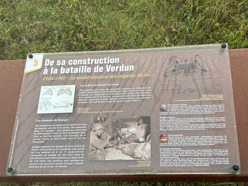
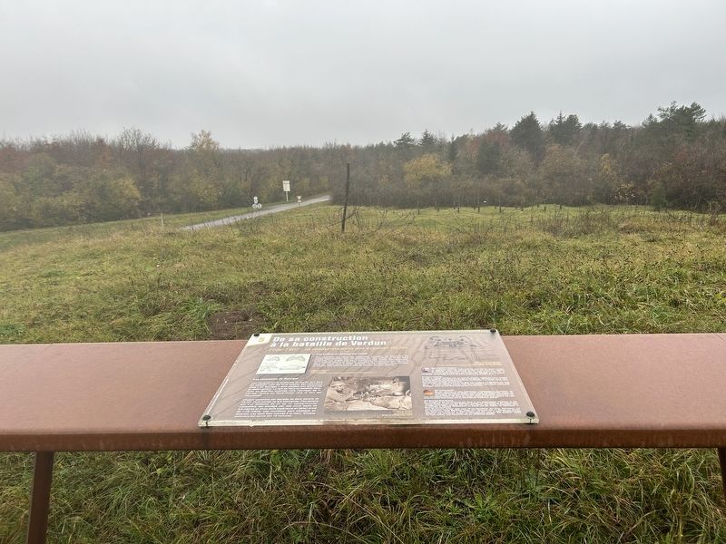
De sa construction à la bataille de Verdun
1904-1905: la modernisation des organes de feu
Photographed by Steve Stoessel, November 18, 2024
1. De sa construction à la bataille de Verdun Marker

Trop exposées aux obus, les casemates avancées qui défendent les fossés (caponnières) sont remplacées par des coffres en béton armé encastrés aux angles des murs extérieurs des fossés (contrescarpe). On y accède depuis le fort par une galerie souterraine elle-même en béton qui passe sous le fossé, défendu par trois coffres: deux doubles, un simple. Ces coffres sont armés de canons de petit calibre.
Les casemates de Bourges
Afin d'augmenter la puissance de feu du fort dans les espaces avec les forts voisins, des casemates dites « de Bourges » sont placées aux extrémités du casernement. Le fort de Vaux en possède deux, l'une au Sud-Est orientée vers l'ouvrage de la Laufée, l'autre au Nord-Ouest vers le fort de Douaumont.
Chaque casemate est équipée de deux canons de 75 mm d'une portée de 5,5 kilomètres. Ces canons ont une cadence de tir de 11 coups/minute. L'ensemble est protégé par des murs épais de 2,5 mètres et d'une dalle supérieure en béton armé de 1,75 mètre. Les munitions sont stockées en sous-sol. Les obus sont montés à la main. Chaque casemate est servie par 15 hommes.
The
this page online
Bourges casemates
In order to increase firepower over the intervals between neighbouring forts, so-called 'Bourges casemates' were placed at the edges of the garrison. Fort Vaux had two of them, one in the south-east pointing towerds the infantry fortifications of La Laufée, and the other to the north-west towards Fort Douaumont.
Each casemate was fitted with two 75 mm guns with a range of 5.5 kilometres and firing rate of 11 shots per minute. The entire structure was protected by walls 2.5 metres thick and a 1.75 metre reinforced concrete slab roof. Munitions were stored underground. Shells were loaded by hand. Each casemate had a 15-man crew.
Die den Granaten zu sehr ausgesetzten,
Photographed by Steve Stoessel, November 18, 2024
2. De sa construction à la bataille de Verdun Marker
Die Bourges-Kasematten
Zur Steigerung der Feuerleistung des Forts in den gemeinsamen Bereichen zu den Nachbarwerken werden an den äußersten Flanken der Kasernierung die sogenannten „Bourges-Kasematten" errichtet. Das Fort Vaux besitzt zwei solcher Kampfräume, einen Im Südosten in Richtung Zwischenwerk La Laufée und den anderen im Nordwesten in Richtung Fort Douaumont.
Jede Kasematte verfügt über zwei 75-mm-Geschütze mit einer Reichweite von 5,5 Kilometern. Diese Geschütze haben eine Feuerrate von 11 Schuss pro Minute. Das Ganze wird durch 2,5 m dicke Mauern und eine 1,77 m dicke Stahlbetondecke geschützt. Die Munitionen werden Im Untergeschoss gelagert. Die Granaten werden von Hand montiert. Jede Kasematte wird von
Photographed by Steve Stoessel, November 18, 2024
3. De sa construction à la bataille de Verdun Marker
Topics. This historical marker is listed in these topic lists: Forts and Castles • War, World I.
Location. 49° 12.021′ N, 5° 28.188′ E. Marker is near Douaumont-Vaux, Grand Est (Alsace, Lorraine, Champagne-Ardenne), in Meuse. It is in Vaux-devant-Damloup. It can be reached from Grand Est Route 913a 3.2 kilometers north of Route 913. The fort is located at the end of D913a. Touch for map. Marker is in this post office area: Douaumont-Vaux, Grand Est 55400, France. Touch for directions.

Regionally, it is in the North Atlantic Region, Europe, the European Union, Atlantic Europe, the Schengen Area, Western Europe, a coastal Mediterranean country, and the Western World. Historically, it finds itself in what was once a French colony, the Roman Empire, and specifically the Holy Roman Empire.
Other nearby markers. At least 8 other markers are within walking distance of this marker: Dans la Bataille de Verdun (here, next to this marker); a different marker also named De sa construction à la bataille de Verdun (here, next to this marker); a different marker also named De sa construction à la bataille de Verdun (here, next to this marker); Dans la bataille de Verdun (a few steps from this marker); a different marker also named Dans la bataille de Verdun (a few steps from this marker); a different marker also named De sa construction à la bataille de Verdun (a few steps from this marker); a different marker also named De sa construction à la bataille de Verdun (a few steps from this marker); a different marker also named Dans la bataille de Verdun (a few steps from this marker). Touch for a list and map of all markers in Douaumont-Vaux.
Credits. This page was last revised on March 5, 2025. It was originally submitted on March 5, 2025, by Steve Stoessel of Niskayuna, New York. This page has been viewed 101 times since then and 15 times this year. Photos: 1, 2, 3. submitted on March 5, 2025, by Steve Stoessel of Niskayuna, New York.
