Zillebeke near Ieper in West-Vlaanderen, Flanders, Belgium — Northwestern Europe
Kasteeldomeinen Worden Front
Photographed by Steve Stoessel, November 14, 2024
1. Kasteeldomeinen Worden Front Marker

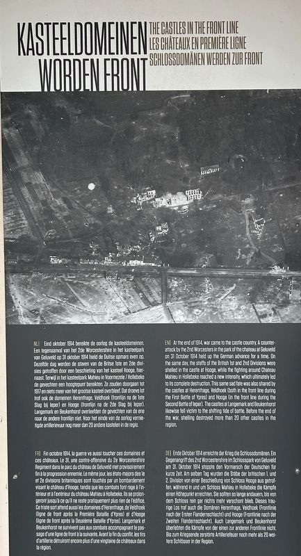
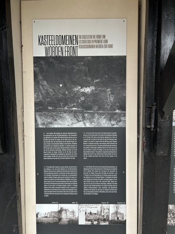
Eind oktober 1914 bereikte de oorlog de kasteeldomeinen. Een tegenaanval van het 2de Worcestershire in het kasteelpark van Geluveld op 31 oktober 1914 hield de Duitse opmars even op. Dezelfde dag werden de staven van de Britse 1ste en 2de divisies getroffen door een beschieting van het kasteel Hooge, hiernaast. Terwijl in het kasteelpark Mahieu in Voormezele / Hollebeke de gevechten een hoogtepunt bereikten. Ze zouden doorgaan tot 1917 en niets meer van het grootse kasteel overbleef. Dat droeve lot trof ook de domeinen Herenthage, Veldhoek (frontlijn na de 1ste Slag bij Ieper) en Hooge (frontlijn na de 2de Slag bij leper). Langemark en Beukenhorst overleefden de gevechten van de ene naar de andere frontlijn niet. Voor het einde van de oorlog vernietigde artillerievuur nog meer dan 20 andere kastelen in de regio.
At
this page online
Ende Oktober 1914 erreichte der Krieg die Schlossdomänen. Ein Gegenangriff des 2nd Worcestershire im Schlosspark von Geluveld am 31. Oktober 1914 stoppte den Vormarsch der Deutschen für kurze Zeit. Am selben Tag wurden die Stäbe der britischen 1. und 2. Division von einer Beschießung von Schloss Hooge aus getroffen, während
Photographed by Steve Stoessel, November 14, 2024
2. Kasteeldomeinen Worden Front Marker
Topics. This historical marker is listed in these topic lists: Forts and Castles • War, World I. A significant historical date for this entry is October 31, 1914.
Location. 50° 50.789′ N, 2° 56.629′ E. Marker is near Ieper, Vlaanderen (Flanders), in West-Vlaanderen. It is in Zillebeke. It is at the intersection of Meenseweg (National Route 8) and Bellewaardestraat, on the right on Meenseweg. Touch for map. Marker is at or near this postal address: Meenseweg 467A, Ieper, Vlaanderen 8902, Belgium. Touch for directions.

Regionally, it is in Europe, the European Union, Atlantic Europe, the Benelux Low Countries, the Schengen Area, Western Europe, and the Western World. Historically, it finds itself in what was once the Roman Empire and specifically also the Holy Roman Empire.
Other nearby markers. At least 8 other markers are within walking distance of this marker: Kasieeldumeinen na de Oorlog (here, next to this marker); Kasteeldomeinen In De Klein Ieperboog (here, next to this marker); Kastelenin de Ieperboog (here, next to this marker); Thomas Keith Hedley Rae (a few steps from this marker); Hooge Crater Cemetery (within shouting distance of this marker); Bellewaarde Ridge: a fiercely contest position, both above and below ground (approx. 0.6 kilometers away); The Liverpool Scottish (approx. 0.8 kilometers away); Pte John William Ogley (approx. 0.8 kilometers away). Touch for a list and map of all markers in Ieper.
Credits. This page was last revised on March 11, 2025. It was originally submitted on March 6, 2025, by Steve Stoessel of Niskayuna, New York. This page has been viewed 94 times since then and 16 times this year. Photos: 1, 2. submitted on March 6, 2025, by Steve Stoessel of Niskayuna, New York.
