Pocatello in Bannock County, Idaho — The American West (Mountains)
Oregon Short Line & Union Pacific
| — | Portneuf Gap-Gittins Cutoff Historic Loop | — |
Photographed by Cosmos Mariner, July 10, 2024
1. Oregon Short Line & Union Pacific Marker
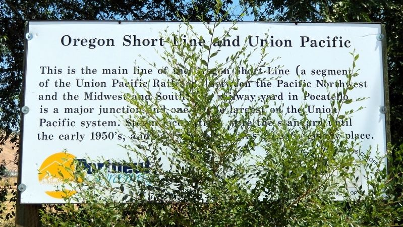
This is the main line of the Oregon Short Line (a segment of the Union Pacific Railroad) between the Pacific Northwest and the Midwest and South. The railway yard in Pocatello is a major junction and one of the largest on the Union Pacific system. Steam locomotives were the standard until the early 1950’s, and early Pocatello was a dusty, smoky place.
Erected by Portneuf Greenway.
Topics. This historical marker is listed in these topic lists: Industry & Commerce • Railroads & Streetcars.
Location. 42° 47.791′ N, 112° 19.916′ W. Marker is in Pocatello, Idaho, in Bannock County. It is at the intersection of South 5th Avenue (Old U.S. 91) and West Blackrock Road, on the right when traveling west on South 5th Avenue. The marker is located in a pull-out on the north side of the highway. Touch for map. Marker is in this post office area: Pocatello ID 83204, United States of America. Touch for directions.

Regionally, this marker is in Bear River Country. It is also in the American Mountain West. Globally, it is in North America, the Western Hemisphere, the Western
this page online
Other nearby markers. At least 8 other markers are within 6 miles of this marker, measured as the crow flies: Port of Entry (here, next to this marker); Utah and the Northern Railway (a few steps from this marker); Why is Portneuf Gap Here? (approx. 0.8 miles away); Gateway to the Pacific Northwest (approx. 0.8 miles away); Copper Mines in the Pocatello Formation (approx. 0.8 miles away); Idaho's 1st Railroad (approx. 3.6 miles away); First School House (approx. 4.4 miles away); Fort Hall (approx. 5½ miles away). Touch for a list and map of all markers in Pocatello.
Related markers. Click here for a list of markers that are related to this marker. Portneuf Gap-Gittins Cutoff Historic Loop
Also see . . . Oregon Short Line Railroad (Wikipedia).
Excerpt: The line was organized as the Oregon Short Line Railway in 1881 as a subsidiary of the Union Pacific Railway. The Union Pacific intended the line to be the shortest route ("the short line") from Wyoming to Oregon and the Pacific Northwest.(Submitted on March 8, 2025, by Cosmos Mariner of Cape Canaveral, Florida.)The line started from the Union Pacific main line in Granger, Wyoming, and reached Montpelier,
Idaho, on August 5, 1882, and then to McCammon, Idaho, in the Fall of 1882. Between McCammon and Pocatello, Idaho, the line was shared with fellow Union Pacific subsidiary Utah & Northern's grade by adding a third rail to the 3 ft narrow gauge track to accommodate the 4 ft 8½ in standard gauge cars. The line from Pocatello to Huntington, Oregon, was completed in late 1884.Photographed by Cosmos Mariner, July 10, 20242. Oregon Short Line & Union Pacific MarkerLooking north; this is the rightmost of three related markers located at this pull-out on the old highway. The active Union Pacific railroad tracks are south of these markers, on the opposite side of Old U.S. Highway 91.In 1889, the Oregon Short Line Railway merged with Utah & Northern Railway and 6 other smaller railroads to form the Oregon Short Line and Utah Northern Railway. The OSL was independent for a short period of time until October 1898 when the newly reformed Union Pacific Railroad took control of a majority of the board of directors. In 1938, Union Pacific began consolidating operations and leased for operation a number of its subsidiaries including the Oregon Short Line. The railroad operated under the lease until December 30, 1987, when the OSL was fully merged into the Union Pacific Railroad.

Credits. This page was last revised on March 8, 2025. It was originally submitted on March 6, 2025, by Cosmos Mariner of Cape Canaveral, Florida. This page has been viewed 285 times since then and 87 times this year. Photos: 1, 2. submitted on March 8, 2025, by Cosmos Mariner of Cape Canaveral, Florida.
