Zonnebeke in West-Vlaanderen, Flanders, Belgium — Northwestern Europe
Fire Trench
1915-1917

Photographed by Steve Stoessel, November 13, 2024
1. Fire Trench Marker

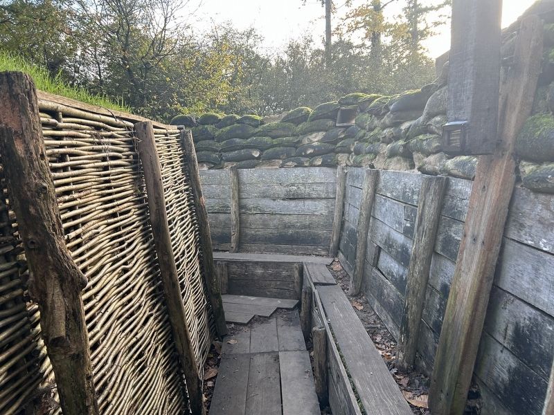
Een gevechtsloopgraaf heeft een grillige vorm. Zo wordt de impact van inslaande projectielen beperkt en zijn observatie en mitrailleurposten verborgen.
Typisch is het opstapje om over de borstwering of 'parapet' te schieten. Een rugwering of 'parados' camoufleert soldaten die over de borstwering kijken. Om bouwmaterialen te sparen is ze gemaakt met vlechtwerk en aarde.
A combat trench had an irregular shape. This ensured that the blast of incoming projectiles was stifled and observation and machine gun posts were concealed. Typically there was a fire step that enabled troops to shoot over the parapet.
On the rear side is a parados to conceal soldiers looking over the parapet. To save on building materials, it is made from wickerwork and earth.
Une tranchée de combat avait une forme imprévisible. De cette façon, l'impact des projectiles lancés était limité et les postes d'observation et de mitrailleuses étaient cachés. L'escabeau était typique afin de pouvoir tirer au-dessus du parapet.
Un parados camouflait les soldats qui
this page online
Kampfgraben, 1915-1917
Ein Kampfgraben hat eine unregelmäßige Form. So wird die Wirkung einschlagender Geschosse begrenzt, und bleiben Beobachtungs- und Maschinengewehrstellungen verborgen. Typisch ist die Treppe um über die Brüstung oder 'Parapet: zu schießen. Eine Rückwand oder 'Parados' tarnt Soldaten, die über die Brüstung blicken. Um Baumaterial zu sparen, wird sie aus Flechtwerk und Lehm hergestellt. [Photo] German observation of no man's land, Geluveld.
Topics. This historical marker is listed in this topic list: War, World I.
Location. 50° 52.207′ N, 2° 59.313′ E. Marker is in Zonnebeke, Vlaanderen (Flanders), in West-Vlaanderen. It can be reached from Berten Pilstraat. Marker is in the trench exhibit at the Passchendaele Museum. Touch for map. Marker is at or near this postal address: Berten Pilstraat 13, Zonnebeke, Vlaanderen 8980, Belgium. Touch for directions.

Regionally, it is in Europe, the European Union, Atlantic Europe, the Benelux Low Countries,

Photographed by Steve Stoessel, November 13, 2024
2. Fire Trench Marker
A fire Step can be seen on the left.
Other nearby markers. At least 8 other markers are within walking distance of this marker: Protective Wooden Structure (a few steps from this marker); Communication Trench (a few steps from this marker); a different marker also named Communication Trench (a few steps from this marker); Narrow-gauge Railways (a few steps from this marker); a different marker also named Communication Trench (a few steps from this marker); American Temporary Shelter (a few steps from this marker); Model Trench System (a few steps from this marker); a different marker also named Communication Trench (a few steps from this marker). Touch for a list and map of all markers in Zonnebeke.
Photographed by Steve Stoessel, November 13, 2024
3. Model of German Fire Trench
Note the use of wicker on trench walls to save material.
Credits. This page was last revised on March 8, 2025. It was originally submitted on March 7, 2025, by Steve Stoessel of Niskayuna, New York. This page has been viewed 93 times since then and 12 times this year. Photos: 1, 2, 3. submitted on March 7, 2025, by Steve Stoessel of Niskayuna, New York.
