Zonnebeke in West-Vlaanderen, Flanders, Belgium — Northwestern Europe
Communication Trench
1916-1917
Photographed by Steve Stoessel, November 13, 2024
1. Communication Trench Marker

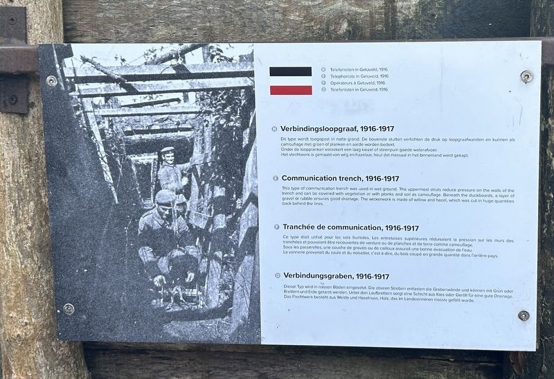
Dit type wordt toegepast in natte grond. De bovenste stutten verlichten de druk op loopgraafwanden en kunnen als camouflage met groen of planken en aarde worden bedekt. Onder de loopplanken verzekert een laag kiezel of steenpuin goede waterafvoer. Het vlechtwerk is gemaakt van wilg en hazelaar, hout dat massaal in het binnenland werd gekapt.
This type of communication trench was used in wet ground. The uppermost struts reduce pressure on the walls of the trench and can be covered with vegetation or with planks and soil as camouflage. Beneath the duckboards, a layer of gravel or rubble ensures good drainage. The wickerwork is made of willow and hazel, which was cut in huge quantities back behind the lines
Ce type était utilisé pour les sols humides. Les entretoises supérieures réduisaient la pression sur les murs des tranchées et pouvaient tré recouvertes de verdure ou de planches et de terre comme camouflage. Sous les passerelles, une couche de gravats ou de cailloux assurait une bonne évacuation de l'eau. La
this page online
Dieser Typ wird in nassen Böden eingesetzt. Die oberen Streben entlasten die Grabenwände und können mit Grün oder Brettern und Erde getarnt werden, Unter den Laufbrettern sorgt eine Schicht aus Kies oder Geröll für eine gute Drainage. Das Flechtwerk besteht aus Weide und Haselnuss, Holz, das im Landesinneren massiv gefallt wurde. [Photo] Telephonists in Geluveld, 1916
Topics. This historical marker is listed in this topic list: War, World I. A significant historical year for this entry is 1916.
Location. 50° 52.201′ N, 2° 59.314′ E. Marker is in Zonnebeke, Vlaanderen (Flanders), in West-Vlaanderen. It can be reached from Berten Pilstraat. Marker is in an exhibit at the Passchendaele Museum. Touch for map. Marker is at or near this postal address: Berten Pilstraat 13, Zonnebeke, Vlaanderen 8980, Belgium. Touch for directions.

Regionally, it is in Europe, the European Union, Atlantic Europe, the Benelux Low Countries, the Schengen Area, Western Europe, and the Western World. Historically,

Photographed by Steve Stoessel, November 13, 2024
2. Communication Trench Marker
Other nearby markers. At least 8 other markers are within walking distance of this marker: A different marker also named Communication Trench (a few steps from this marker); Fire Trench (a few steps from this marker); a different marker also named Communication Trench (a few steps from this marker); Model Trench System (a few steps from this marker); Protective Wooden Structure (a few steps from this marker); Narrow-gauge Railways (a few steps from this marker); a different marker also named Communication Trench (a few steps from this marker); Mortar Post (a few steps from this marker). Touch for a list and map of all markers in Zonnebeke.
Also see . . . Trench Warfare (Wikipedia). (Submitted on March 8, 2025, by Steve Stoessel of Niskayuna, New York.)
Credits. This page was last revised on March 8, 2025. It was originally submitted on March 7, 2025, by Steve Stoessel of Niskayuna, New York. This page has been viewed 109 times since then and 15 times this year. Photos: 1, 2. submitted on March 7, 2025, by Steve Stoessel of Niskayuna, New York.
