Near Monroe in Walton County, Georgia — The American South (South Atlantic)
William Harris Homestead
Circa 1825

Photographed by Duane and Tracy Marsteller, November 26, 2024
1. William Harris Homestead Marker
National Register of Historic Places
Walton County Historic Landmark
Erected 2013 by Georgia Piedmont Chapter XXXIII, The Colonial Dames of America.
Topics and series. This historical marker is listed in this topic list: Settlements & Settlers. In addition, it is included in the National Register of Historic Places (NRHP), and the The Colonial Dames of America series lists. A significant historical year for this entry is 1825.
Location. 33° 53.856′ N, 83° 43.365′ W. Marker is near Monroe, Georgia, in Walton County. It is on Winder-Monroe Highway (Georgia Route 11) 0.1 miles south of Emmett Doster Road Northwest, on the right when traveling south. Touch for map. Marker is at or near this postal address: 3636 GA-11, Monroe GA 30656, United States of America. Touch for directions.

Regionally, this marker is in the Piedmont and in Metro Atlanta. It is also in the American South and specifically in the Deep South. Globally, it is in North America, the Western Hemisphere, the Western World, and the Anglosphere. Historically, it finds itself in what was once the territory of the Mississippian Culture, one of
this page online
Other nearby markers. At least 8 other markers are within walking distance of this marker: Soil and Water Conservation Districts (about 600 feet away, measured in a direct line); a different marker also named The William Harris Homestead (about 600 feet away); Harris Smokehouse (approx. 0.2 miles away); “Improved” Land (approx. 0.2 miles away); Harris Blacksmith Shop (approx. 0.2 miles away); King Cotton (approx. 0.2 miles away); Boll Weevil Eradication Program (approx. 0.2 miles away); Harris Family Cemetery (approx. 0.2 miles away). Touch for a list and map of all markers in Monroe.
Also see . . .
1. Harris Family History. The William Harris Homestead is an excellent example of the homes and plantations established in Walton County, Georgia, after the formation of the County in 1818. The lands owned by William Harris originally were Land Lots Numbers 122 and 149, consisting of 250 acres each in District 3, as set out in the County when organized and located on both sides of Rogue’s Road (now Georgia Highway 11)

Photographed by Duane and Tracy Marsteller, November 26, 2024
2. William Harris Homestead Marker
2. William Harris Family Farmstead (PDF). National Register nomination for the property, which includes the main house and four outbuildings and was listed in 1982. (Prepared by Richard Cloues, Historic Preservation Section, Georgia Department of Natural Resources; via National Archives) (Submitted on March 10, 2025, by Duane and Tracy Marsteller of Murfreesboro, Tennessee.)
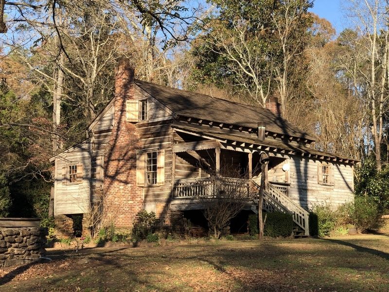
Photographed by Duane and Tracy Marsteller, November 26, 2024
3. William Harris Homestead
Credits. This page was last revised on March 10, 2025. It was originally submitted on March 9, 2025, by Duane and Tracy Marsteller of Murfreesboro, Tennessee. This page has been viewed 154 times since then and 25 times this year. Photos: 1, 2, 3. submitted on March 9, 2025, by Duane and Tracy Marsteller of Murfreesboro, Tennessee.
