Lavonia in Franklin County, Georgia — The American South (South Atlantic)
Veteran's Walk
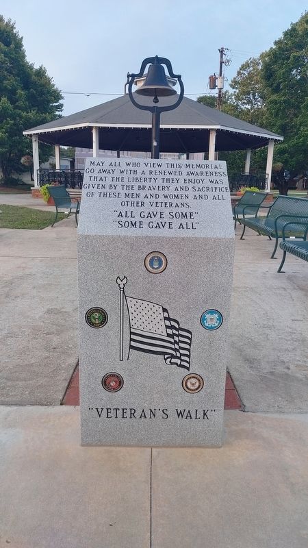
Photographed by Mark Parker, June 10, 2022
1. Veteran's Walk Marker
"All gave some"
"Some gave all"
Topics. This memorial is listed in this topic list: Military.
Location. 34° 26.175′ N, 83° 6.355′ W. Memorial is in Lavonia, Georgia, in Franklin County. It is on East Main Street south of West Avenue (Georgia Route 59), on the left when traveling south. The memorial is at the entrance to Weldon Memorial Park. Touch for map. Memorial is at or near this postal address: 1222 E Main St, Lavonia GA 30553, United States of America. Touch for directions.

Regionally, this memorial is in the Mountains. It is also in the American South and specifically in the Deep South. Globally, it is in North America, the Western Hemisphere, the Western World, and the Anglosphere. Historically, it finds itself in what was once the territory of the Mississippian Culture, one of the original Thirteen Colonies, one of the Confederate States of America, and the Antebellum South.
Other nearby markers. At least 8 other markers are within 8 miles of this marker, measured as the crow flies: The State of Georgia Salutes (approx. 3.2 miles away); Shoal Creek (approx. 4 miles away); Double Branches Baptist Church (approx. 4.8 miles away); Poplar Springs Baptist Church (approx. 4.8 miles away); Red Hollow Road (approx. 5.6 miles away); Carroll’s Methodist Church (approx. 5.6 miles away); Poplar Springs Methodist Camp Ground (approx. 7.4 miles away); a different marker also named Carroll's Methodist Church (approx. 7.9 miles away). Touch for a list and map of all markers in Lavonia.
Other markers no longer nearby. Parkertown - 1832 (was approx. 4 miles away
this page online

Photographed by Mark Parker, June 10, 2022
2. Full view of Weldon Memorial Park. Marker is just to the left at the entrance
Credits. This page was last revised on April 3, 2025. It was originally submitted on March 11, 2025, by Mark Parker of Hickory, North Carolina. This page has been viewed 157 times since then and 27 times this year. Photos: 1, 2. submitted on March 11, 2025, by Mark Parker of Hickory, North Carolina. • Andrew Ruppenstein was the editor who published this page.
