Weiden in der Oberpfalz in Weiden i.d. OPf., Bavaria, Germany — Central Europe
Weiden von den Anfängen bis 1400
⎯⎯⎯
Weiden from the beginnings to 1400
Photographed by James Hulse, February 17, 2024
1. Weiden von den Anfängen bis 1400 / Weiden from the beginnings to 1400 Marker

Spuren von Besiedelung gibt es im Stadtgebiet Weidens schon aus der Mittelsteinzeit. Am Edeldorfer Weg befand sich einst ein Lagerplatz von Jägern, Fischern und Sammlern dieser Epoche.
Eines der wohl ältesten Bauwerke im heutigen Stadtgebiet von Weiden ist die Keckenburg. Der Turmhügel von Rothenstadt trug ursprünglich eine Burg. Der ovale, steil geböschte Hügel liegt unmittelbar westlich des heutigen Naabufers an der Verbindungsstraße Rothenstadt-Pirk. Er wird von einem doppelten Ringraben mit Zwischenwall umgeben. Auf dem Hügel steht heute eine neugothische Grufkapelle der Familie von Satzenhofen, erbaut 1863. Der Vorgängerbau, eine hölzerne Burgstallanlage aus dem 12. Jahrhundert, gilt als das erste befestigte Gebäude in Weiden.
1034 werden in ersten Beurkundungen von König Heinrich III. die heutigen Teile der Stadt, nämlich Mogenriut = Muglhof, Mazelinesriut = Matzlesrieth und Tragesindorf = Trauschendorf genannt.
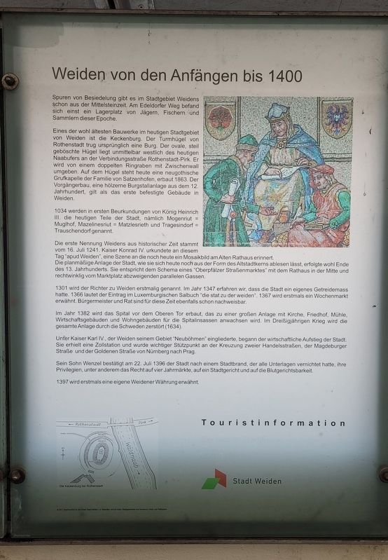
Die erste Nennung Weidens aus historischer Zeit stammt vom 16. Juli 1241. Kaiser Konrad IV. urkundete an diesem Tag "apud Weiden", eine Szene an die noch heute ein Mosaikbild am Alten
this page online
1301 wird der Richter zu Weiden erstmalig genannt. Im Jahr 1347 erfahren wir, dass die Stadt ein eigenes Getreidemass hatte. 1366 lautet der Eintrag im Luxemburgischen Salbuch "die stat zu der weiden". 1367 wird erstmals ein Wochenmarkt erwähnt. Bürgermeister und Rat sind für diese Zeit ebenfalls schon nachweisbar.
Im Jahr 1382 wird das Spital vor dem Oberen Tor erbaut, das zu einer großen Anlage mit Kirche, Friedhof, Mühle, Wirtschaftsgebäuden und Wohngebäuden für die Spitalinsassen anwachsen wird. Im Dreißigjährigen Krieg wird die gesamte Anlage durch die Schweden zerstört (1634).
Unter Kaiser Karl IV., der Weiden seinem Gebiet "Neuböhmen" eingliederte, begann der wirtschaftliche Aufstieg der Stadt. Sie erhielt eine Zollstation und wurde wichtiger Stützpunkt an der Kreuzung zweier Handelsstraßen, der Magdeburger

Photographed by James Hulse, February 17, 2024
2. The Marker is the left marker of the group
Sein Sohn Wenzel bestätigt am 22. Juli 1396 der Stadt nach einem Stadtbrand, der alle Unterlagen vernichtet hatte, ihre Privilegien, unter anderem das Recht auf vier Jahrmärkte, auf ein Stadtgericht und auf die Blutgerichtsbarkeit.
1397 wird erstmals eine eigene Weidener Währung erwähnt.
Touristinformation
Ein kleiner Stadtführer durch Weiden
Stadt Weiden in der Oberpfalz
©2011 Verantwortlich fur den Inhalt Stadt Weiden i d Oberplatz, Amt für Kulfur, Stadtgeschichte und Tourismus / Hoch- und Tiefbauamt
There are traces of settlement in the city area of Weiden dating back to the Middle Stone Age. At Edeldorfer Weg, there was once a camp of hunters, fishermen, and gatherers from this era.
One of the oldest buildings in what is now the city area of Weiden is the Keckenburg. The Rothenstadt hillfort originally housed a castle. The oval, steeply embanked hill is located immediately west of the present-day Naab riverbank along the connecting road between Rothenstadt and Pirk. It is surrounded by a double ring ditch with an intermediate rampart. Today, a neo-Gothic chapel, the Grufkapelle of the von Satzenhofen family, stands on the hill, built in 1863. The predecessor, a wooden castle site from the 12th century, is considered the first fortified structure in Weiden.
In 1034, the first documents from King Henry III mention the current areas of the city, namely Mogenriut = Muglhof, Mazelinesriut = Matzlesrieth, and Tragesindorf = Trauschendorf.
The first historical mention of Weiden dates back to July 16, 1241. Emperor Conrad IV issued a document on this day "apud Weiden," a scene that is still commemorated today by a mosaic at the Old Town Hall. The planned layout of the city, which can still be seen in the form of the old town center, was likely carried out at the end of the 13th century. It follows the pattern of a "Upper Palatinate street market," with the town hall in the center and parallel streets branching off from the market square at right angles.
In 1301, the judge of Weiden is mentioned for the first time. In 1347, it is recorded that the city had its own grain measure. In 1366, the entry in the Luxembourg Book of the City reads "the city of the pastures." In 1367, a weekly market is mentioned for the first time. The mayor and council are already documented during this time.
In 1382, the hospital was built outside the Upper Gate, which would grow into a large complex with a church, cemetery, mill, farm buildings, and residences for the hospital inmates. During the Thirty Years' War, the entire complex was destroyed by the Swedes in 1634.
Under Emperor Charles IV, who integrated Weiden into his "New Bohemia" territory, the city began its economic rise. It received a customs station and became an important hub at the intersection of two trade routes: the Magdeburg Road and the Golden Road from Nuremberg to Prague.
His son, Wenceslas, confirmed the city's privileges on July 22, 1396, after a city fire had destroyed all the records, including the right to hold four annual fairs, the right to a city court, and the right to blood justice.
In 1397, Weiden's own currency was mentioned for the first time.
Tourist Information
A Small City Guide through Weiden
City of Weiden in the Upper Palatinate
©2011 Responsible for the content City of Weiden in the Upper Palatinate, Department of Culture, Local History and Tourism / Department of Civil and Structural Engineering
Erected by Stadt Weiden.
Topics. This historical marker is listed in this topic list: Settlements & Settlers. A significant historical date for this entry is July 16, 1241.
Location. 49° 40.622′ N, 12° 9.925′ E. Marker is in Weiden in der Oberpfalz, Bayern (Bavaria), in Weiden i.d. OPf.. It is on Hinter der Mauer just north of Unterer Markt. The marker is located in a small alleyway under an open air patio with several other markers. Touch for map. Marker is at or near this postal address: Hinter d Mauer 21, Weiden in der Oberpfalz BY 92637, Germany. Touch for directions.

Regionally, it is in Europe, the European Union, Atlantic Europe, Central Europe, the Schengen Area, Western Europe, and the Western World. Historically, it finds itself in what was once the Holy Roman Empire.
Other nearby markers. At least 8 other markers are within walking distance of this marker: Das 15. Jahrhundert - Wohlstand überall / The 15th Century - Prosperity Everywhere (here, next to this marker); Ab 1500 - Reformation und Katastrophen / From 1500 - Reformation and catastrophes (here, next to this marker); Das 18. Jahrhundert - Goethe in Weiden / The 18th Century - Goethe in Weiden (here, next to this marker); Krieg und Pest im 17. Jahrhundert / War and Plague in the 17th Century (here, next to this marker); Der History-Point / The History Point (here, next to this marker); Ab 1900 - Weiden's Weg in die Moderne / From 1900 - Weiden's Path to Modernity (here, next to this marker); Ab 1800 - Weiden wird Industriestandort / From 1800 - Weiden becomes an industrial location (here, next to this marker); Die Kirchengeschichte Weidens / The Church History of Weiden (here, next to this marker). Touch for a list and map of all markers in Weiden in der Oberpfalz.
Credits. This page was last revised on March 14, 2025. It was originally submitted on March 13, 2025, by James Hulse of Medina, Texas. This page has been viewed 175 times since then and 31 times this year. Photos: 1, 2. submitted on March 13, 2025, by James Hulse of Medina, Texas.
