Fenwick in Pelham in Niagara Region, Ontario — Central Canada (North America)
O’Reilly’s Bridge
Photographed by Tim Boyd, March 14, 2025
1. O’Reilly’s Bridge Marker
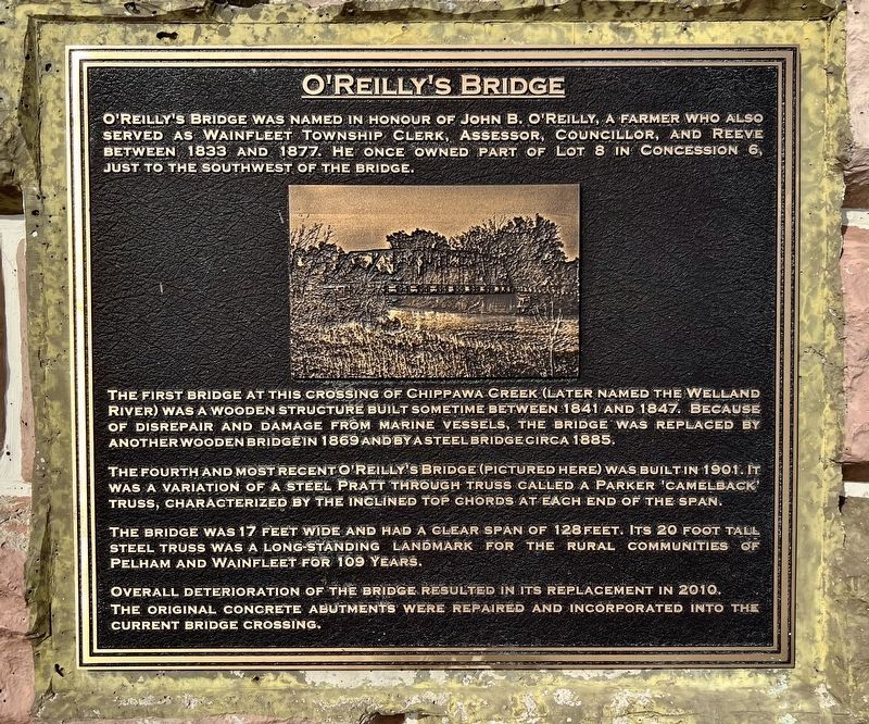
O'Reilly's Bridge was named in honour of John B. O'Reilly, a farmer who also served as Wainfleet Township clerk, assessor, councillor, and reeve between 1833 and 1877. He once owned part of lot 8 in concession 6, just to the southwest of the bridge.
The first bridge at this crossing of Chippawa Creek (later named the Welland River) was a wooden structure built sometime between 1841 and 1847. Because of disrepair and damage from marine vessels, the bridge was replaced by another wooden bridge in 1869 and by a steel bridge circa 1885.
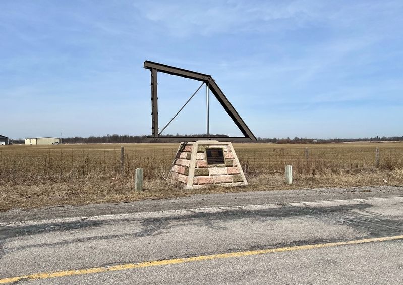
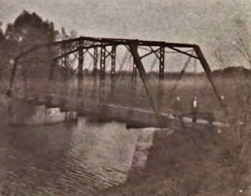
The fourth and most recent O'Reilly's Bridge (pictured here) was built in 1901. It was a variation of a steel pratt through truss called a Parker 'camelback' truss, characterized by the inclined top chords at each end of the span.
The bridge was 17 feet wide and had a clear span of 128 feet. Its 20 foot tall steel truss was a long-standing landmark for the rural communities of Pelham and Wainfleet for 109 years.
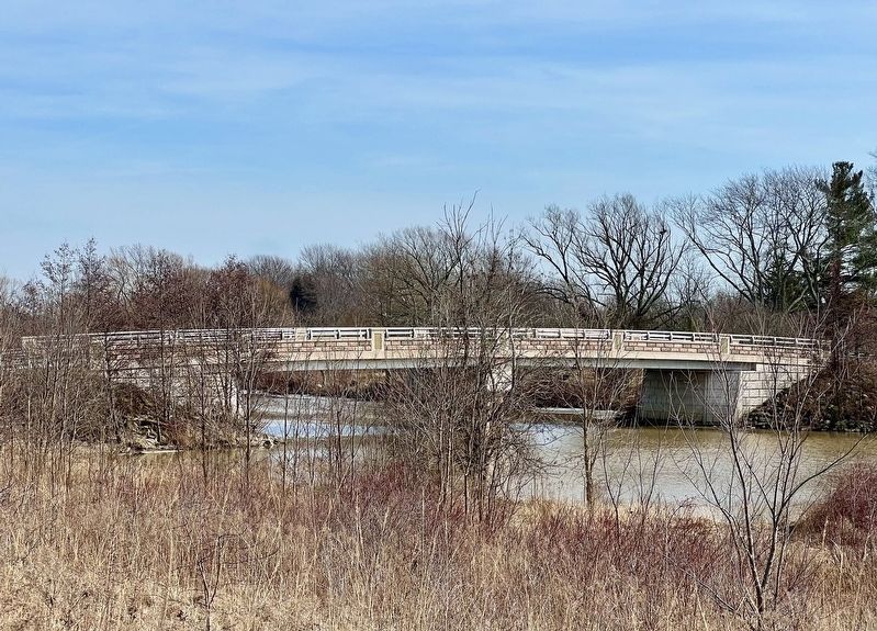
Overall deterioration of the bridge resulted in its replacement in 2010. The original concrete abutments were repaired and incorporated into the current bridge crossing.
Topics.
this page online
Location. 42° 58.359′ N, 79° 19.159′ W. Marker is in Pelham, Ontario, in Niagara Region. It is in Fenwick. It is on River Road 0.1 kilometers west of O’Reilly’s Road North, on the right when traveling west. Touch for map. Marker is at or near this postal address: 415 River Road, Pelham ON L0S 1C0, Canada. Touch for directions.

Regionally, this marker is on Ontario’s Golden Horseshoe and in Niagara Canada. It is also in Central Canada. Globally, it is in North America, on the Great Lakes, in the Western Hemisphere, in the Western World, and in the Anglosphere. Historically, it finds itself in what was once a British colony, the Viceroyalty of New France, the Haudenosaunee (Iroquois) Confederacy, and Rupert’s Land.
Other nearby markers. At least 8 other markers are within 6 kilometers of this marker, measured as the crow flies: Junction Village (approx. 5 kilometers away); The Origins (approx. 5 kilometers away); The Decline (approx. 5 kilometers away); The Raceway (approx. 5 kilometers away);
Photographed by Tim Boyd, January 14, 2025
2. O’Reilly’s Bridge Marker
(incorparating a segment of the 2902 bridge span)
Also see . . . O’Reilly’s Bridge (Historic Bridges).
This magnificent bridge was an extremely rare example of a pin connected camelback truss bridge in Ontario. Camelback truss bridges are a variation of the Parker truss, where the camelback has exactly five slopes contained in the top chord and end post. A Parker truss is essentially a Pratt truss with a polygonal top chord. At the time this narrative was composed, HistoricBridges.org had 1205 truss bridges documented in the United States and Canada combined. Of those, only 18 were pin-connected Camelback truss bridges, or 1.5% of all truss bridges. At that time, only one other pin-connected Camelback truss had been documented by HistoricBridges.org in Ontario and it was a railroad bridge. This indicates that O'Reilly's Bridge was an exceedingly rare structure in Ontario, and a rare structure in both the United States and Canada.(Submitted on March 15, 2025, by Tim Boyd of Hamilton, Ontario.)
3. 1901 O’Reilly’s Bridge ca 1910
Source: Brock University (public domain)
Photographed by Tim Boyd, March 14, 2025
4. The present O’Reilly’s Bridge (built 2010)
Credits. This page was last revised on March 15, 2025. It was originally submitted on March 15, 2025, by Tim Boyd of Hamilton, Ontario. This page has been viewed 170 times since then and 21 times this year. Photos: 1, 2, 3, 4. submitted on March 15, 2025, by Tim Boyd of Hamilton, Ontario. • Andrew Ruppenstein was the editor who published this page.
