Near Erie in Monroe County, Michigan — The American Midwest (Great Lakes)
"War" With Happy Ending
Photographed by Dale K. Benington, July 16, 2009
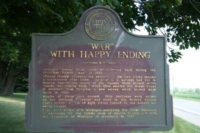
1. "War" With Happy Ending Marker
Michigan troops made heir headquarters here during the bloodless Toledo "war" in 1835.
Intense rivalry between the settlers of the two states fanned a controversy near flame. Original U. S. surveys had put in Monroe County the mouth of the Maumee River around which Toledo was taking form. When Ohio started the Miami Canal it obtained from Congress a new survey which showed these lands in Ohio.
Months of disturbance ensued. Ohio partisans were seized on the contested frontier and tried in the Monroe County Court House. Militia of both states rushed to the border but never fought.
The "war" ended with Michigan accepting the Upper Peninsula in exchange for the Toledo strip of Monroe County and with the admission of Michigan to statehood in 1837.
Erected by Monroe County Historical Society.
Topics. This historical marker is listed in this topic list: Settlements & Settlers. A significant historical year for this entry is 1835.
Location. Marker has been reported missing. It was located near 41° 46.886′ N, 83° 30.225′ W. Marker was near Erie, Michigan, in Monroe County. It was on South Dixie Highway 0.1 miles north
this page online

Regionally, this marker was in Southeast Michigan and in Greater Detroit. It was also in the American Midwest. Globally, it was in North America, on the Great Lakes, in the Western Hemisphere, in the Western World, and in the Anglosphere. Historically, it found itself in what was once the Northwest Territory.
Other nearby markers. At least 8 other markers are within 4 miles of this location, measured as the crow flies: St. Joseph Sur La Baie (approx. 0.9 miles away); Erie Township Veterans Memorial (approx. 0.9 miles away); a different marker also named "War" With Happy Ending (approx. 0.9 miles away); Historic Banner Oak School (approx. 3.1 miles away); Bedford Township Veterans Memorial (approx. 3.2 miles away); Luna Pier Veterans Memorial (approx. 3.7 miles away);
Photographed by Dale K. Benington, July 16, 2009
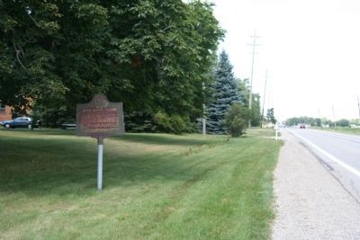
2. "War" With Happy Ending Marker
View of the historical marker looking north along the Dixie Highway.
Also see . . . Toledo War. Wikipedia entry (Submitted on July 22, 2009, by Dale K. Benington of Toledo, Ohio.)
Photographed by Dale K. Benington, July 16, 2009
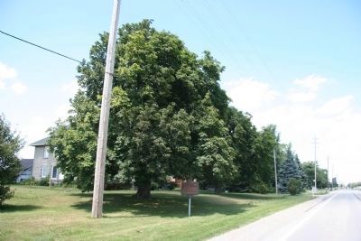
3. "War" With Happy Ending Marker
A more distant view of the historical marker, looking north, and seeing residential property adjacent to the marker.
Credits. This page was last revised on March 31, 2025. It was originally submitted on July 17, 2009, by Dale K. Benington of Toledo, Ohio. This page has been viewed 2,402 times since then and 61 times this year. Last updated on March 17, 2025, by Ian Lefkowitz of New York, New York. Photos: 1, 2, 3. submitted on July 17, 2009, by Dale K. Benington of Toledo, Ohio. • Devry Becker Jones was the editor who published this page.
